


Today’s Forecast:
Conditions will be windy today with first a warming, dry wind from the west. Temperatures will be warm early in the day. Then this evening a cold front will blow in from the north bringing cold air behind it.
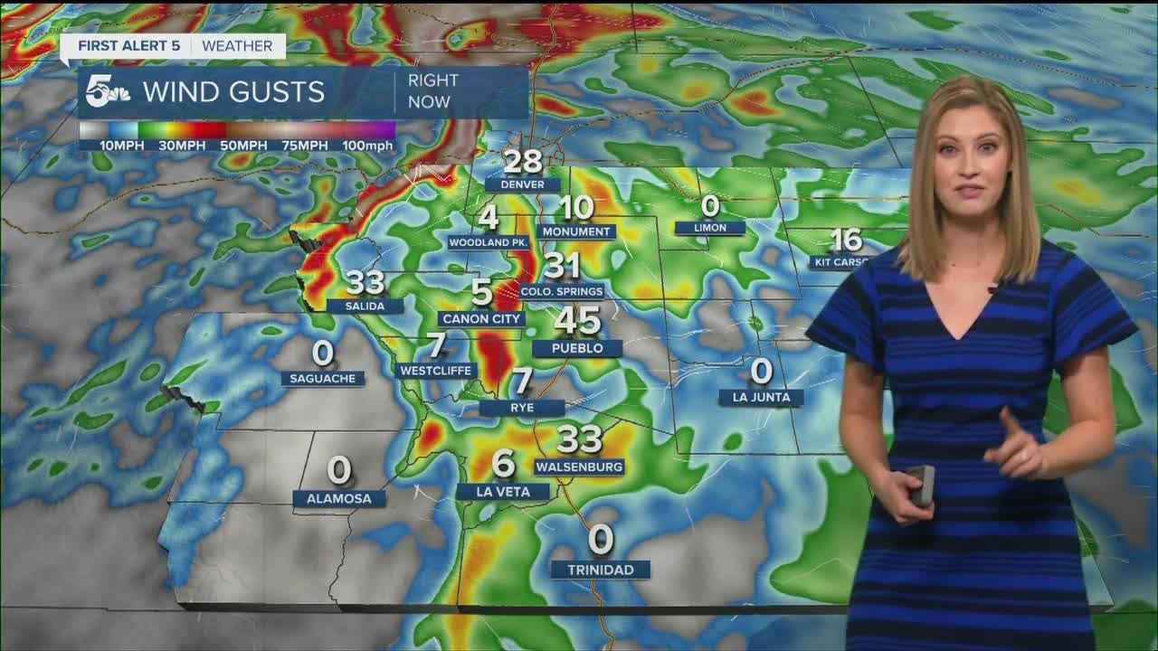
A RED FLAG WARNING is in effect from 9 am to 5 pm for Teller, El Paso, Pueblo, Crowley, Otero, Fremont, Huerfano, Custer, and Las Animas counties, and the Sangre De Cristo mountains.
COLORADO SPRINGS: High: 65; Low: 16. Wind gusts up to 35 mph are possible today. Cold air moves in late this afternoon.
PUEBLO: High: 70; Low: 17. A warm and windy start with gusts up to 45 mph. Colder air moves in the evening.
CANON CITY: High: 68; Low: 22. Gusty all day with wind up to 45 mph. Partly cloudy and mild during the day.
WOODLAND PARK: High: 54; Low: 20. A windy day with thick high clouds and fire danger.
TRI-LAKES: High: 60s; Low: teens. Low 60s today with clouds and winds gusting to 45mph. A cold front blows in late afternoon.
PLAINS: High: 70s; Low: teens. Low 70s today with breezy conditions early then becoming very windy and cold this afternoon/evening.
WALSENBURG/TRINIDAD: High: 60s/70s; Low: teens. Upper 60s to low 70s with very strong winds today gusting to 45 mph.
MOUNTAINS: High: 50s; Low: teens/20s. Mid to upper 50s for mountain valleys today with consistently strong wind gusts throughout the day.
Extended Outlook:
After the cold front moves through this evening it will leave Monday about 10 degrees below average. Temperatures gradually climb through the week and become mild. Then our next system comes in Friday into Saturday bringing cold air and snow potential.
KOAA News5 on your time, streaming on your Roku, FireTV, AppleTV and AndroidTV.
