


Tonight's Forecast:
Slow-moving storms, with the potential for heavy rainfall and gusty winds will favor the mountains and Pikes Peak Region through sunset this evening. After tonight's sunset, which comes at 7:55 pm, storms should fade away pretty quickly. The overnight hours should be fairly quiet and mild, with overnight lows only cooling down to the 50s and 60s.
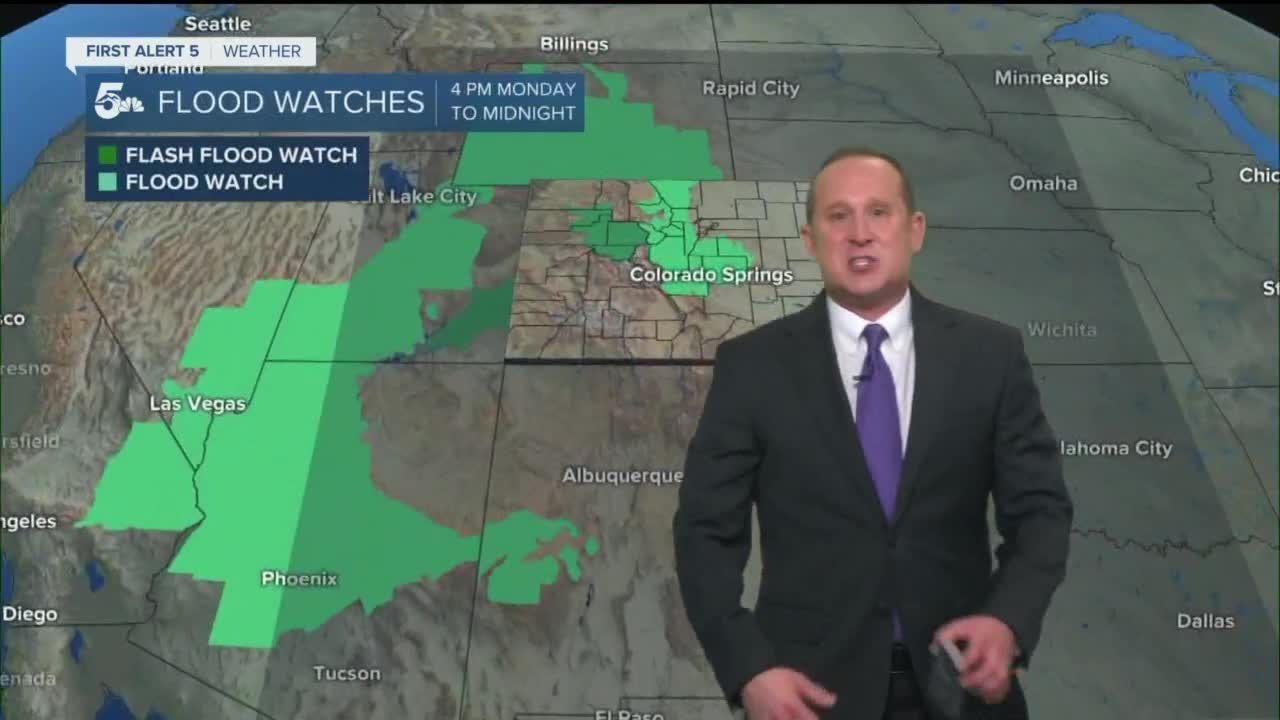
Colorado Springs forecast: Low: 61; High: 84; A cold front will bring us a cooler start to the work week, along with the potential for heavy rainfall and thunderstorms late Monday afternoon and Monday evening. A Flood Watch has been issued for El Paso County from 4 pm to midnight.
Pueblo forecast: Low: 64; High: 92; Dry skies will allow for a decent amount of heating before showers and storms begin to move into Pueblo County from the mountains. Once the rain picks up, we could be looking at rain lasting well into the overnight hours.
Canon City forecast: Low: 65; High: 89; Mostly sunny skies early Monday will give way to afternoon clouds, showers and thunderstorms. With heavy rain in the forecast, a Flood Watch has been issued for Fremont County from 4 pm to midnight.
Woodland Park forecast: Low: 53; High: 76; If you're looking to get some errands or a hike in on Monday, you'll need to plan it during the first part of the day before the rain moves in. Showers and thunderstorms will start to develop by mid-afternoon, with rain possible well into late Monday night.
Tri-Lakes forecast: Low: 50s; High: 70s/80s; A nice and mellow start to our Monday will give way to showers and thunderstorms by the late afternoon and evening hours. Some rain could be locally heavy, which has prompted the National Weather Service to issue a Flood Watch for the Palmer Divide.
Plains forecast: Low: 60s; High: 90s; Widely scattered thunderstorms will start to form over the Plains by late afternoon, and a few of these storms along and north of Highway 50 could turn severe. The rain will continue into Monday night, with some heavy rain possible at times.
Walsenburg and Trinidad forecast: Low: 50s/60s; High: 80s; The southern I-25 corridor will see late afternoon and evening showers and thunderstorms, but the heaviest rain in the forecast tomorrow should stay farther to our north.
Mountains forecast: Low: 40s/50s; High: 60s/70s; Showers and thunderstorms will begin to develop in the mountains and mountain valleys between 11 am and 1 pm, and could continue at times well into Monday night. The heaviest rain looks to favor mountain areas along and north of I-70.
Extended outlook forecast:
The atmosphere will remain primed for more rain late Monday night into early Tuesday morning, with another round of scattered showers and thunderstorms returning by Tuesday afternoon. Tuesday's highs will be refreshingly cool across the region, topping out in the 60s and 70s from Teller County into the I-25 corridor.
Lingering moisture will maintain storm chances Wednesday afternoon before the moisture retreats back towards the mountain ranges later this week. This will allow for drier weather along the urban corridor and a late week warm-up.
____
Curious about the First Alert 5 Weather Storm Impact Scale? Check out our cheatsheet explainer.
Watch KOAA News5 on your time, anytime with our free streaming app available for your Roku, FireTV, AppleTV and Android TV. Just search KOAA News5, download and start watching.
