


An arctic blast slams into Southern Colorado Wednesday night, bringing snow and freezing temperatures to the region through Friday.
Round number one has cleared the state as of Thursday morning. The round of snow moves through Thursday afternoon and evening, favoring the southern mountains, southern I-25 corridor and south of HWY 50.
DIA flight cancellations and delays
Colorado Springs Airport flight cancellations and delays
Weather Updates:
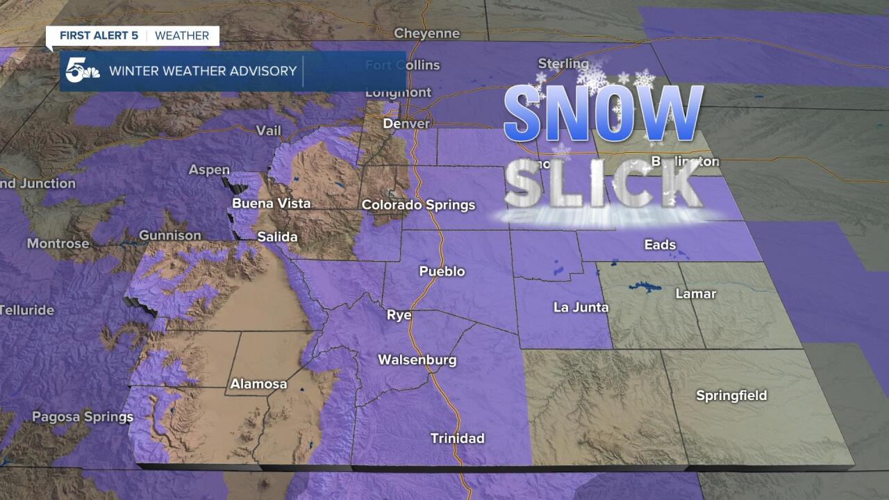
9:00 a.m. Current alerts as of 9 am. Another round of snow moves in this afternoon and evening.

5:00 a.m. Current alerts in effect. El Paso County has been taken out of the advisory. Western Las Animas and the Sangre De Cristos have been upgraded to a Winter Storm Warning.

Thursday 4:55 a.m.
Per CDOT, northbound: Crash between Exit 91 - Stem Beach and Exit 94 - Pueblo Boulevard. Crash in area - Use caution - Road blocked - Watch for crews
6:10 p.m. The City of Fountain was placed on accident alert status. If you are involved in a traffic accident and there are no injuries and no suspected alcohol or drug involvement, exchange information with the other driver. Within 72 hours you can pick up a cold counter crash report form at the Fountain Police Department, any State Patrol office, or online.
6:00 p.m. Plunging temperatures on Thursday for the Pikes Peak Region, with a few light snow showers possible by the late afternoon and evening hours.
Bitter cold air arrives tomorrow, with highs in the 10s for Colorado Springs. A second round of snow will skirt the Pikes Peak Region on Thursday while bringing the potential for heavy snow to our south. #cowx pic.twitter.com/ROPX84g3XB
— Alan Rose (@AlanRoseWX) March 10, 2022
5:35 p.m. Current Winter Weather Advisories for Southern Colorado.
5:10 p.m. Latest First Alert 5 snowfall forecast for Southern Colorado. As a reminder, this will come in two waves...one tonight, the second Thursday night to Friday morning.

4:50 p.m. Some of the first bands of heavy snowfall have arrived in the Steel City this afternoon. Visibility from the "Big Hill" is down near zero.
Not much of a view this afternoon from our Pueblo studios. Heavy snow has moved in and visibility in parts of town is down near zero. #cowx pic.twitter.com/HcLvPOflwz
— Alan Rose (@AlanRoseWX) March 9, 2022
3:25 p.m. With several rounds of snow over the next 48-60 hours, there's a high likelihood of more than 3" of snow for the southern I-25 corridor and southern mountains. Those chances are still decent for the Pikes Peak Region, but not as high.

3:10 p.m. CSPD is now on accident alert due to deteriorating road conditions
Track this storm through the morning, including snow totals and updated forecasts, on the First Alert 5 Weather stream, which can be viewed on the KOAA News5 app for your Roku, FireTV, AppleTV or AndroidTV.
Resources:
- Get your latest First Alert 5 Weather Forecast
- Find the current school closing and delay list
- Keep track of flight delays at Denver International Airport or the Colorado Springs Airport
- Watch KOAA News5 LIVE newscasts and updated content throughout the day in your browser, the News5 App, or your favorite streaming device.
- Download the free News5 App for your iOS or Android device to get the latest headlines and news across Colorado.
- Download the free First Alert 5 Weather App for your iOS or Android device to get the latest headlines and news across Colorado.
- You can find us on social media with KOAA on Youtube, Facebook, Instagram, and Twitter
