


Tonight's Forecast:
Any threat for thunderstorms this evening will be across our eastern counties as dry remains in place closer to the interstate. Later tonight, a weak front will increase the amount of moisture in the air, keeping overnight temperatures mild for this time of the year.
Colorado Springs forecast: Low: 54; High: 85; Dry air and a mix of sun and clouds on Sunday. Much like what we saw today, some virga showers will be possible during the afternoon hours, but not much rain will actually reach the ground.
Pueblo forecast: Low: 55; High: 91; Partly cloudy and hot in Pueblo as highs are expected to return to the 90s for the second day in a row.
Canon City forecast: Low: 53; High: 87; A dry and very warm end to the weekend, with the perfect chance to get outside and enjoy the summer-like weather.
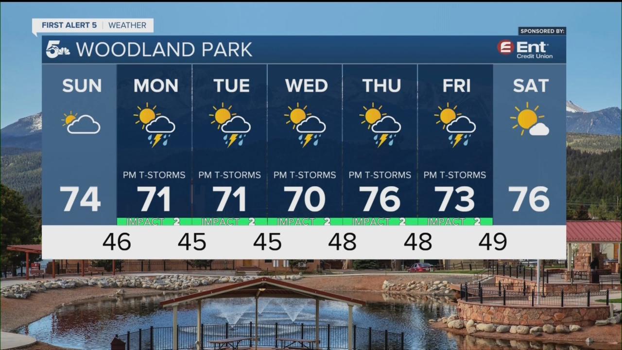
Woodland Park forecast: Low: 48; High: 74; Warm on Sunday, with the potential for an isolated afternoon thundershower over parts of Teller County.
Tri-Lakes forecast: Low: 40s/50s; High: 705s/80s; A warm end to the weekend for northern El Paso County, with just an isolated mention in the forecast of a passing afternoon thunderstorm.
Plains forecast: Low: 50s; High: 80s/90s; Hot across the Plains of Colorado on Sunday, with the potential for an isolated shower or thunderstorm by the afternoon hours, mainly for areas north of Highway 50.
Walsenburg and Trinidad forecast: Low: 40s/50s; High: 70s/80s; A partly sunny, dry and warm end to the weekend for the southern I-25 corridor, with afternoon highs topping out in the upper 70s and 80s.
Mountains forecast: Low: 40s; High: 60s; It should be another fantastic day across the mountains of Southern Colorado on Sunday. Along with comfortable daytime temperatures, the threat for thunder and lightning remains very low.
Extended outlook forecast:
Strengthening westerly winds will allow for a few disturbances to increase the potential for stormier weather over Southern Colorado by early next week. Daily thunderstorm chances can be expected region-wide from Monday through Wednesday, and could continue for areas west of the interstate through the end of the week. Temperatures will cool through Wednesday before warming as we head towards next weekend.
____
Curious about the First Alert 5 Weather Storm Impact Scale? Check out our cheatsheet explainer.
Watch KOAA News5 on your time, anytime with our free streaming app available for your Roku, FireTV, AppleTV and Android TV. Just search KOAA News5, download and start watching.
