


Tonight's Forecast:
Winds will pick up swiftly tonight across the mountains and I-25 corridor.
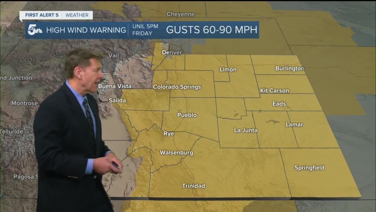
A HIGH WIND WARNING is in effect tonight until 5 pm on Friday for almost the entire News 5 viewing area. Top wind gusts will range from 50-90 mph. Isolated gusts may exceed 90 mph in Huerfano county or western Las Animas county.

Westerly winds will bring dangerous conditions for high-profile vehicles along north-south oriented roads. Portions of I-25 may close due to winds.
Other hazards will be power outages due to downed trees or downed powerlines. Blowing dust will reduce visibility.
In addition, fire danger will be very high due to the strong wind and low humidity. A RED FLAG WARNING is in effect Friday from 5 am to 5 pm for I-25 and the eastern plains.

Colorado Springs forecast: Low: 37; High: 66; HIGH WIND WARNING from 8 pm Thursday until 5 pm Friday. West winds will gust up to 80 mph.
Pueblo forecast: Low: 35; High: 69; HIGH WIND WARNING from 8 pm Thursday until 5 pm Friday. West winds will gust up to 60 mph.
Canon City forecast: Low: 39; High: 66; HIGH WIND WARNING from 8 pm Thursday until 5 pm Friday. West winds will gust up to 60 mph.
Woodland Park forecast: Low: 31; High: 56; HIGH WIND WARNING from 5 pm Thursday until 5 pm Friday. West winds will gust up to 75 mph.
Tri-Lakes forecast: Low: 41; High: 50; HIGH WIND WARNING from 8 pm Thursday until 5 pm Friday. West winds will gust up to 80 mph.
Plains forecast: Low: 30s; High: 60s; HIGH WIND WARNING from 7 am Thursday until 5 pm Friday. West winds will gust up to 70 mph.
Walsenburg and Trinidad forecast: Low: 42/40; High: 53/60; HIGH WIND WARNING from 8 pm Thursday until 5 pm Friday. West winds will gust up to 90 mph.
Mountains forecast: Low: 20s/30s; High: 40s/50s; HIGH WIND WARNING from 5 pm Thursday until 5 pm Friday for the Sangre De Cristos and Wet Mountains. WSW wind will be sustained 35-45 mph gusting 75 to 100 mph.
Extended outlook forecast:
Winds will significantly calm down on Saturday. Temperatures will start cooler this weekend in the upper 30s for the mountain valleys and 40s for the plains. Then temperatures will gradually rise through Monday, when highs will reach the 50s and 60s. Conditions will be generally calm and sunny this weekend.
____
Curious about the First Alert 5 Weather Storm Impact Scale? Check out our cheatsheet explainer.
Watch KOAA News5 on your time, anytime with our free streaming app available for your Roku, FireTV, AppleTV and Android TV. Just search KOAA News5, download and start watching.
