


BOULDER, Colo. — Antarctic sea ice has likely reached its minimum extent for the year, tying for the second-lowest in the 46 years of satellite data, according to the National Snow and Ice Data Center (NSIDC) at the University of Colorado in Boulder.
And the data is preliminary, as the ice extent could lower with more melting.
Sea ice — simply frozen ocean water — around Antarctica is measured by its extent. This is the area of the ocean where at least 15% of the surface is frozen, according to NSIDC. Antarctic sea ice extent typically reaches its annual minimum in February, after melting during the spring and summer in the Southern Hemisphere.
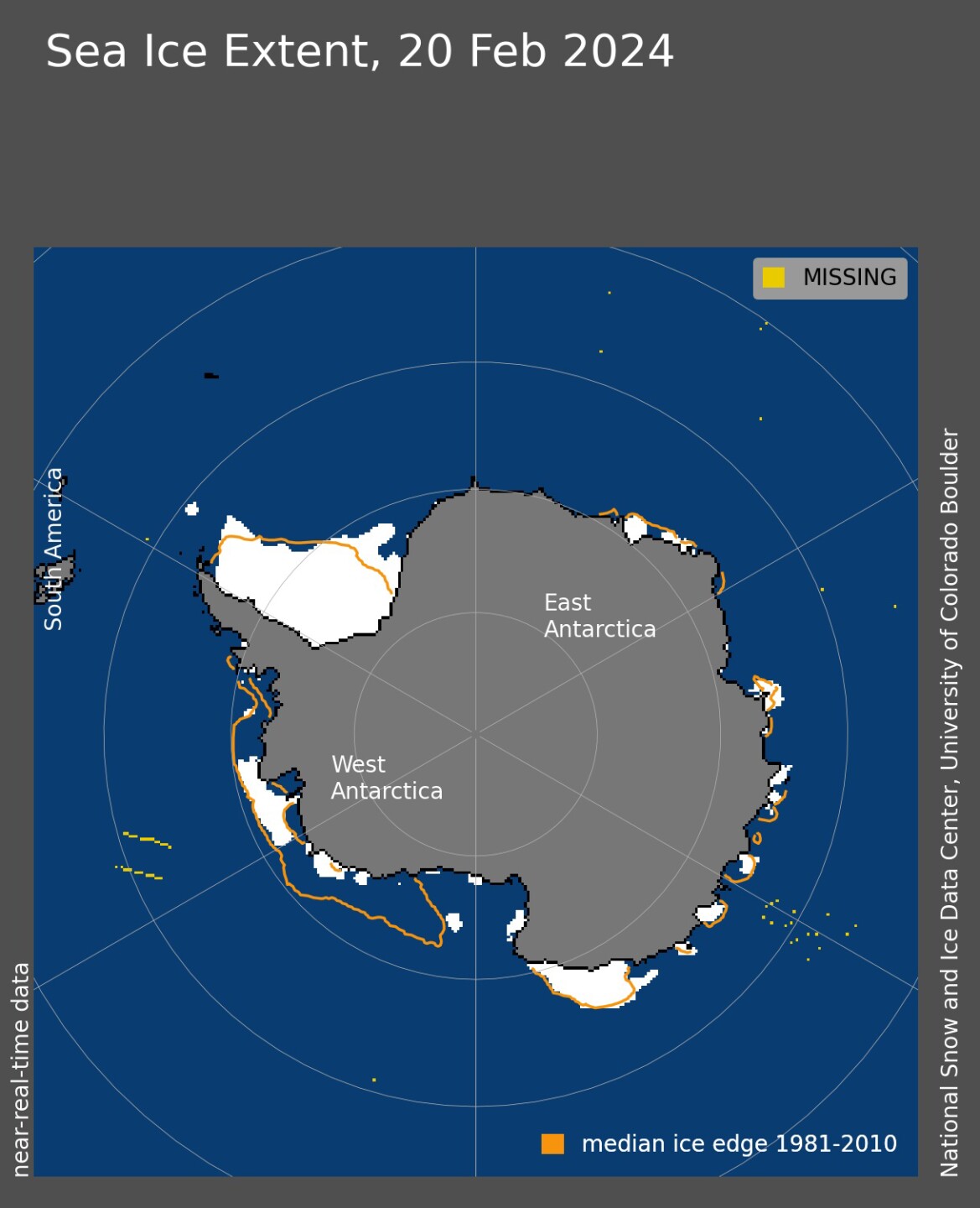
The NSIDC reported that based on satellite imagery, scientists have determined that the minimum extent this year was 768,000 square miles as of Feb. 20, 2024. Most of the remaining sea ice is in the Weddell Sea, Amundsen Sea, and the Southern Ocean off of Victoria Land, with a few patches along the coasts of Enderby Land and Wilkes Land, the NSIDC reported.
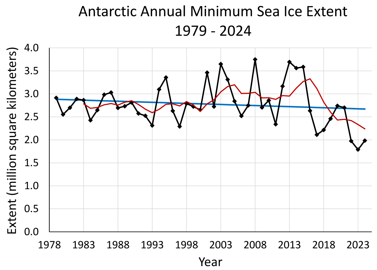
This year's minimum ties with 2022 for the second-lowest in the 46 years of satellite records, the NSIDC said. The record low was 2023, when Antarctic sea ice extent was calculated at 691,000 square miles on Feb. 21, 2023.
In addition, NSIDC said five of the lowest Antarctic sea ice extents on record have happened since 2017.
"With this series of low years, the trend in Antarctic minimum extent is negative and it is natural to speculate if this decline is significant," the organization said. "However, the period since 2017 is still too short to assess if these recent low extents indicate a clear decreasing signal; the magnitude of the trend is still small relative to the year-to-year variations in the ice cover."
Ted Scambos, senior research scientist with the Cooperative Institute for Research in Environmental Sciences (CIRES), said that the continent's low sea ice extent in 2023 paired with the low 2024 minimum "is nothing short of shocking."
"But Antarctica has shown huge sea ice variability in the recent past — setting record highs just 10 years ago," he said. "Connecting what we see in the sea ice with ocean changes is probably the key to understanding the cause, and the likelihood of persistence.”
Antarctica stores about 80% of the planet's freshwater in its ice.
The NSIDC, which is part of the CIRES at CU Boulder, said it plans to release a full analysis on this year's ice conditions, plus a look at the winter ahead. That will be published in a March article on its Arctic Sea Ice News and Analysis page, which is partly supported by NASA.
