


SOUTHERN COLORADO (KOAA) — Southern Colorado temperatures climbed into the 70s and 80s Tuesday, breaking records across the region — but today's heat is just the latest chapter in a winter that has been anything but typical.
Morning anchor Tony Keith put it well in a chat with me last week: this winter, it has felt like warm conditions with occasional cold, rather than the cold conditions punctuated by warm streaks that define a typical season. I crunched the numbers. He's right.
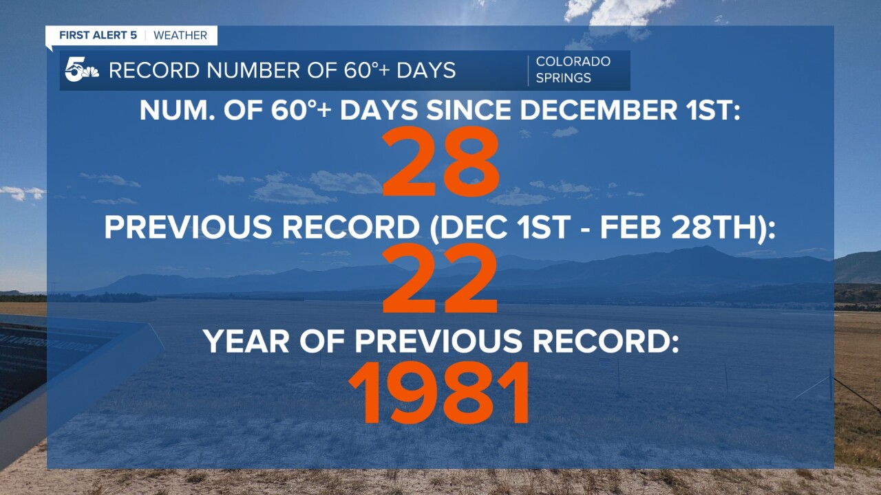
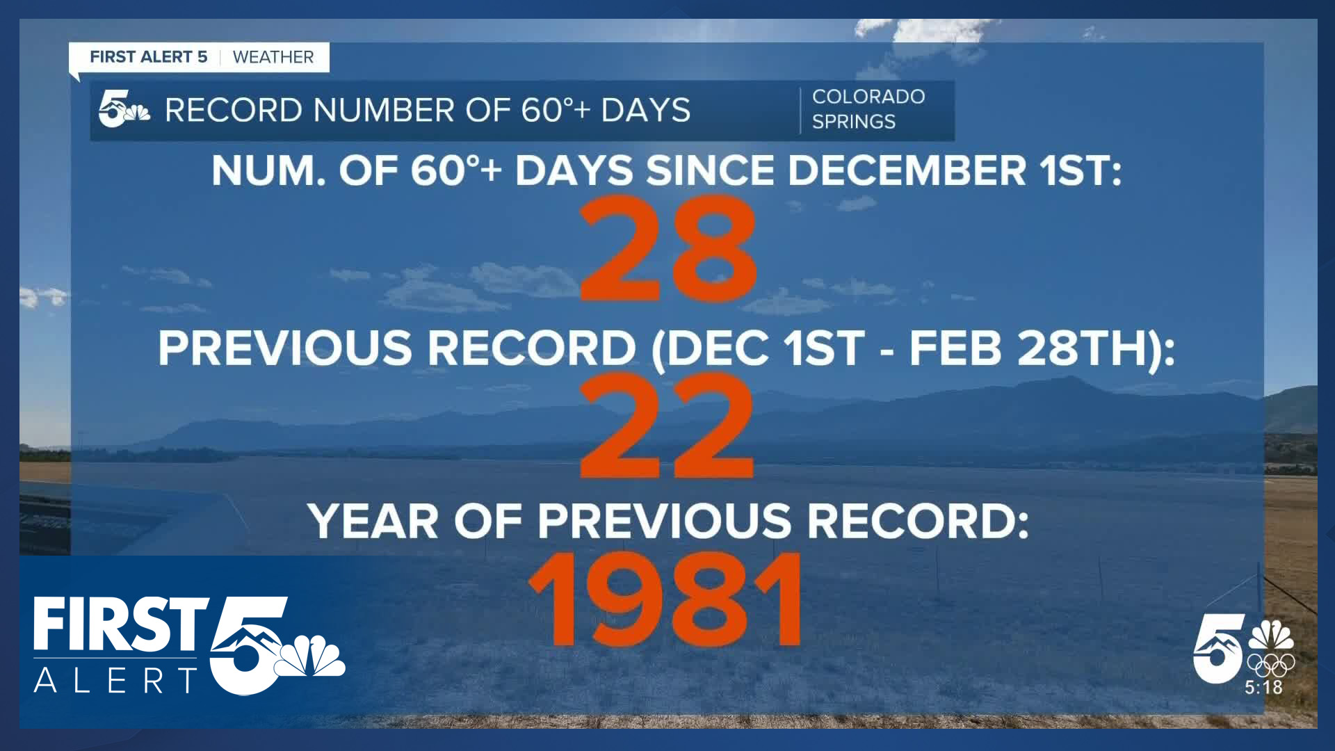
Meteorological winter runs from Dec. 1 through the end of February. This season, Colorado Springs has recorded 28 days at or above 60 degrees — the most on record, and it isn't close. That means nearly 1 in every 3 days this winter has reached or exceeded 60 degrees. The forecast over the next several days suggests we're likely to finish meteorological winter with at least 30 days at or above 60.
The previous record-holder is 1981 — a year widely regarded as having the worst winter snowpack on record in Colorado, according to data from the Colorado Climate Center. That winter, there were 22 days at or above 60 degrees.

The record warmth shows up on the cold end of the thermometer, too. Colorado Springs has seen only 69 nights with a low temperature at or below freezing this winter. Again, 1981 ranks second, with 75 such nights. Even if temperatures drop below freezing every remaining day in February — an unlikely scenario given downslope winds — that record will stand.
The culprit is a potent and unusually persistent ridge of high pressure over the western United States. In a La Niña pattern, a ridge like this is not unexpected. But this winter's high-pressure system has been positioned farther east and has been far more consistent than in a typical La Niña year.

That persistent ridge has also kept the jet stream north of Colorado for much of the season. In a typical La Niña winter, the jet stream pushes into Colorado from the northwest, producing significant snowfall in the northern mountains. This winter, the jet stream — and the storm track with it — has remained to the north, keeping the entire state dry.
The ridge's influence on wind has been more nuanced. Significant downslope wind events did occur, including last week. But overall, February has not been a particularly windy month. The average wind speed in Colorado Springs this month has been just under 9 miles per hour, below the monthly average of approximately 9.5 miles per hour. While that difference may seem minor, it is significant in the context of snowfall: the ridge has been strong enough to suppress the wind-driven storm systems that typically deliver mountain snow.
The recent May-like warmth has even left its mark on the landscape, with trees budding early in some areas. The numbers tell the story — this winter has been anything but.
____
Have a question or story idea you would like the First Alert 5 Weather team to consider? Email: weather@koaa.com
Watch KOAA News5 on your time, anytime with our free streaming app available for your Roku, FireTV, AppleTV and Android TV. Just search KOAA News5, download and start watching.
