


COLORADO SPRINGS, Colo. (KOAA) — Tonight's Forecast:
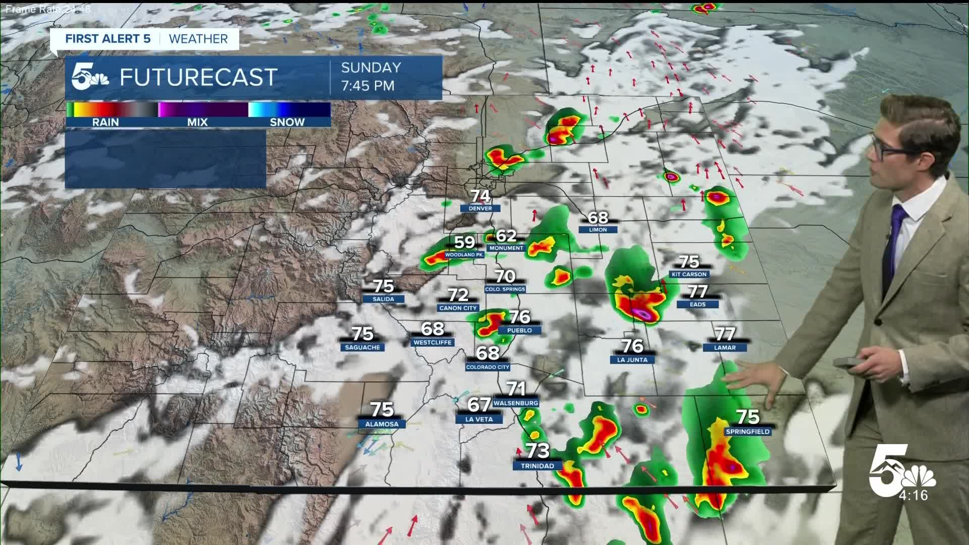
Heavy rainfall this weekend prompted a Flash Flood Emergency with major impacts to the Beulah area today, as heavy thunderstorms formed over the fire both Saturday and Sunday afternoons.
Thunderstorms remain possible early tonight, with a Severe Thunderstorm Watch in place for Eastern Colorado through 9:00 PM. Isolated thunderstorms will continue to pulse up around the Pikes Peak Region, and into the southern mountains before about 10 PM, and a few storms are still possible early tomorrow morning on the plains - which will remain capable of heavy rainfall.
Skies will clear out before sunrise.
Colorado Springs forecast: Low: 56; High: 86;
A few thunderstorms are still possible early tonight, with heavy rain being the biggest potential issue. The storm chance drops after about 1:00 AM and skies will clear out. There are lower storm chances on Monday.
Pueblo forecast: Low: 60; High: 89;
Isolated thunderstorms are still possible tonight, but the main threats should end by 9:00 PM. Expect a sunnier day on Monday.
Canon City forecast: Low: 59; High: 88;
Partly cloudy with storms possible before 10 PM, with heavy rain the main concern. Decreasing clouds overnight.
Woodland Park forecast: Low: 50; High: 76;
Additional thunderstorms are still possible for the next few hours as poorly defined upper level energy continues to move overhead and the environment remains supportive. That said, severe threats should reduce after sunset, and end after midnight. Skies then clear slowly.
Tri-Lakes forecast: Low: 50s; High: 80s;
A couple of early evening thunderstorms, then drying and clearing overnight. Low storm chances on Monday.
Plains forecast: Low: 60s; High: 80s;
Thunderstorms will remain possible late this evening, with a couple storms capable of producing damaging winds and large hail. These will continue well into the overnight hours.
Walsenburg and Trinidad forecast: Low: 56/58; High: 85/87;
Mainly dry overnight, with mostly cloudy skies.
Mountains forecast: Low: 50s; High: 70s;
FLASH FLOOD WATCH in effect until 8:00 PM for the ASPEN ACRES BURN SCAR
Flash flooding from thunderstorms is still possible over the Aspen Acres burn scar this evening, with a new warning in place until 10:00 PM.
Extended outlook forecast:
Storm chances decrease significantly Monday in southern Colorado as high pressure begins to nose back into the state and tamps down on storm formation. This will also redirect the monsoon moisture plume to the west. The high will strengthen over the Four Corners Region, as a secondary center of high pressure weakens over Texas.
Temperatures will warm back up again to near seasonal averages.
The high will continue to strengthen over the Four Corners region on Tuesday leading to a warming and drying trend with isolated PM mountain storms each day. Tuesday itself will be hot.
A cold front will arrive Tuesday night, which brings additional moisture back to southern Colorado and your next chance for thunderstorms on Wednesday. Some strong storms will be possible on the far eastern plains.
The ridge will then return to being the dominant weather driver through the end of the week as it bobbles around Colorado, with more daily afternoon mountain thunderstorms while the local story turns back to heat. The sinking air under the ridge will crank up the thermostat into the 90s and triple digits by next weekend.
____
Curious about the First Alert 5 Weather Storm Impact Scale? Check out our cheatsheet explainer.
Watch KOAA News5 on your time, anytime with our free streaming app available for your Roku, FireTV, AppleTV and Android TV. Just search KOAA News5, download and start watching.
