

Today’s Forecast:
Even with a few degrees of cooling in some areas today, warmer than average highs will continue across Southern Colorado. Highs on I-25 and the Plains will warm into the 80s and 90s, with a mix of 70s and 80s for our mountains and mountain valleys.
Recycled moisture combined with daytime heating will provide enough lift to generate some hit or miss showers today along and west of I-25. Storms could generate more gusty winds, along with frequent lighting and the possibility of small hail. Storms in the Pikes Peak Region could fire off as early as the lunch hour in Teller County, with rain possible near I-25 anytime between 3-6 pm.
Colorado Springs forecast: High: 87; Low: 59. Today's highs may cool by a degree or two from yesterday, but will still remain around 3-5 degrees above average. A few showers will be possible this afternoon, mainly between 3-6 pm.
Pueblo forecast: High: 94; Low: 62. Drier skies on Tuesday will mark the start of a quieter stretch of weather that's likely to continue until Thursday. Highs for the next few days will top out in the middle to upper 90s.
Canon City forecast: High: 91; Low: 63. Sunshine early will give way to increasing clouds this afternoon, with around a 30% chance of shower today. Even if you don't see rain today where you live, it will turn breezy this afternoon due to developing storms in the area.
Woodland Park forecast: High: 79; Low: 48. Much like yesterday, we'll see a warm and unsettled afternoon, with another round of scattered thunderstorms today in Teller County.
Tri-Lakes forecast: High: 80s; Low: 50s. Warm, with increasing clouds this afternoon and the potential for a few showers or thunderstorms. The main threats from today's storms may include strong wind gusts and frequent lightning.
Plains forecast: High: 90s; Low: 50s/60s. Drier air will settle into the Plains on Tuesday, with highs down a few degrees from yesterday.
Walsenburg and Trinidad forecast: High: 80s/90s; Low: 50s. After some scattered rain showers this morning, we should dry out for a few hours before a chance for spotty thunderstorms later today and this evening. Severe weather is not expected on Tuesday.
Mountains forecast: High: 70s; Low: 40s. The southeastern mountains will see another round of scattered thunderstorms this afternoon, with storms likely to pulse up as early as the lunch hour. Storms will be capable of moderate to heavy rainfall, gusty winds, small hail and frequent lightning.
Extended outlook forecast:
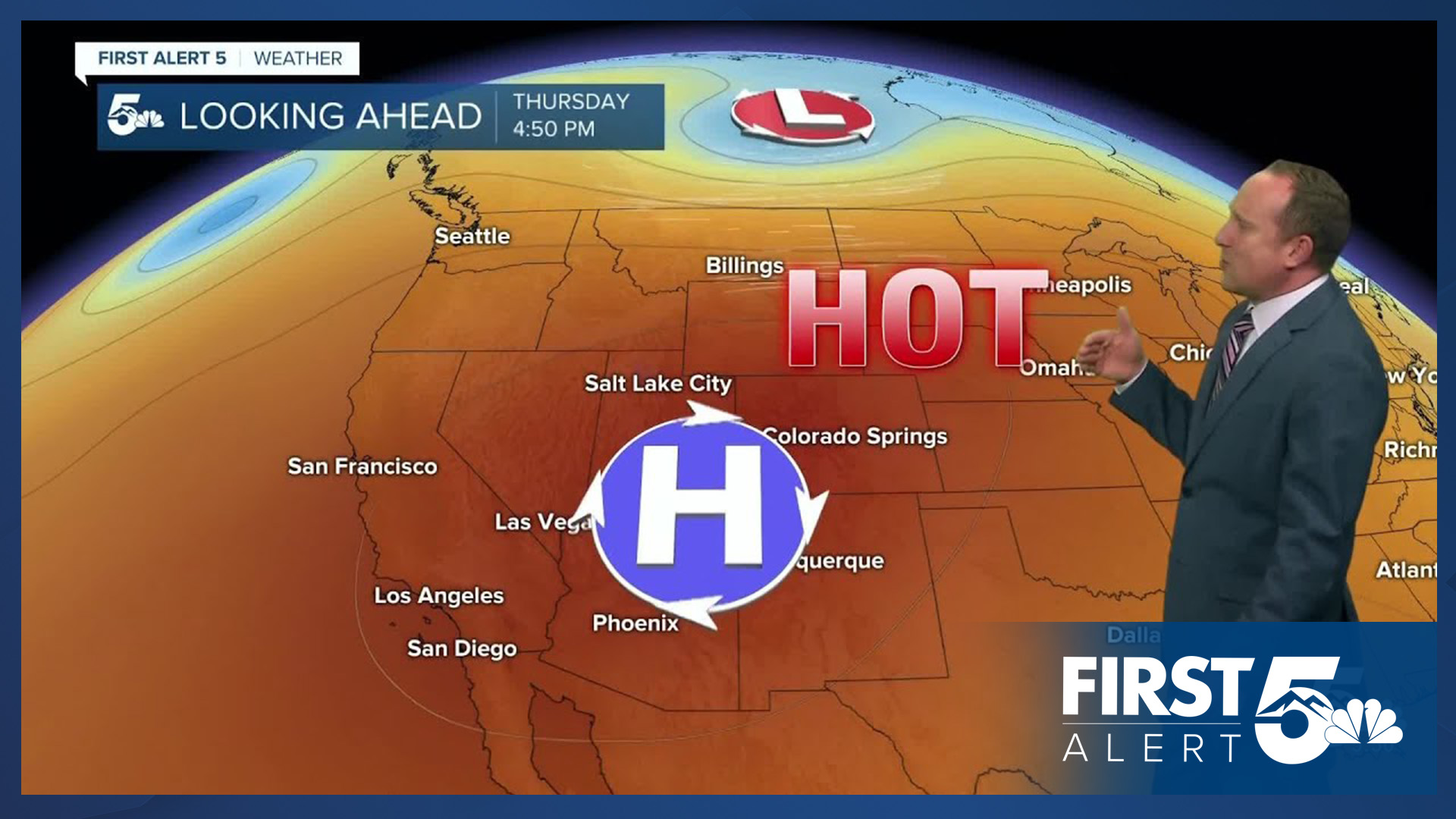
High pressure will continue its dominance in the short-term period, settling over the Four Corners Region through Thursday. This will lead to a warm-up, with highs in the upper 80s on Wednesday and the lower 90s on Thursday. The current record on Thursday at the Colorado Springs Airport is 94 (2007). These two days will also be mostly dry in Colorado Springs, with only a few mountains showers each afternoon. Highs on the Plains on Thursday could top 100 degrees in several areas.
As high pressure drifts farther west on Friday, a cold front will move into the state from the north. This will lead to increasing showers both Friday and Saturday, along with cooling highs. As a deeper plume of sub-tropical moisture interacts with our state, we'll see the potential threat of heavy rain from Sunday into early next week.
Curious about the First Alert 5 Weather Storm Impact Scale? Check out our cheatsheet explainer.
Watch KOAA News5 on your time, anytime with our free streaming app available for your Roku, FireTV, AppleTV and Android TV. Just search KOAA News5, download and start watching.
