We see it here all the time in the cold season. The air temperature is 40F, and it’s snowing! Weren’t we taught in school, that 32F is the freezing point (of pure water) and that snow/ice melts at 33F and above? So, how can it be snowing at 36F, 38F, 40F? Are we seeing things? Is it a mirage?!
It’s a mystery until you begin to picture what is happening…in 3D.
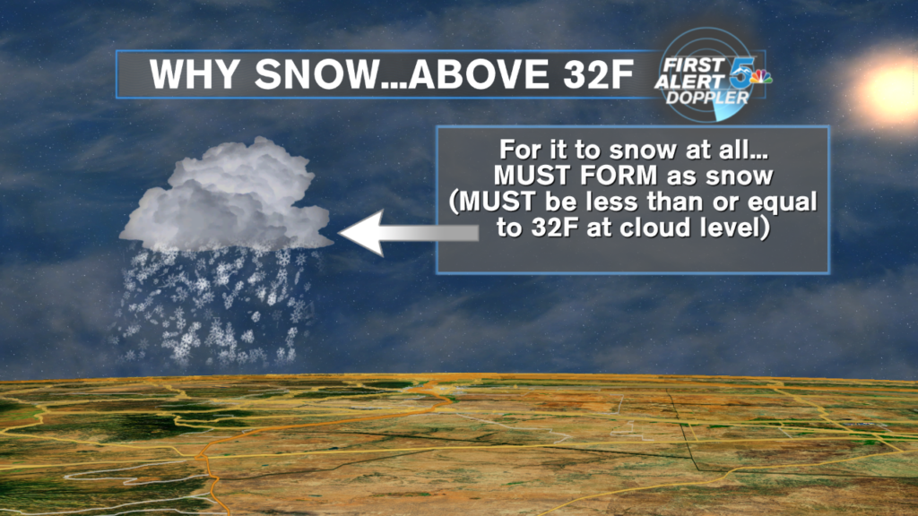
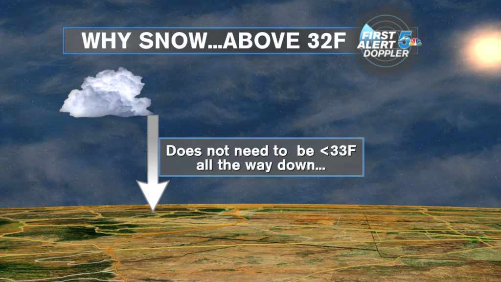
In order for a snowflake to form, the temp must be 32F or lower. No exceptions.That flake then falls. Usually a few thousand feet or more, from the cloud that “birthed” it. Once formed and falling, it has several thousand feet of air to deal with, before reaching the ground. The air, from cloud to ground, could be at or below freezing, and that is the simplest case. The flake survives.
But again, how is it possible to be 45F and snowing?
Suppose the air was below freezing, all the way down…until about say, 20 feet above your head. That would mean that the flake only has to survive 20 feet of fall, through the above freezing temperature, to survive. That happens all the time here. How? Why?

Remember, ANY moisture falling through air, is affected by the air but is also affecting the air, in return! It is symbiotic! (Great word.) So, in that last 20 feet, the air may be beginning to melt the flake, but, the flake…by the process of melting in and of itself, is evaporatively cooling that air! So, those first few minutes of flakes never reach the ground, because they are evaporating in to the air (virga), and thus, cooling that air, often several degrees or more. (Try wetting your finger and sticking it just outside the car window. The wind evaporates the moisture, which then cools your finger. Same exact physics here.)
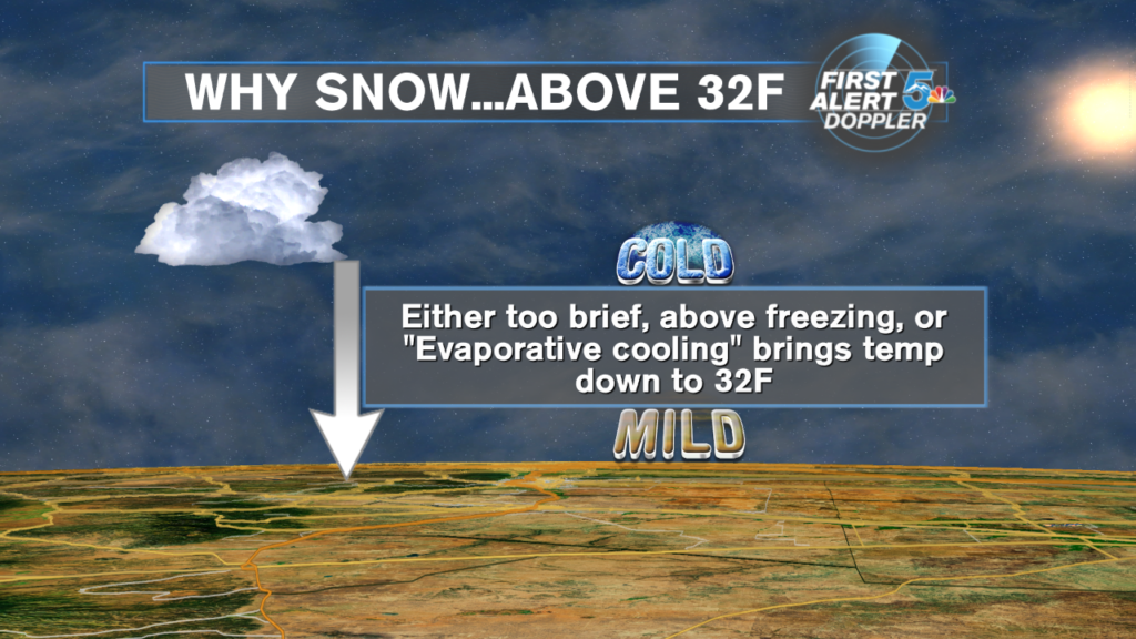
So, some moisture is spent, cooling the air. If the above freezing layer is thick, the snow will change to rain. But, if it is a thin layer (final 20 feet), the flakes evaporate at first, cooling down that 45F air to close to 32F, and the subsequent flakes…survive the trip! (It’s nice to know that snowflakes can be so unselfish, sacrificing themselves for their fellow flake!)
This happens more often in higher elevations like ours, because the air is usually much drier than nearer sea level. That dry air temperature can be changed much quicker and easier than humid air. (Also, the temperatures tend to fall off faster with height, in dry, mountainous air.)
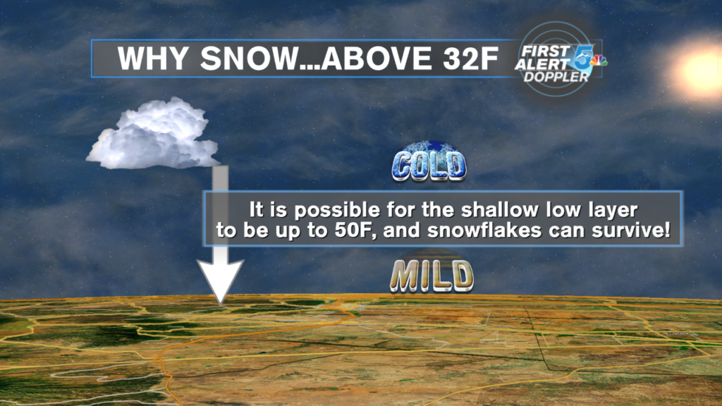
I have personally seen it snow, when the air at head and sensor height was 49F! It is briefly possible to do it at 50F. Obviously, within minutes, the air temp falls towards 32F, but it was snowing briefly, at 49F!
But that is why, especially in daytime…when it is usually warmer than night, we often see snow begin at 40-45F, and then temps plummet…because the first snowflakes are melting and cooling the air, at first…so that subsequent snowflakes never melt!
This process happens all the time it rains or snows. The precipitation, of any type, cools the air it falls through, especially in the beginning of an event, when it is used up…saturating that air (virga). That’s why a hot summer day, suddenly gets much cooler after a refreshing thunderstorm.
