

Tonight's Forecast:
Storms will linger late tonight and dissipate between midnight to 2 am in the plains. Otherwise, it will be partly cloudy tonight with mild temperatures.
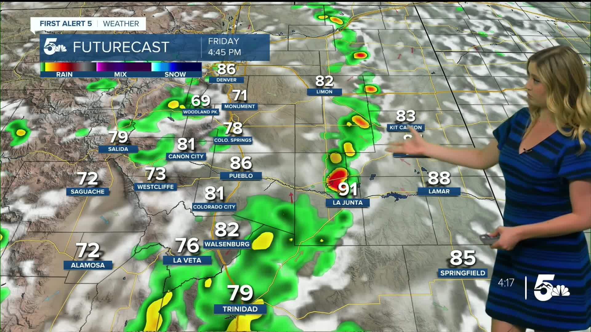
Colorado Springs forecast: Low: 55; High: 82;
It will be partly cloudy on Friday with temperatures remaining a couple of degrees below average. Thunderstorms will be possible in the early afternoon to early evening. The main hazards will be heavy rain and hail.
Pueblo forecast: Low: 58; High: 90;
It will be partly cloudy and warm on Friday, but still a couple of degrees below average. Thunderstorms will be possible in the afternoon, bringing the risk of heavy rain and hail.
Canon City forecast: Low: 59; High: 88;
Friday will be partly cloudy with warm temperatures. Thunderstorms will be possible in the early afternoon, with small hail and heavy rain possible.
Woodland Park forecast: Low: 46; High: 75;
It will be partly cloudy on Friday with mild temperatures and another round of afternoon showers and thunderstorms.
Tri-Lakes forecast: Low: 54; High: 81;
It will be partly cloudy with afternoon rain and thunderstorms on Friday.
Plains forecast: Low: 50s-60s; High: 80s-90s;
Starting with some morning clouds with increasing sunshine allowing highs to rise to the upper 80s to mid-90s. Thunderstorms will be possible from mid-afternoon to evening.
Walsenburg and Trinidad forecast: Low: 55/55; High: 86/86;
It will be partly cloudy on Friday with another round of afternoon thunderstorms possible.
Mountains forecast: Low: 40s; High: 70s-80s;
It will be mostly sunny to partly cloudy on Friday. Scattered thunderstorms will be possible in the early afternoon, with small hail and heavy rain possible.
Extended outlook forecast:
This weekend, we will be a bit warmer in the 70s to 90s. And you guessed it, thunderstorms are possible in the afternoon on Saturday. But on Sunday, it is looking drier for most of us with sunshine, and just a few spotty storms are possible in the plains.
Next week is setting up to be a scorcher every day. We could be close to records next week. Tuesday looks like the highest likelihood to break a record right now, with a forecast high of 93, which would tie the record of 93 for August 5th in Colorado Springs. The forecast high in Pueblo next Tuesday is 101 and the record is 102.
____
Curious about the First Alert 5 Weather Storm Impact Scale? Check out our cheatsheet explainer.
Watch KOAA News5 on your time, anytime with our free streaming app available for your Roku, FireTV, AppleTV and Android TV. Just search KOAA News5, download and start watching.
