Disclaimer: This is sponsored content. All opinions and views are of Monarch Mountain and does not reflect the same of KOAA.
A large winter storm will impact Colorado's ski resorts this weekend after a bit of a lull in the past week in mountain snow. Winter weather alerts are painted across the western half of the state.

Winter Storm warnings are in effect for the San Juan mountains through 5PM Saturday, and until 5AM Sunday for the northern mountains as well as the Elk range (Aspen area). Up to 2 or more feet of snow are possible in these warning zones through Sunday.

The highest totals right now look to be in the central I-70 corridor near Vail Pass, and the San Juans, both of which could see 2 feet or more of snow. Other resort zones will see a foot.

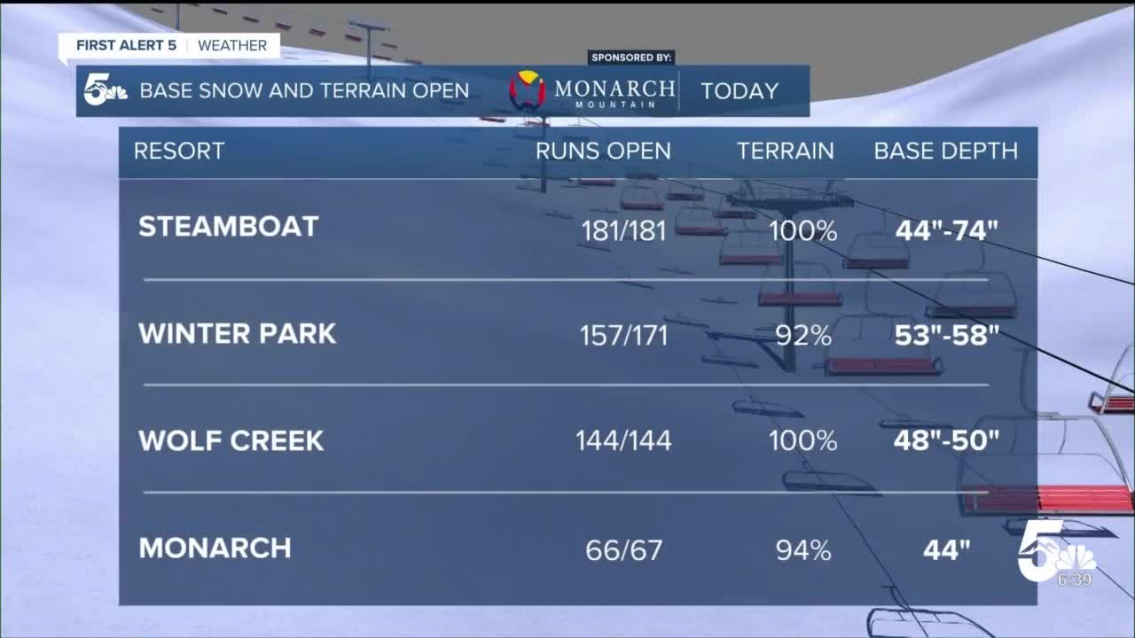
Resort base depths are a bit lower than they were a few weeks ago, with statewide snowpack dropping a bit as well - but overall base depths remain respectable. In addition, most resorts now have all, or almost all, terrain open...so you'll have no shortage of lines to pick.
Temperatures will be in the 30s Friday, and 20s to 30s Saturday and Sunday - so no arctic cold with this system, in fact the snow itself will be a bit "heavier" than most of our storms with a higher water content. Good for snowball throwing at other skiers in your party!
In the backcountry, avalanche risk has dropped generally to a 2/5 moderate risk, however, the southwestern mountains have avalanche watches posted for this weekend - with risk expected to rise with this new storm.
__
Watch KOAA News5 on your time, anytime with our free streaming app available for your Roku, FireTV, AppleTV and Android TV. Just search KOAA News5, download and start watching.


