


Today’s Forecast:
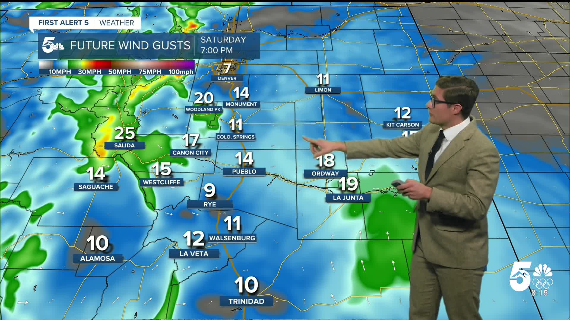
Following record-shattering warmth on Friday, driven by downslope wind...we're tracking more wind on Saturday. Downslope breezes have continued overnight and it's mild this morning in the mountains and along I-25... with many of us beginning the day in the 50s and 60s. That's well above our average -high- temperatures for this time of year. Our upper-level winds are largely west to east at the moment , which is leading to another round of wave clouds this morning across parts of the area too, though these should dissipate.
A cold front is pushing in from the northeast, and will cool temperatures today across the plains. As a result, highs today will only climb to the upper 50s to low 60s - not that much warmer than the temperatures this morning.
Skies will remain partly to mostly cloudy today. Winds will be out of the west near the mountains but will shift northeast late this morning on the eastern side of the city.
Colorado Springs forecast: High: 58; Low: 27.
Decreasing clouds, with partly cloudy skies this afternoon. Gusty west of I-25, particularly this morning, with wind gusts of 25-35 mph possible and sustained wind at 10-20 mph out of the west northwest. By late morning, along and east of I-25, winds shift east at 10-15 mph, and eventually southeast.
Pueblo forecast: High: 62; Low: 25.
Mostly sunny and windy this morning! Expect gusts of 25-40 mph through mid-morning. An incoming cold front and modestly weaker upper-level flow will reduce winds a bit this afternoon, and winds eventually shift easterly with patchy clouds by mid-afternoon.
Canon City forecast: High: 64; Low: 31.
Mostly sunny, and it will again be gusty and warm. Winds won't be as strong as yesterday - 10-20 mph sustained, gusts to 35.
Woodland Park forecast: High: 52; Low: 30.
Sunny and windy - again - but significantly less windy than Friday. West winds at 15-25 mph, gusting 40-50 mph through early afternoon (1/2 PM), then decreasing.
Tri-Lakes forecast: High: 50s; Low: 20s.
Mostly sunny with northwest winds at 10-15 mph, shifting south this afternoon.
Plains forecast: High: 40s/50s; Low: 20s.
Mostly sunny with east winds at 10-15 mph.
Walsenburg and Trinidad forecast: High: 63/68; Low: 32/31.
Mostly sunny and gusty, mainly this morning. West winds at 10-25 mph, gusting to 35 mph.
Mountains forecast: High: 50s; Low: 20s/30s.
Sunny and windy. West winds at 10-25 mph, gusting to 40 mph through the morning. After 1/2PM, winds will steadily decrease but remain westerly.
Extended outlook forecast:
It will be slightly cooler on Sunday - the first day of calendar winter, and the last day of Hanukkah, due to weaker and more sporadic downslope flow. Higher elevation zones are still likely to see westerly winds and remain mild. For the plains, highs in the 40s to low 50s will feel a bit more seasonal.
Downslope wind returns on Monday and fire danger will increase again. Highs will warm to the upper 60s to low 70s. The record in Colorado Springs Monday is 69, and it's 75 in Pueblo. With this setup, you can again expect gusty winds in and near the mountains and in gap flow zones. In general, Christmas week is going to feature many days of record-breaking heat potential in southern Colorado on the plains.
Tuesday will be cooler with another "cool" push of air, but that should keep most spots in the lower 60s.
A ridge of high pressure will shift southeast by Wednesday, providing most of the country with above average temperatures. In Colorado, that high position helps turn the jet stream to a more southwesterly direction over the state, which means more wind and warmth in southern Colorado. It could however also bring the western mountains some snow.
And we'll track more downslope wind in the second half of next week, with Christmas looking warm and gusty.
____
Curious about the First Alert 5 Weather Storm Impact Scale? Check out our cheatsheet explainer.
Watch KOAA News5 on your time, anytime with our free streaming app available for your Roku, FireTV, AppleTV and Android TV. Just search KOAA News5, download and start watching.
