

Wednesday Wildfire Danger:
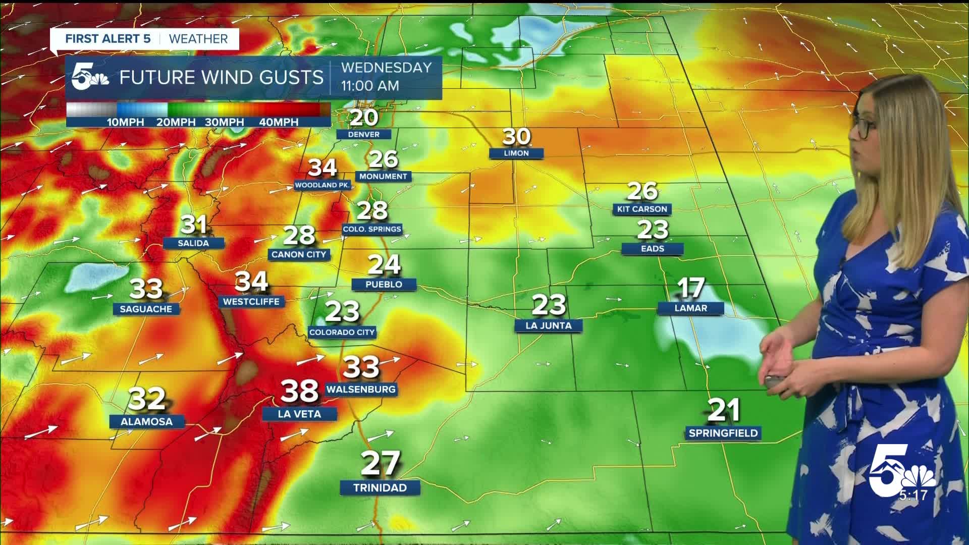
A RED FLAG WARNING is in effect from 10 am until midnight in southern Colorado. Wind gusts will reach 45-65 mph, and humidity will drop below 15%.
In the zones highlighted in yellow, including the upper Arkansas River, the San Luis Valley, the Sangre De Cristo Mountains, and the Wet Mountains region, it is a particularly dangerous situation. This means that fire danger is VERY high in this region with humidity less than 9%, gusts over 45 mph, and critically dry fuels.

Colorado Springs forecast: Low: 50; High: 80;
RED FLAG WARNING 10 am until midnight. Wind will be out of the WSW, gusting up to 45 mph. The high temperature will be almost 20 degrees above average.
Pueblo forecast: Low: 47; High: 87;
RED FLAG WARNING 10 am until midnight. It will be very warm and gusty on Wednesday. Wind will be out of the WSW, gusting up to 45 mph.
Canon City forecast: Low: 49; High: 81;
RED FLAG WARNING 10 am until midnight. It will be warm and dry on Wednesday. Wind will be out of the WSW, gusting up to 45 mph.
Woodland Park forecast: Low: 42; High: 68;
RED FLAG WARNING 10 am until midnight. A dry and gusty day, with W wind gusts up to 45 mph.
Tri-Lakes forecast: Low: 47; High: 75;
RED FLAG WARNING 10 am until midnight. It will be warm and dry on Wednesday with W wind gusts up to 40 mph.
Plains forecast: Low: 40s-50s; High: 80s-90s;
RED FLAG WARNING 10 am until midnight. A dry and hot day is expected on Wednesday. Wind will be out of the WSW, gusting 35-40 mph.
Walsenburg and Trinidad forecast: Low: 52/53; High: 78/81;
RED FLAG WARNING 10 am until midnight. It will be dry and very gusty with WSW wind gusting up to 50 mph in Walsenburg and 35 mph in Trinidad.
Mountains forecast: Low: 30s-40s; High: 60s-70s;
RED FLAG WARNING 10 am until midnight. A very dry and windy day leads to extreme fire danger. Wind will be out of the W or WSW, gusting 45-65 mph. The strongest gusts will be in the northern San Luis Valley, where a high wind warning is in effect from 1-8 pm.
Extended outlook forecast:
Thursday brings high fire danger once again, but wind gusts will be lower, maxing out in the 40 mph range, and temperatures will be about 10-15 degrees cooler.
____
Curious about the First Alert 5 Weather Storm Impact Scale? Check out our cheatsheet explainer.
Watch KOAA News5 on your time, anytime with our free streaming app available for your Roku, FireTV, AppleTV and Android TV. Just search KOAA News5, download and start watching.
