


Tonight's Forecast:
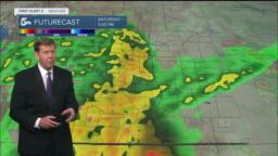
A few rogue thunderstorms will be possible through early this evening over the southeastern Plains. Most areas will stay dry however from the I-25 corridor west into the mountains.
More importantly, the Summer Solstice will occur at 3:14 am MDT. This is the time of the year when the sun reaches it's highest point in the Northern Hemisphere at 23.5 degrees north latitude.
Colorado Springs forecast: Low: 54; High: 74; Thanks to an overnight cold front, summer will begin with a cool down and a healthy dose of cloud cover for the Pikes Peak Region.
Pueblo forecast: Low: 56; High: 80; Cooling highs on Tuesday, and mainly just a slight chance of an afternoon or evening thunderstorm, with the best chances for rain tomorrow staying southeast of Pueblo County.
Canon City forecast: Low: 57; High: 77; Tuesday's going to be a beautiful day, with cooler highs across the region. Skies will be on the partly to mostly cloudy side, with an isolated shower possible for the afternoon to evening hours.
Woodland Park forecast: Low: 46; High: 68; Mostly cloudy skies and cooler than average highs on Tuesday. Not a bad start to summer in my opinion considering the heat that we often see this time of the year!
Tri-Lakes forecast: Low: 40s; High: 60s/70s; A mostly cloudy and mild start to summer over northern El Paso County. Moisture could try to sneak into the forecast by the afternoon, but shower chances appear slim this far north.
Plains forecast: Low: 50s/60s; High: 70s/80s; A slight chance of showers in the morning will give way to widely scattered showers and thunderstorms by the afternoon, with Tuesday's severe storm threat low.
Walsenburg and Trinidad forecast: Low: 40s/50s; High: 60s/70s; Tuesday will be a cooler and unsettled day for the southern I-25 corridor, with the potential for showers and thunderstorms increasing throughout the afternoon.
Mountains forecast: Low: 30s/40s; High: 50s; Cooler weather will move into the mountains on Tuesday, and along with the cool down, we're looking at the potential for scattered afternoon showers and thunderstorms. Above 11,000 feet, snow could mix in at times during some heavier showers.
Extended outlook forecast:
If last week(end) was a tease, late this week will be serve as a much larger sample of the summer monsoon as storm chances will increase across Southern Colorado. After an isolated chance of storms Wednesday, the work week is likely to end with improved storm chances Thursday and Friday, along with some summer sizzle.
A weekend cold front will drop highs down to the 60s and 70s, and bring a wetter and unsettled pattern to Southern Colorado from Saturday to Sunday. Heavier rain and thunderstorms will be possible both days, with impacts to outdoor plans quite likely. Stay tuned this week for further details as we fine tune the forecast.
____
Curious about the First Alert 5 Weather Storm Impact Scale? Check out our cheatsheet explainer.
Watch KOAA News5 on your time, anytime with our free streaming app available for your Roku, FireTV, AppleTV and Android TV. Just search KOAA News5, download and start watching.
