



Today’s Forecast:
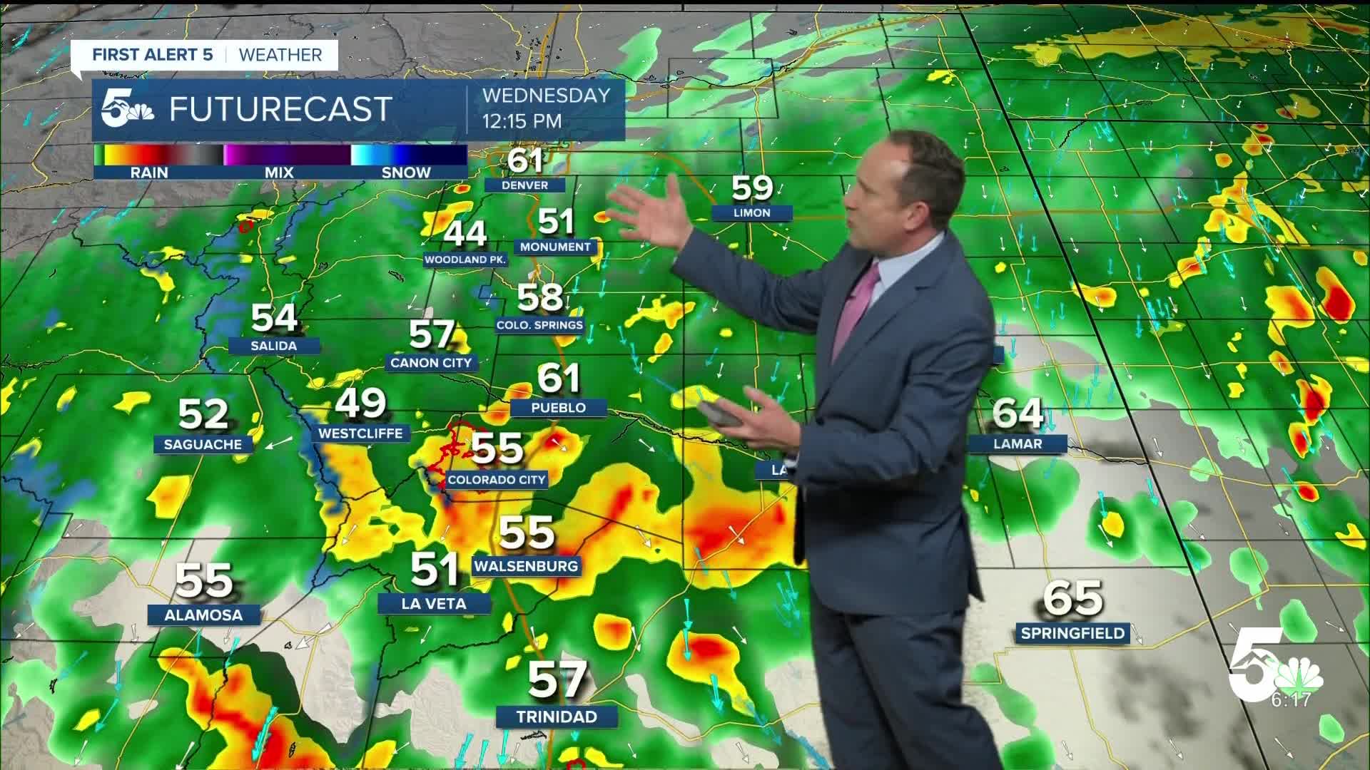
A high-impact storm will bring periods of rain and gusty wind to Southern Colorado on Wednesday, with a few isolated thunderstorms possible over the eastern Plains. This morning, we have seen a subtle shift in the evolution of the storm and the track of the incoming low and main moisture swath associated with the remnants of Hurricane Polo. While confidence is high for the highest totals to fall south of Highway 50, there's less confidence for beneficial moisture north of the Palmer Divide. In the Pikes Peak Region, rain totals over the next 12-24 hours look to fall within the 0.5"-1.5" range.
FLOOD WATCHES will remain in effect until early tomorrow for the entire News5 coverage area, including the ever so delicate Aspen Acres burn scar. Flooding is likely to occur in this area today, so stay tuned and please make sure that you have a way to receive updates.
That's just one component to this multi-faceted storm. We're also tracking mountain snow, with several inches of accumulation above 11,000 to 12,000 feet.
Lastly, the storm will bring 30-45 mph wind gusts to Southern Colorado and cool highs this afternoon. Temperatures today will only top out in the 50s and 60s.
Colorado Springs forecast: High: 59; Low: 46. Cool, unsettled and windy on Wednesday. Rain totals for the next 12-24 will range between 0.5"-1.5". A FLOOD WATCH will remain in effect until noon Thursday.
Pueblo forecast: High: 63; Low: 50. FLOOD WATCHES are now in effect in Pueblo County and what we've seen so far today is just the beginning of what's to come over the next 12-24 hours. Rain totals look to range between 1-2" for the incoming storm.
Canon City forecast: High: 61; Low: 50. A FLOOD WATCH will continue until noon Thursday, with periods of rain and gusty wind in our forecast for the next 12-24 hours. Rain totals around 1-2".
Woodland Park forecast: High: 50; Low: 37. Wet, cool and windy weather can be expected on Wednesday, with as much as 0.5" to 1.5" of rain on the way over the next 12-24 hours. This will mainly be a rain event for areas below 11,000 feet, but into the overnight hours, it's possible that we could see our first flakes of the season.
Tri-Lakes forecast: High: 50s; Low: 40s. Today's weather will be the coolest that we've seen since the end of May. Clouds and showers, heavy at times, can be expected throughout the day, along with gusty winds. Rain totals around 0.5" to 1".
Plains forecast: High: 60s; Low: 40s/50s. Our well advertised storm will bring rain and gusty winds to the southeastern Plains today, with areas south of Highway 50 seeing as much as 2-3" of rain through Thursday morning.
Walsenburg and Trinidad forecast: High: 50s/60s; Low: 40s. Windy, with periods of moderate to heavy rain on Wednesday as our well advertised storm moves closer to Southern Colorado. Rain totals around 2-3" through Thursday morning, with flooding possible.
Mountains forecast: High: 40s/50s; Low: 30s. It will be wet and unsettled on Wednesday in the mountains and any outdoor plans you have for today should be moved! As much as 2-4" of rain can be expected in the Sangres and Wet Mountains. Snow level today and tonight will be at or above 11,000 feet.
Extended outlook forecast:
On the backside of the storm, it will remain gusty and unsettled into Thursday morning. A few showers and thunderstorms will linger into Thursday morning on the eastern Plains before clearing out from west to east by the afternoon. Highs on Thursday will warm into the mid 60s in Colorado Springs and Pueblo, with upper 50s in Woodland Park.
Sunshine and upper 60s on Friday will be followed by dry skies and highs in the 70s this weekend.
____
Curious about the First Alert 5 Weather Storm Impact Scale? Check out our cheatsheet explainer.
Watch KOAA News5 on your time, anytime with our free streaming app available for your Roku, FireTV, AppleTV and Android TV. Just search KOAA News5, download and start watching.
