



Today’s Forecast:
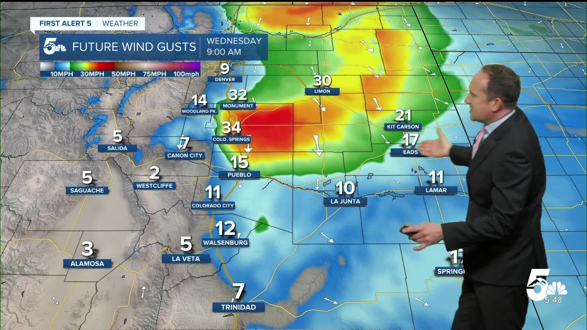
A potent cold front will sweep into Southern Colorado this morning, with some of the stronger 30-40 mph wind gusts expected right here in El Paso County. Wind gusts will be around 20-30 mph for the rest of Southern Colorado and should weaken this afternoon while shifting out of east.
Drier air behind the front will limit storms during the day, with highs this afternoon much closer to seasonal averages. A stalled out cold front over northern New Mexico will lift back into Colorado late tonight, and will act as a breeding ground for showers and thunderstorms. This morning, it appears that storms will stay along and south of Highway 50, with heavy rain, gusty winds and hail the main threats. Main timing of tonight's storms will be between 11 pm tonight and 6 am Thursday. Our afternoon and evening crews will be monitoring this closely for any potential impacts on the Aspen Acres burn scar.
Colorado Springs forecast: High: 82; Low: 55. Morning wind gusts could top 30-40 mph in the Pikes Peak Region, and look to peak between 8 am and noon. Behind this morning's front will come a cooler and breezy afternoon.
Pueblo forecast: High: 87; Low: 58. Morning wind gust in the Pueblo area will range between 20-30 mph. Dry skies will continue much of the day, but will be followed by a chance for thunderstorms later tonight after 11 pm.
Canon City forecast: High: 86; Low: 60. Breezy and cooler weather will make for a nice day in eastern Fremont County, with highs today about 10-12 degrees cooler than Monday.
Woodland Park forecast: High: 75; Low: 47. Skies will dry out today after a stormy day on Tuesday. Temperatures will continue to cool as well after the passage of another cold front this morning, with highs in the middle 70s.
Tri-Lakes forecast: High: 70s/80s; Low: 50s. Skies will dry out after some very gusty winds this morning. The worst of wind should weaken towards the lunch hour, with temperatures much cooler today compared to what we saw earlier this week.
Plains forecast: High: 80s/90s; Low: 50s/60s. On the Plains, we will see a dry and breezy day ahead of what looks to be a wet and stormy night. A cold front lifting northward from New Mexico will increase rain chances after 10-11 pm, with storms and heavy rain likely into the overnight hours.
Walsenburg and Trinidad forecast: High: 70s/80s; Low: 50s/60s. A breezy and cooler afternoon will give way to increasing chances for rain this evening near the Raton Mesa. Storms later tonight will intensify as they move east of I-25.
Mountains forecast: High: 60s/70s; Low: 40s/50s. Other than a few isolated showers in the southern Sangres, skies should be much drier today (and tomorrow) in the high country.
Extended outlook forecast:
A dry and breezy westerly flow pattern will develop late this week, with pleasant lower to middle 80s on Thursday that will be followed by hotter highs near 90 degrees on Friday. A few isolated storms will be possible near the Raton Mesa on Thursday and across the Continental Divide on Friday.
The longer-range forecast will feature a series of cold fronts, with modest temperature swings and some chances for rain. I have noticed that the models are backing off on beneficial moisture in the extended period, with lower end chances for afternoon thunderstorms in the Pikes Peak Region from Sunday through early next week.
____
Curious about the First Alert 5 Weather Storm Impact Scale? Check out our cheatsheet explainer.
Watch KOAA News5 on your time, anytime with our free streaming app available for your Roku, FireTV, AppleTV and Android TV. Just search KOAA News5, download and start watching.
