

It can be hard to tell when pumpkin spiced latte season arrives in southern Colorado.
Today has not been one of those days.
Temperatures are between thirty to forty-five egrees cooler than yesterday.
But that's not the biggest surprise to many of you this time of year. Powerful season-shifting cold fronts are actually common in September.
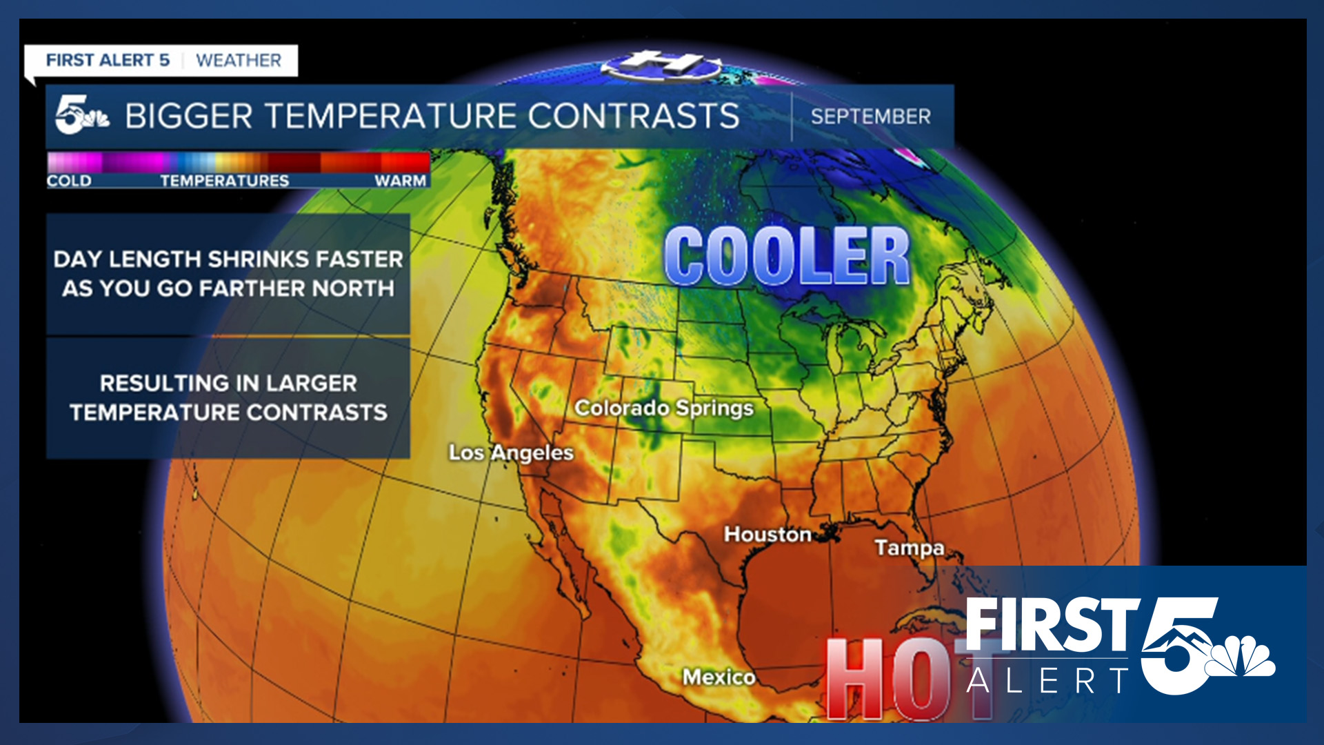
A cold front divides two different masses of air with the colder air pushing the warmer air away. Fronts form and are fueled by temperature contrasts - the bigger the contrast, the more potent the front.
As we head into fall, the days are getting shorter in the Northern Hemisphere - but they're staying about the same length in the tropics.
So the air in the Arctic gets colder but the air in the tropics remains hot.
Because of that the northern branch of our jet stream becomes more active and wavy which allows cold Canadian air to spill southward.
It clashes with the still very warm air in the South and boom you've got a strong cold front.
That's what happened today.
While these powerful fronts are common in September - the temperature change from yesterday to today has been particularly notable. The last time a more powerful front hit in September was in 2020.
That year - another Canadian front dropped temperatures from a high of 90 on the seventh to a low of 30 on the eighth!
____
Have a question or story idea you would like the First Alert 5 Weather team to consider? Email: weather@koaa.com
Watch KOAA News5 on your time, anytime with our free streaming app available for your Roku, FireTV, AppleTV and Android TV. Just search KOAA News5, download and start watching.
