


We've got another low pressure system moving in at the end of this week. And we're expecting rain, a good amount of it. You've probably heard us say this exact sentence countless times. But, have you ever wondered why low pressure systems cause rain, snow, and wind? Let's check it out!
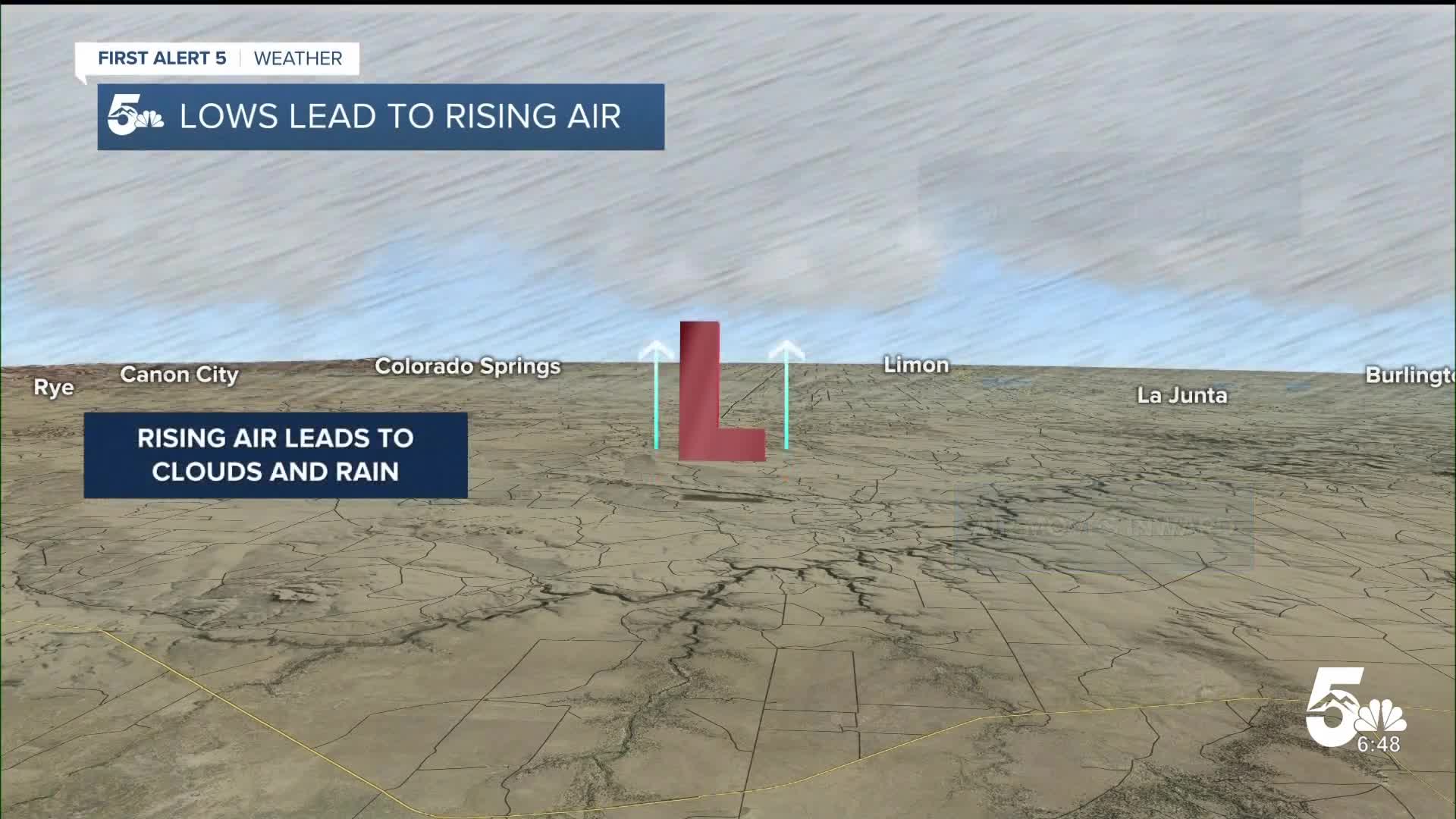
Air moves from where there's more to where there's less. Low pressure at the ground means there's less air where the low is compared to the air around it. Air moves in front around the low, to fill this hole.

When air moves in toward the low, it has to go somewhere. It can't go down though...the ground is in the way! So, the only way it can go, is up.

This means that surface low pressure leads to rising air. So, here's the science: When air rises - it cools. When air cools, water vapor becomes water droplets - and we get clouds and rain. Have you ever cracked open a cold bottle and seen a brief "cloud" form? There's water vapor in the bottle. When you open the bottle - air escapes, which cools the air in the bottle - and that cooler water vapor condenses, forming a cloud.

As for the wind - low pressure causes air to move as the atmosphere tries to return to equilibrium. A stronger low leads to faster moving air.

In the weather world, we call the energy air gains from the difference in pressure inside and outside a low the "pressure gradient force": the stronger the difference between the outside and inside air, the bigger that force gets, and the stronger our wind howls.
Our latest weather maker is complex - with multiple lows and fronts, moving through. That leads to several rain and snow chances. Statewide, here's how much we could see through this weekend:

Which is great news given how dry our April has been so far. But we'll have to be mindful of flooding potential. For the forecast itself, check here. To be clear, there's more to forecasting rain than just where low pressure is tracking across our state. But it's a good starting place.
____
Have a question or story idea you would like the First Alert 5 Weather team to consider? Email: weather@koaa.com
Watch KOAA News5 on your time, anytime with our free streaming app available for your Roku, FireTV, AppleTV and Android TV. Just search KOAA News5, download and start watching.
