

SOUTHERN COLORADO (KOAA) — What should feel like early spring is feeling more like the middle of summer, and the heat is just getting started.
A powerful heat dome is parked over the Southwest, bringing a weather pattern that is unprecedented for March.
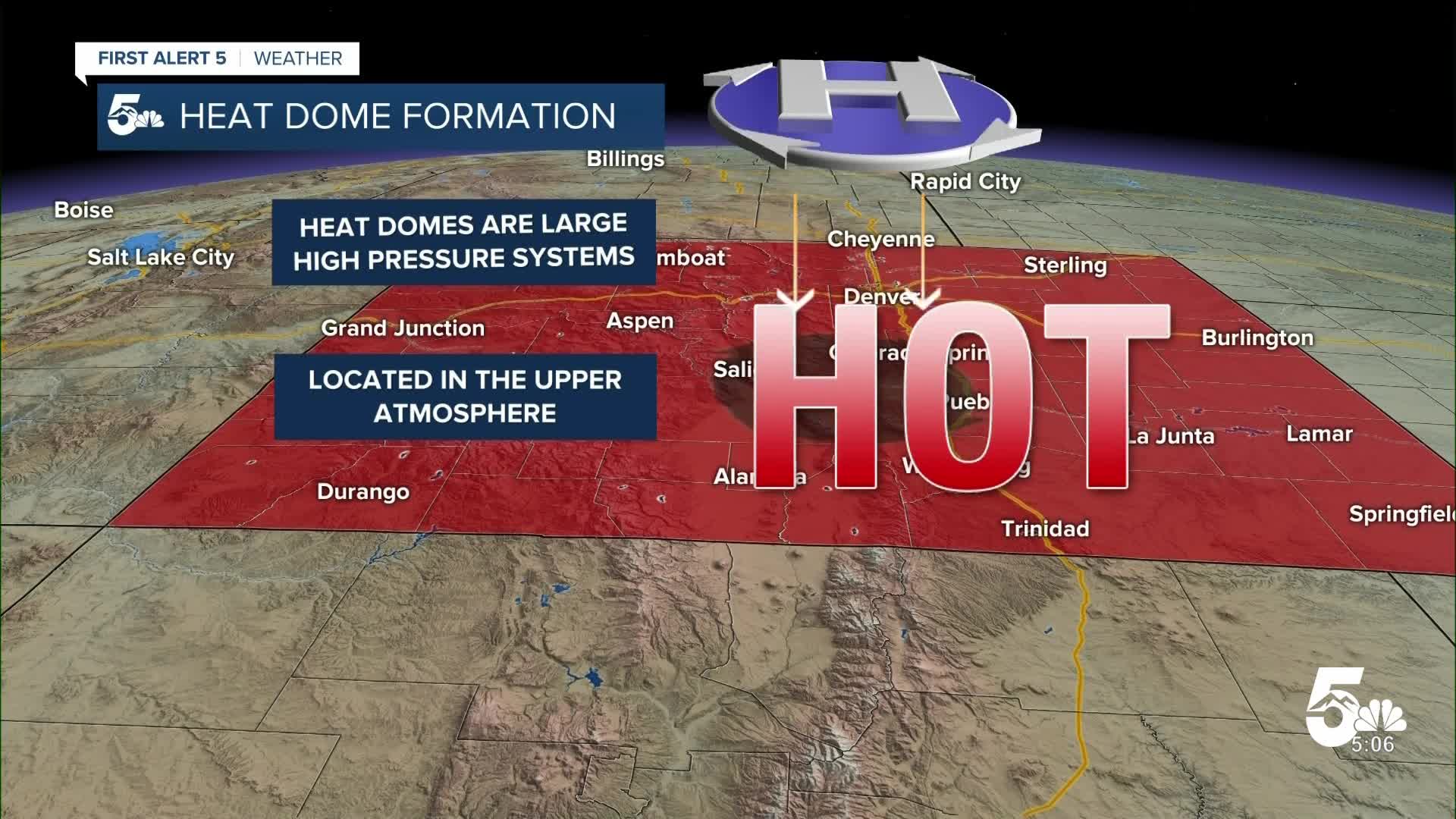
A heat dome is a large area of high pressure that forms in the middle of the atmosphere, thousands of feet higher than even the tallest mountains in Colorado.
Think of it like a giant lid in the sky. That lid creates sinking air, which warms temperatures, dries out conditions, and keeps skies sunny.
Heat domes are not rare, they appear every summer. What makes this one unusual is the timing.
The pattern feeds on itself, warm weather helps strengthen the ridge, leading to even hotter conditions the following day.
Normally, the jet stream dips south to bring cooler air to the region. Right now, it is bulging far to the north, allowing this summer-like heat to completely dominate the pattern weeks ahead of schedule.
Because a June weather pattern is arriving in March, meteorologists are tracking the potential for multiple days of record-shattering temperatures.
It is not just going to feel like summer this week — for the atmosphere, it essentially is.
____
Have a question or story idea you would like the First Alert 5 Weather team to consider? Email: weather@koaa.com
Watch KOAA News5 on your time, anytime with our free streaming app available for your Roku, FireTV, AppleTV and Android TV. Just search KOAA News5, download and start watching.
