


Wildfires from Oregon to California to Colorado continue to make headlines this week, with at least 36 deaths being blamed on the fires.
As of this evening, we have 66 active wildfires burning across the west. Smoke from these wildfires is now impacting Southern Colorado, as well as a large portion of the United States.
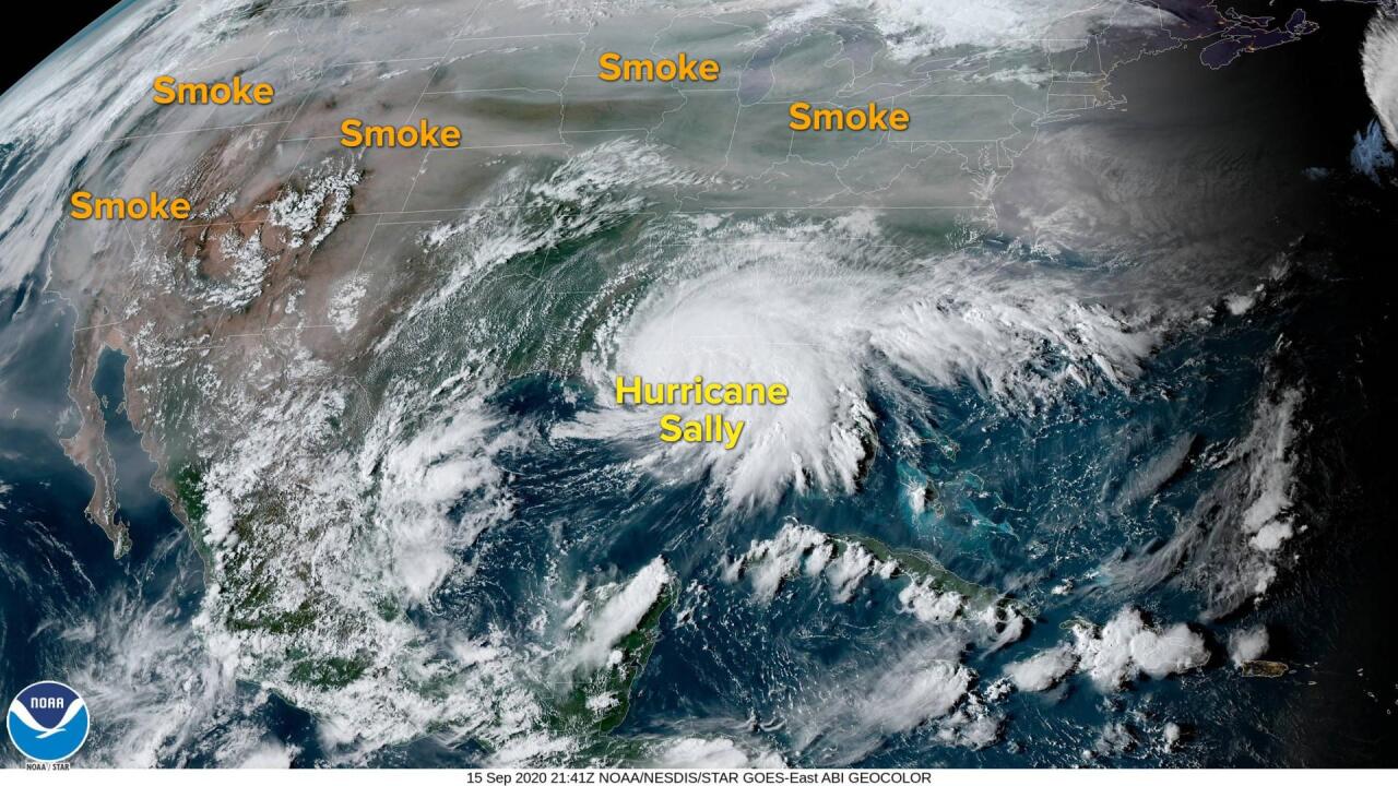
Taking a look at high definition GOES satellite imagery, this picture clearly shows how pervasive wildfire smoke is across the United States. It stretches across the West Coast, through the Rocky Mountain states, and now as far east as the Great Lakes and New England.
On a side note, the other visible feature on this image is Hurricane Sally over the northern Gulf of Mexico.
As for the smoke, it's now moving back into parts of El Paso County from the north. Until we get rain or a shift in the weather pattern, it could be sticking around for quite some time.
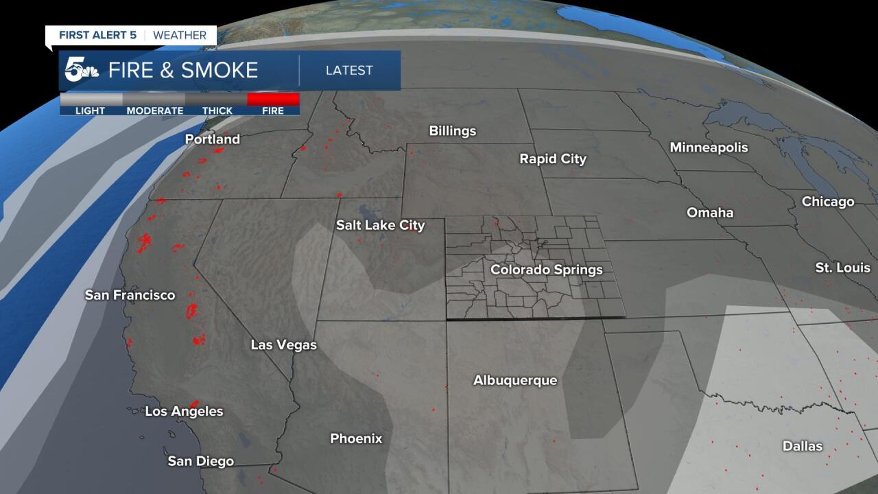
This map shows all of the active fires burning right now in the western half of the country, plus varying levels of wildfire smoke.
According to NBC News, some of the worst air quality in the world tonight is being reported across the West Coast.
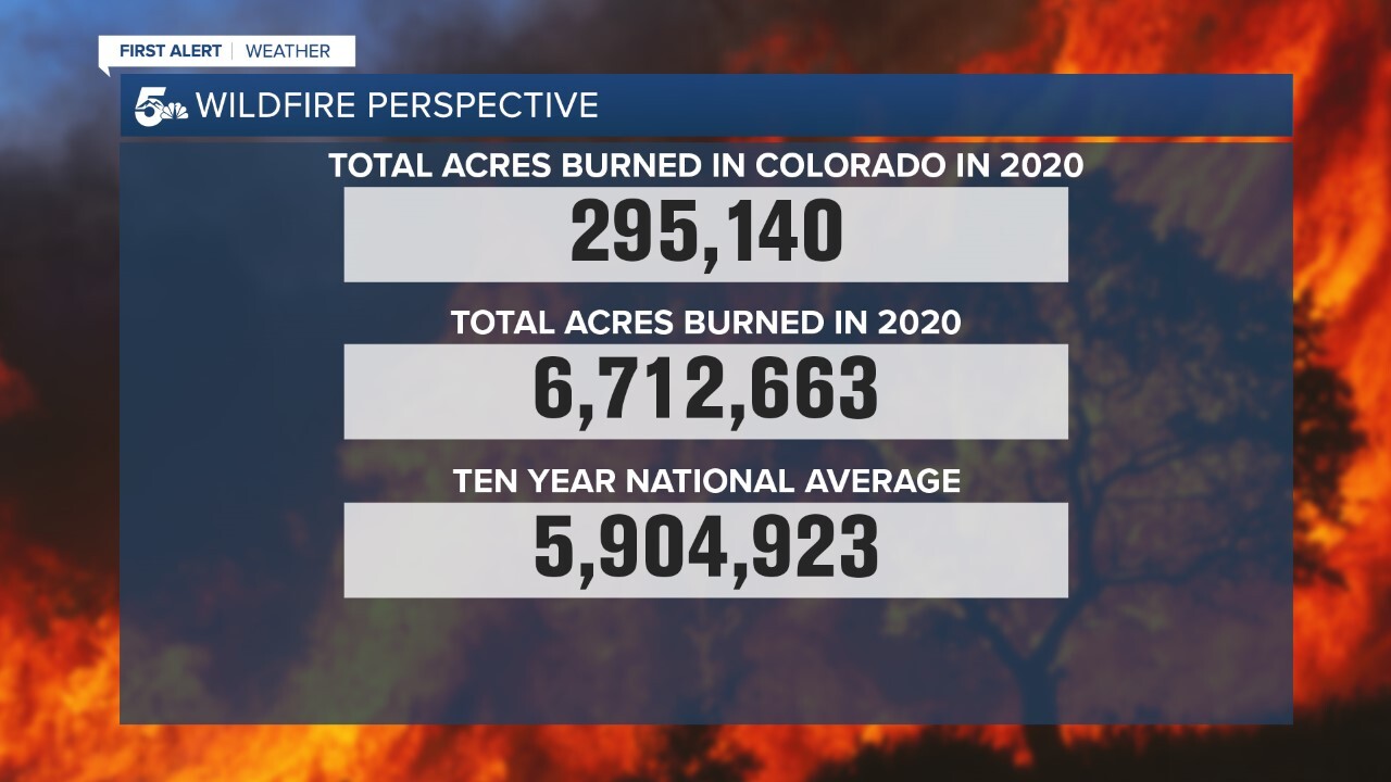
Now let's talk numbers. In Colorado, we've scorched nearly 300,000 acres of land this year, with two of this year's fires now ranking among the top-10 all time largest in our state's history.
The National Interagency Fire Center, or NIFC, is reporting that more than 6.7 million acres of land have burned so far this year.
The 10 year average is just above 5.9 million acres. We're already above that and for many areas, fire season is far from over.

Putting those numbers into perspective, the amount of land that's been charred by wildfire this year is equivalent to a large chunk of the News 5 viewing area.
What's to blame? Many experts agree that drought dry conditions, record heat and a warming climate are the key factors.
