


September isn't typically a month we think of when someone mentions severe weather in southern Colorado, but it's actually more common than you think — although the types of severe weather we get do shift a bit.
The Storm Prediction Center issues severe thunderstorm outlooks based on how likely quarter sized or larger hail, wind gusts above 57 miles per hour, or a tornado is in a given area. Today, they've issued a slight risk, which is a two on a five-point scale for how likely severe storms are.
Between 2019 and 2024, there were only four slight risk days in southern Colorado. One of those was exactly one year ago - on September 17th 2024. Interestingly, this is the first time in the past 5 years with 2 slight risks in September - part of the area was under a less expansive similar risk on September 9th.
Marginal risks - which are 1-out-of-5s on the severe risk scale, are more common with several occurring in an average September in southern Colorado.
Today the Storm Prediction Center also has some areas in a 2% tornado probability. This is the lowest possible level and it's about average, with the Storm Prediction Center issuing about one of these risks per September in the last 10 years in some part of southern Colorado.
But, actual tornado warnings and confirmed tornadoes are extremely rare. The last tornado warning in September was in Las Animas County in 2019. The last confirmed tornado in September was all the way back on September 3, 2009 in Crowley County near Ordway.
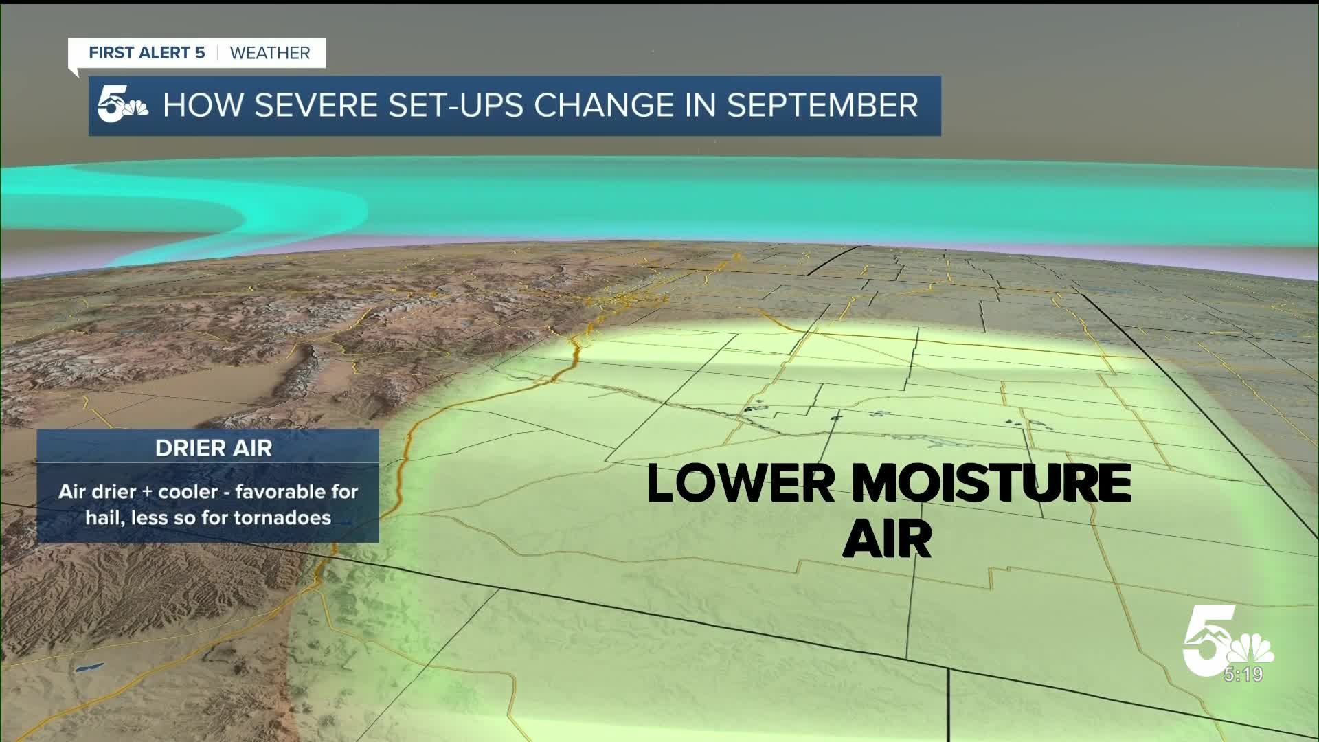
Large hail is by far the main severe weather threat in southern Colorado no matter the time of year. But the reason tornado threats are relatively lower in September is because our weather setup changes.
In September our jet stream becomes more active providing stronger winds in the upper atmosphere. This can enhance storm formation. But, at the same time, air at the ground tends to be colder and often drier than it is in spring and summer. The summer monsoon is typically petering out and upslope flow is reducing.
These factors lower the energy available for intense thunderstorm updrafts and can change the height where clouds form in the sky. These set ups are favorable for hail and wind, but aren't particularly good for tornadic potential.
____
Have a question or story idea you would like the First Alert 5 Weather team to consider? Email: weather@koaa.com
Watch KOAA News5 on your time, anytime with our free streaming app available for your Roku, FireTV, AppleTV and Android TV. Just search KOAA News5, download and start watching.
