


A strong and dynamic storm coming out of California has been hitting Colorado with some vengeance this week.
For the mountains...it's been a wintry mess, complete with heavy snow and powerful wind gusts.
For the Plains...we've seen some occasional showers, but our big weather story has been the wind and high fire danger.
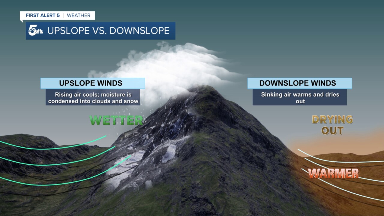
To explain what's happening, let's take a look at the difference between upslope and downslope flow.
With winds generally flowing west to east across the country, upslope winds in the example below will occur on western mountain slopes.
This causes rising air to cool and moisture to condense into clouds and snow.
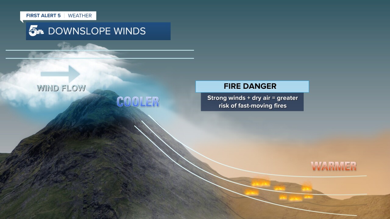
Meanwhile on the eastern slopes, the opposite occurs as sinking air warms and dries out.
Looking more closely at downslope flow (see example below)...storm energy aloft increases the potential for stronger winds at ground level.
For the Plains...the stronger the downslope wind, the higher the fire danger.
We can see that here as we take a look at the strength of the position of the jet stream winds (see below).
These winds can be found roughly 30,000 feet above ground level.
The orange tones over Colorado indicate upper-level wind speeds around 150 mph.
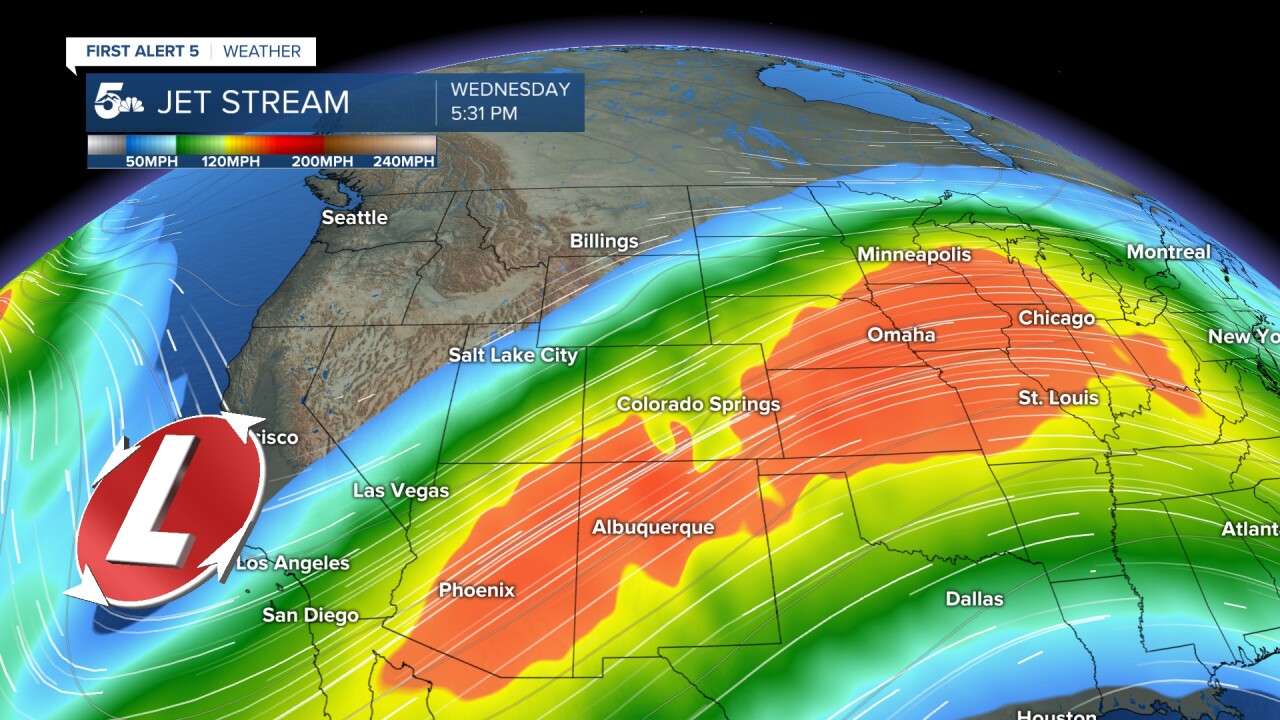
Under the right conditions, strong wind energy in the upper atmosphere can mix down to the surface.
This downslope flow set-up is what leads to many of our Red Flag Warning days in Southern Colorado.
