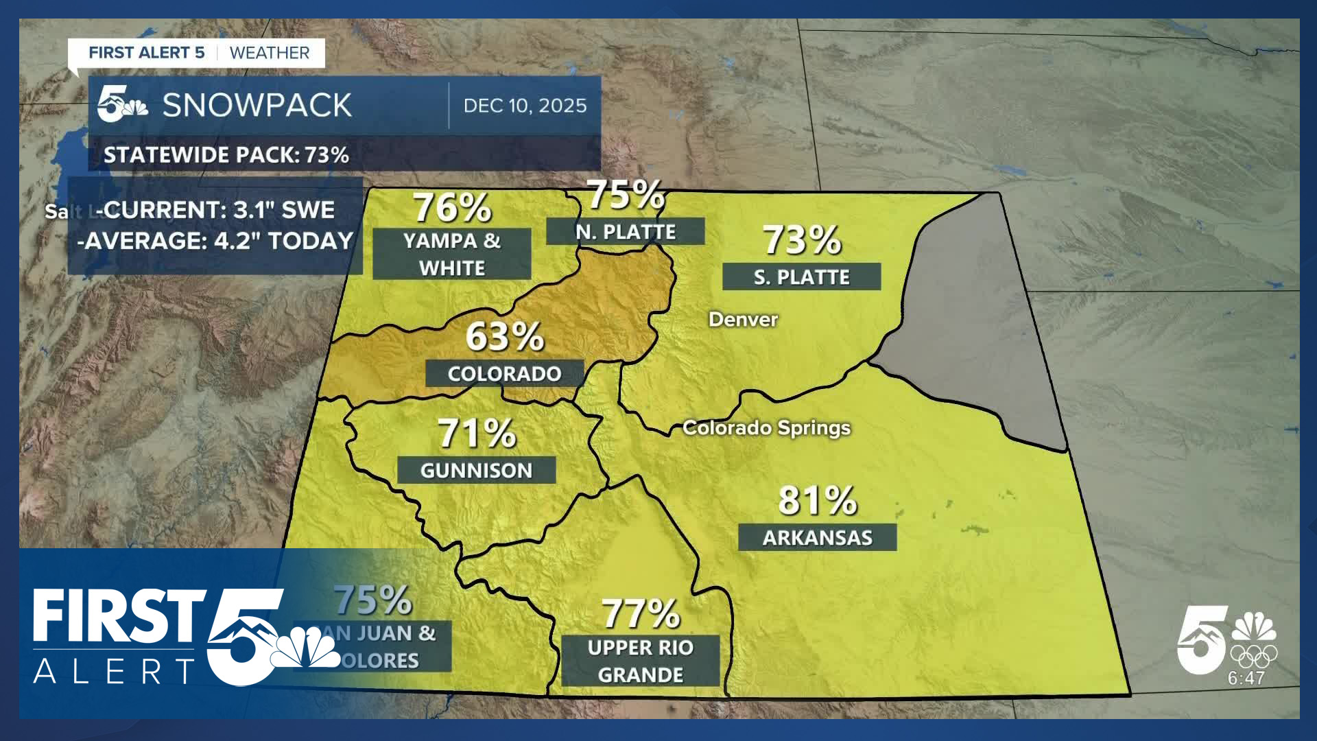


COLORADO (KOAA) — Colorado's snowpack has improved over the past week, jumping from 58% of average on December 5th to 73% of average today, largely due to significant snowfall over the weekend.

The improvement marks a substantial recovery from conditions just three weeks ago, when all basins were sitting in the 20% - 38% range. Numerically, that 73% is 3.1" of liquid water contained in the snowpack, against an average of 4.2" by December 10th.

The Arkansas River Basin has climbed to 81% of average, while the Colorado Headwaters Basin remains the lowest in the state at 63% of average.
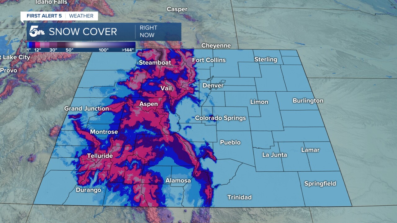
Snow cover in the mountains looks much healthier now, with higher elevation summits generally having several feet of snow.
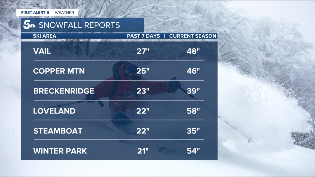
Much of the improvement came from a high-impact snowstorm that hit over the weekend. In the past 7-days, Vail Mountain reported 27 inches of snow and Copper Mountain saw 25 inches. Several northern resorts recorded more than 20 inches.
Copper Mountain received 19 inches of its total snowfall from Saturday and Sunday alone, while Breckenridge saw 17 inches during the same two-day period.
Monitoring Avalanche Risk

The rapid accumulation of wind-driven snow on top of a previously weak snowpack has increased avalanche danger. When air temperatures are very cold, like they were overnight last week, moisture from deep in the snow moves upward to the top of the snow, creating large crystals that do not bond well to new snow. When the layer is initially loaded, it presents very high avalanche risk - but even after the storm departs, that weak layer persists - creating long-duration elevated avalanche threats.
The northern Front Range and parts of the central mountains remain at considerable avalanche risk, rated as level 3 out of 5. This level is down from a high 4 out of 5 risk over the weekend, prompting Avalanche Warnings across the Centennial State by the Colorado Avalanche Information Center (CAIC). Considerable avalanche risk statistically results in the most avalanche fatalities. This is due to increases in back country traffic and underestimation of danger.
That risk level will likely decrease over the next several days as Colorado returns to a much drier weather pattern. I expect the snowpack median numbers to decrease, at least marginally, next week due to the relative lack of additional snowfall.
____
Have a question or story idea you would like the First Alert 5 Weather team to consider? Email: weather@koaa.com
Watch KOAA News5 on your time, anytime with our free streaming app available for your Roku, FireTV, AppleTV and Android TV. Just search KOAA News5, download and start watching.
