


Colorado's snowpack has reached a new milestone, dropping to just 4.7 inches of water content — actually decreasing by a tenth of an inch from last week in an extremely unusual pattern for this time of year.

No meaningful snow fell in the last 7 days across Colorado's high country.

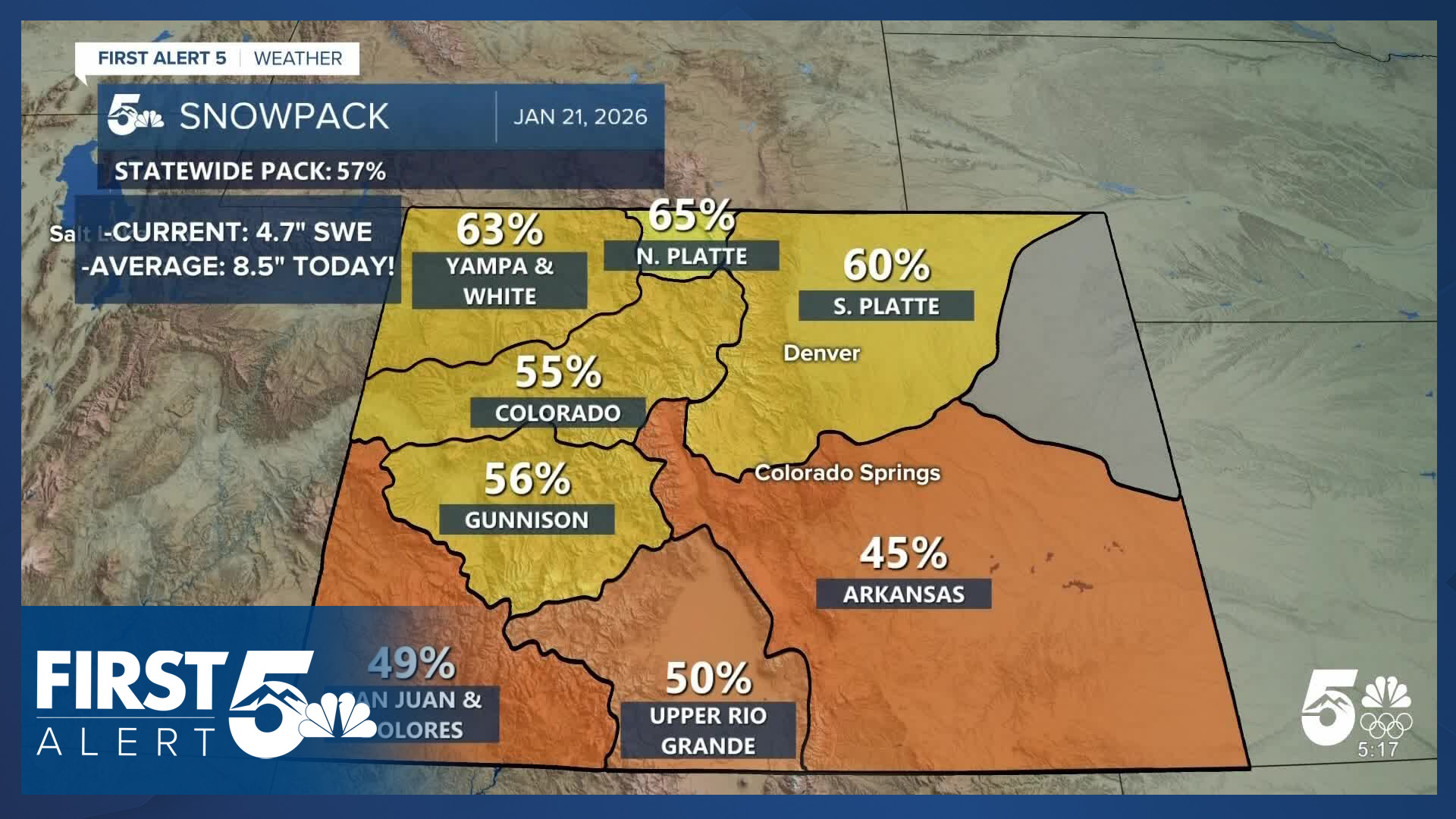
The current snowpack levels sit at 57% of average, representing a 6% drop from the previous week and falling below an early-meteorological-winter benchmark of 58% on December 5th, 2025.
To put this in perspective, the previous record low for January 21 was 5.4 inches of water content. Colorado would need approximately 7 to 14 inches of snow statewide just to reach that former record low threshold (depending on the rain to snow ratio).

Regional variations show the impact across different basins. Last week, the North Platte basin was the highest performer at 77% of average, benefiting from a northerly track system. The Arkansas River Valley stood at 50% of average.

Current conditions show all basins declining by 5 to 10%, with southern basins dropping back into the 40th percentile range. That said - none of the southern basins, despite being the farthest below average, are actually at record lows today. It is the northwestern basins of Colorado that are experiencing record low snowpack and are responsible for the statewide record minimums.
There is good news though. Multiple waves of energy will move over the mountains between Friday and Sunday, and merge together in a process called phasing. A blend of data suggests snow totals above a foot in the San Juans and I suspect that will extend into the Central mountains as well.

Even with this anticipated snowfall, it's notable that this system even with strong performance would likely only bring snowpack levels to just above record low territory. Several storms of this magnitude are needed to truly change the trend of this winter season.
____
Have a question or story idea you would like the First Alert 5 Weather team to consider? Email: weather@koaa.com
Watch KOAA News5 on your time, anytime with our free streaming app available for your Roku, FireTV, AppleTV and Android TV. Just search KOAA News5, download and start watching.
