


Even though parts of Colorado's high country notched a foot or more of snow in last weekend's multiple-impulse winter storm, statewide snowpack remains at record lows, and the medium-term outlook is not favorable.

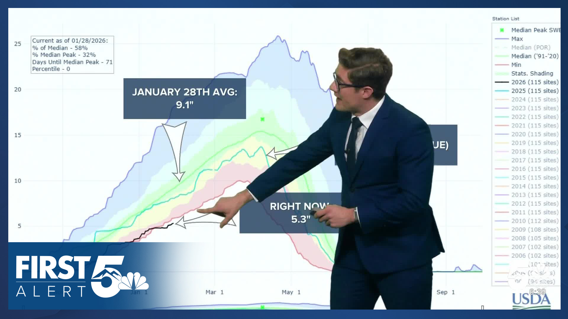
Colorado's snowpack currently contains 5.3 inches of liquid water - nearly 4 inches below average, and 0.6 inches below the old low water mark of 5.9" for today's date.
The season so far has been marked by a persistent ridge of high pressure that's centered farther east than in a typical La Nina winter. The jet stream - which acts as a storm conveyor belt - sits at the edge of this ridge, typically between an upper level high and and upper level low.
In a typical La Nina year, the western ridge results in a northwesterly jet stream over Colorado. This often produces below average statewide precipitation but often with consistent northern mountain snow. Because the ridge is farther east, the storm track is not funneling any storms into Colorado. Making matters worse - the ridge produces a sinking motion in the atmosphere that keeps skies clear and dry, temperatures warm, and promotes evaporation of the snowpack that does exist.

The snowpack graph shows the stark contrast - the black line this year is far below what would be expected in a typical weak La Nina. Last winter, which is shown in blue on the graph, was below average - and was a very weak La Nina year, but still markedly above where the state sits now.
Most of the early-season record low shown on the graph comes from the year 2000. That winter had one of the strongest La Ninas in the past 40 years. Winter through late January that year was very dry. But, starting in February snowpack skyrocketed and the season peaked with near average snowpack despite the persistence of La Nina into the spring. There are no indications of such a turnaround this year.

The weekend winter storm did slightly raise the snowpack percentages. Last week snowpack was at 57% of median statewide, and today the state is at 58% of median.
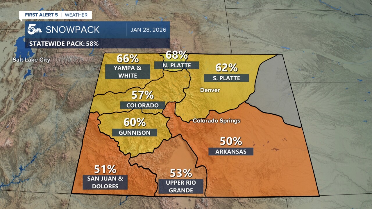
The map view shows a bit more of an improvement with most basins up 3-5% from last week.

Long-term forecasting models paint a concerning picture for Colorado's water supply. The European model, one of the most reliable snow prediction tools for the state, shows only weak weather systems bringing limited snowfall to mountain zones through mid-February. While the mountains will get snow - it's not likely to be enough to keep pace. Note that the above map is not a forecast, it's just an indicator that major storm systems are not particularly likely in the short term.

The Climate Prediction Center's latest outlook shows this too, with below average precipitation favored in the northern half of the state in the next 2 weeks.
The potential positive ahead is that there are signs La Nina is weakening, and there is a high chance of switching to a neutral pattern in the Pacific Ocean by early spring. This means March and April could turn wetter and result in late-season snowpack improvements. Still, it's unlikely the state will end the season with average snow water levels.
____
Have a question or story idea you would like the First Alert 5 Weather team to consider? Email: weather@koaa.com
Watch KOAA News5 on your time, anytime with our free streaming app available for your Roku, FireTV, AppleTV and Android TV. Just search KOAA News5, download and start watching.
