


The Berthoud Pass avalanche that occurred Sunday underscores one of the biggest winter dangers for recreators in Colorado’s mountains. Several feet of snow have fallen in the last week, with more falling now.
Avalanche danger remains high in many parts of Colorado with Avalanche Warnings in effect through Thursday evening.

Many of these mountains have a 4 out of 5 risk score, meaning widespread avalanche conditions, including naturally caused avalanches, are expected. These avalanches may be large, capable of killing a person and burying vehicles.

Avalanches form in a variety of ways. KOAA spoke with Brian Lazar, Deputy Director of The Colorado Avalanche Information Center (CAIC) today. He told KOAA that the current risk is for persistent slab avalanches. They form when new snow falls on top of weaker, older snow.


Compared with other types of avalanches, persistent slabs tend to form after a period of drier weather enabling faceted snow and are often more dangerous – viewer Rebecca Hogan sent First Alert 5 this picture of faceted snow in December after a storm in Pueblo West:
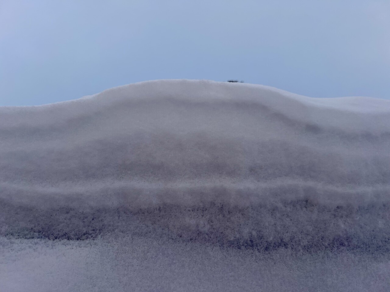
The striations are different snow densities with the lower snow having crystalized into angular snow crystals. This type of snow tends to form from a period of clear and cold weather. This snow tends to be less well bound to adjacent snow particles forming a weak layer. Persistent slabs can occur days to weeks after a snowstorm, hence their name, and they’re unusually hard to predict and can behave in unusual ways.

If you’re a backcountry enthusiast, you want to be particularly cautious with this type of threat. CAIC told us these avalanches can be triggered from a significant distance away, not just by traveling directly over the terrain in question. Therefore: you want to give a wide berth to slopes greater than 30 degrees. Brian says that commercial ski resorts are safe – they have dedicated teams proactively monitoring terrain and in some cases setting off controlled avalanches to mitigate risk for skiers and snowboarders.
Follow these links to stay up to date with travel and avalanche conditions. In terms of driving safety, CAIC coordinates with CDOT to proactively close roads when avalanche danger is high. Brian’s advice to those who want to get outside this weekend is simple: “It’s really easy for a lot of fresh snow to get people really stoked…but people need to temper their enthusiasm and choose low angle slopes to stay safe”.
____
Have a question or story idea you would like the First Alert 5 Weather team to consider? Email: weather@koaa.com
Watch KOAA News5 on your time, anytime with our free streaming app available for your Roku, FireTV, AppleTV and Android TV. Just search KOAA News5, download and start watching.
