


COLORADO SPRINGS, CO (KOAA) — Southern Colorado is experiencing more spring-like warmth Wednesday but the state snowpack has reached an important milestone.
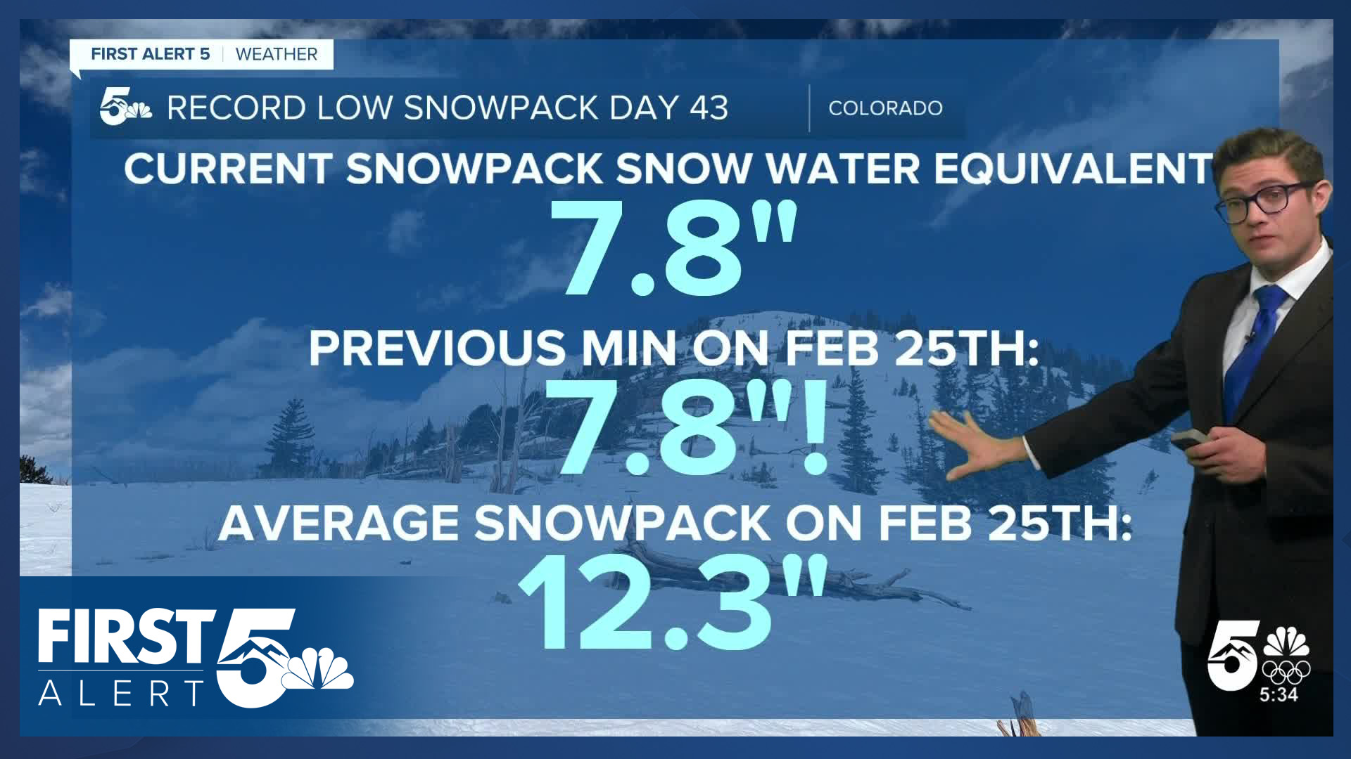
As of today, the snowpack has risen to the modern-era record low, which is 7.8" on February 25th. The last time snowpack was this low was February 25th, 2002. Measuring from the first day snowpack dropped below the old record low, it's been 43 days. Snowpack first reached parity with the record low mark on Tuesday.
We are on an upward trend. Statewide snowpack has increased from 58% to 63% of median in the last 7 days. This is still low - but it is nonetheless a welcomed improvement.
The latest map shows the San Juan's have been particularly hard-hit in the last week. That basin is up 11% in the past week. The North Platte Basin has risen to 71%. That's not a record low for that basin, but it's not far off —it's in the 3rd percentile (97/100 years would on average, have more snow). The other issue here is that in a La Niña winter, that's a basin that should typically be above average for snowpack.
The Arkansas Basin, covering most of southern Colorado, remains worst in the state by percentage - it's the only basin below 50% of average.
More snow has accumulated today in the northern and central mountains, and the pattern is still a bit unsettled in the next week (though less so than in the last two weeks) — which suggests we're likely to keep pace with the record low mark.
____
Have a question or story idea you would like the First Alert 5 Weather team to consider? Email: weather@koaa.com
Watch KOAA News5 on your time, anytime with our free streaming app available for your Roku, FireTV, AppleTV and Android TV. Just search KOAA News5, download and start watching.
