


With the biggest storm of the year winding down tonight, I wanted to take our viewers on a journey to see how the forecast changed over time.
Let's start out by taking you back to last Friday (2/10/23) as this information that I'm going to start with came from a story that you may have seen here on News 5.
Meteorologist Alex O'Brien shared her own in depth analysis of the approaching storm, which at that time, was more than 3,000 miles away.
The model data that Alex showed late last week placed the low pressure system very close to Southern Colorado by midday Wednesday (today), even hinting at a possible Albuquerque low.
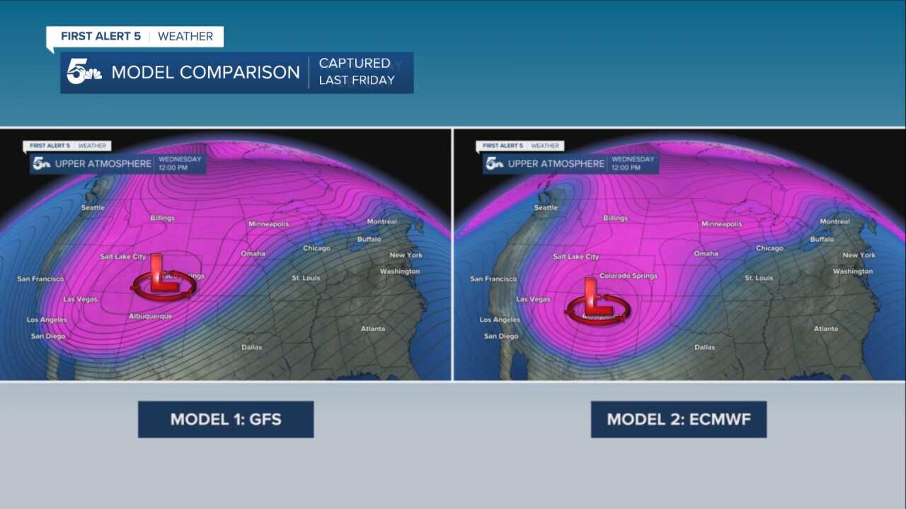
Then through the weekend, the European model began to nudge that low closer to the Four Corners Region.
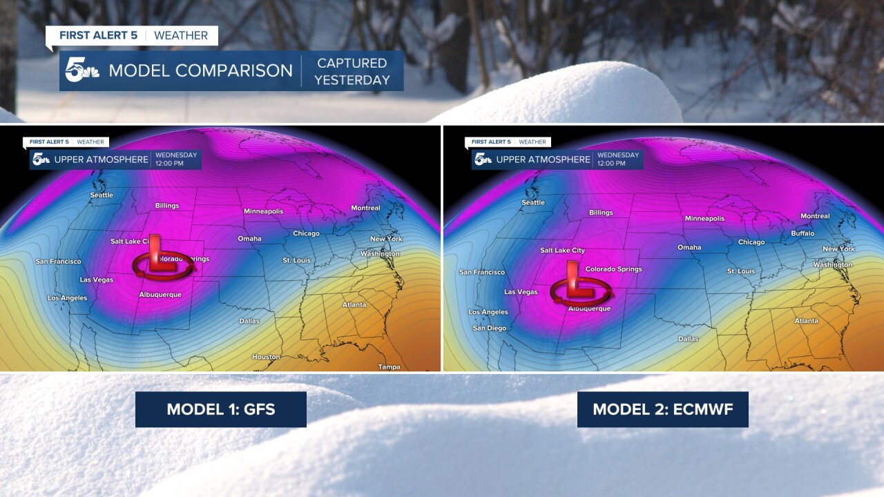
Fast forward to data from Tuesday morning, and you can see that the European model has remained consistent with a Four Corners Region low.
Now let's take a look at how the snow forecast changed over time...
Last Saturday (2/11/23), I tweeted out this image (see below) of what the National Blend of Models (NBM) was showing for the storm.
I hesitate to even show this since the storm is still more than 24-36 hours from moving inland over the Pacific NW, and still 3,000 miles from Colorado. That said, this is simply an idea (not exact forecast) of how much snow we could see. Stay tuned! #cowx pic.twitter.com/CiRTHW7KNa
— Alan Rose (@AlanRoseWX) February 12, 2023
In comparing that NBM forecast to our very own from Tuesday afternoon, we can see how the forecast evolved.
Overall, it's a nice surprise to see the consistency between that NBM model from last Saturday and our forecast from right before the storm hit.
Consistency with any type of forecast is key, and this is what allows for more confidence in what we show our viewers. This includes such things as more specific snow forecast totals, timing, and storm impacts.

The final piece to this puzzle is to compare our forecast to the actual verified reports.
We don't always have time to do this, so it's been fun to compare the two.
Let's start with Colorado Springs...where yesterday we forecasted snow totals in the 4-7" range.
With storm reports between 4-8", I'll call it a win.
In Pueblo, we forecasted 4-6" totals, and came in on the high side of that with reports of 6-7".
In Palmer Lake, we also hit our target, with 8" of snow reported.
Lastly Beulah...the 14.5" of snow that we saw here fell within our forecast range of 8-12".

You might call this storm an *overperformer*, but by looking back at the forecast over time and comparing it to what actually happened, I'd say overall that things went pretty smoothly from a forecast perspective.
