


October 24th is the average first snowfall date in Colorado Springs. The warm weather this month probably didn't give you any hints. But that average covers up a wide range in recent history.

In the last 10 years the average first snowfall has been on October 30th. But the —range—has varied from September 8th, in 2020....to December 31st...just the following year in 2021. And that's just the past 10 years.

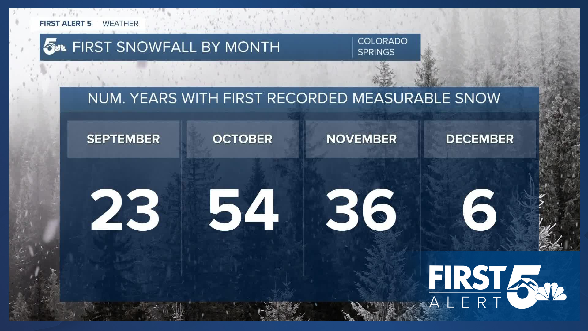
Since records began in 1895...the first snow occurred:
-23 times in September
-54 times in October
-36 times in November
-6 times in December
And once in January - the winter of 1917-1918 saw the first measurable snow on January 12th, 1918! Note that a few years are missing data so the total here won't add up to 130 years.
Of course that doesn't mean we can't get big snowstorms in the fall or early winter season.

Four of the top five highest one day snow totals for Colorado Springs between September and December are more than a foot.
But don't expect that this year. We're in a La Nina, which partly explains the warmth and lack of snow.
So far this month, temperatures are nearly four and a half degrees above average with only three days having below average temperatures in Colorado Springs, and precipitation is 50 percent below average month to date.
That means we're likely to keep that warm, windy, relatively dry trend going as we continue into November.
____
Have a question or story idea you would like the First Alert 5 Weather team to consider? Email: weather@koaa.com
Watch KOAA News5 on your time, anytime with our free streaming app available for your Roku, FireTV, AppleTV and Android TV. Just search KOAA News5, download and start watching.
