


Thanks to a perfect storm of windy and dry weather this past week, high fire danger has remained top of mind across Southern Colorado.
Red Flag Warnings today have once again been widespread across the region thanks to strong wind gusts, dry fuels, and low relative humidity.
In looking at the past 16 years of climate data, Colorado Springs has averaged close to five Red Flag Warnings in the month of April. This year, we're already up to seven.

April on average is the most active month when it comes to the issuance of fire related warnings in the Springs.
March, April, and June see the most occurrences.
The most active April over the past 16 years dates back to 2011, when 11 Red Flag Warnings were put out.
Another factor that goes into high fire danger...a lack of rain and snow.

The Colorado Springs Airport has only seen a trace of rainfall this month, and no snowfall.
Considering that April is typically our second snowiest month of the year, that's not good!
Pueblo has picked up four tenths of an inch of rain so far this month, but no snow.
Both areas were below average last April.
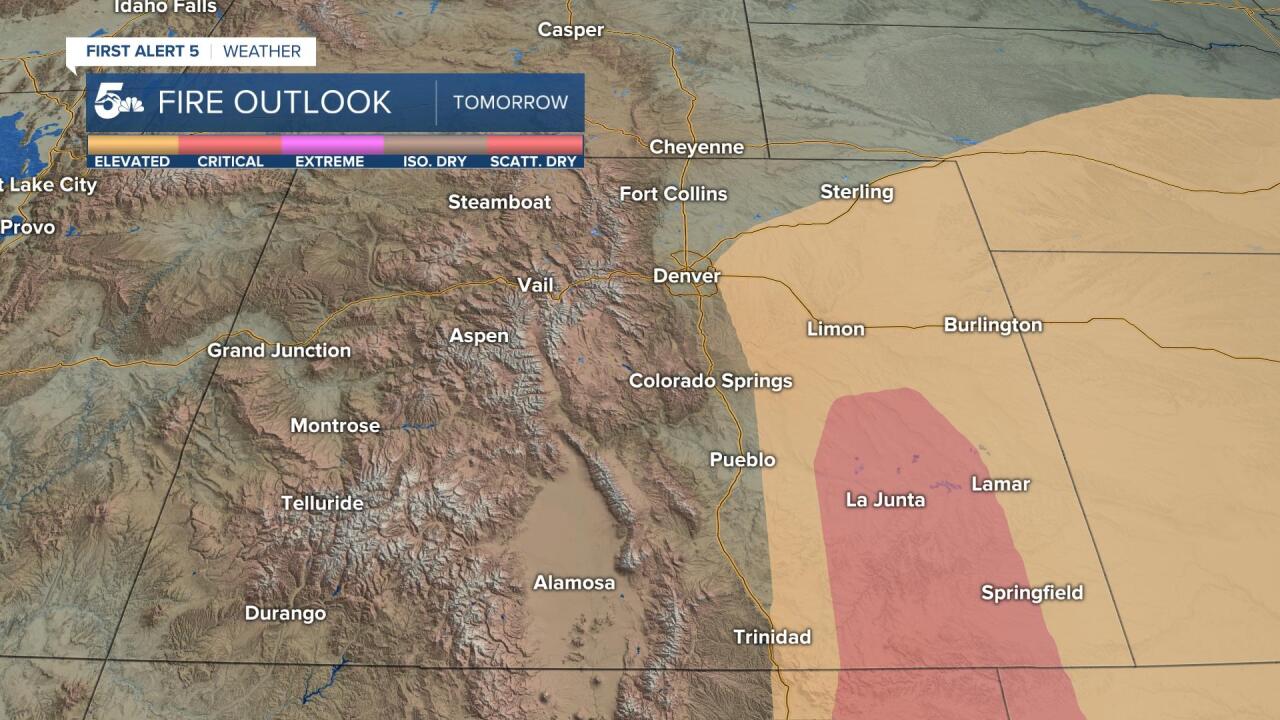
Looking ahead to Wednesday, the southeastern Plains will once again see the most extreme, or critical fire weather threat.
The I-25 corridor for now is just outside of the yellow shaded Elevated Risk region. However, with gusty winds and low relative humidity expected to return Wednesday afternoon to El Paso and Pueblo counties, the National Weather Service has already upgraded Fire Weather Watches to Red Flag Warnings.
