


Today’s Forecast:
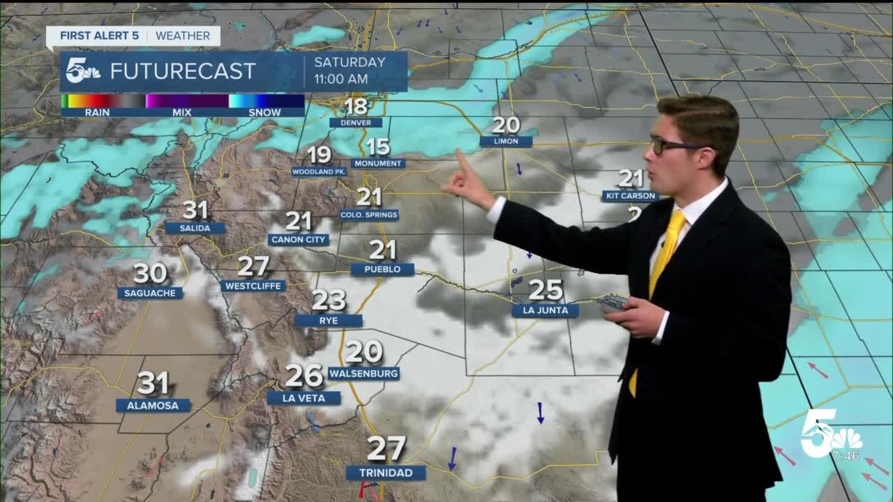
A winter storm is continuing to track through Colorado today, with flurries during the morning and a band of snow moving through from northwest to southeast into the early afternoon. Highs will be 10-15 degrees below seasonal norms. We'll see a mixture of clouds and sun through the day - with some additional wrap-around moisture this afternoon from the departing system leading to an increase in clouds after an initially partly sunny late morning into early afternoon.
Colorado Springs forecast: High: 27; Low: 11.
Snow showers and flurries continue through the middle of the day with little additional accumulations, but roads remain slippery. Mainly cloudy and very cold.
Pueblo forecast: High: 34; Low: 11.
Slick roads through the day with additional snow flurries through the early afternoon, snow ending at 2PM.
Canon City forecast: High: 34; Low: 14.
Snow showers early with partly sunny skies by 3:00PM. Very cold with easterly winds at 10 mph.
Woodland Park forecast: High: 24; Low: 8.
Cloudy through 3:00PM, then partly sunny. A few snow showers through 3:00PM. North winds 10-20 mph.
Tri-Lakes forecast: High: 24; Low: 8.
Cloudy through 2:00PM, then mostly cloudy through 4:00PM, then partly cloudy. Snow showers through 2:00PM. Very cold, with north winds 10-20 mph.
Plains forecast: High: 20s; Low: 10s.
Mostly cloudy with snow showers in the southern tier through 2PM. Slick roads, but little new snow accumulations. North winds at 10-15 mph.
Walsenburg and Trinidad forecast: High: Upper 20s; Low: Teens.
Mostly cloudy through 4:00PM, then partly cloudy. Occasional light snow showers with little new accumulation. Northeast winds at 10 mph.
Mountains forecast: High: 20s; Low: 0-10.
Mostly cloudy with snow showers off and on through the day, 1-3" additional accumulations mainly above 10,000 feet. Lower elevations see snow showers, with little further accumulation. North winds at 10-15 mph.
Extended outlook forecast:
High pressure returns late tonight into early Sunday morning leads to warming temperatures through Tuesday. A weak cold front cools temperatures Wednesday with additional cloud cover arriving. Dry conditions persist into the middle of the week.
____
Curious about the First Alert 5 Weather Storm Impact Scale? Check out our cheatsheet explainer.
Watch KOAA News5 on your time, anytime with our free streaming app available for your Roku, FireTV, AppleTV and Android TV. Just search KOAA News5, download and start watching.
