


Disclaimer: This is sponsored content. All opinions and views are of Monarch Mountain and does not reflect the same of KOAA.
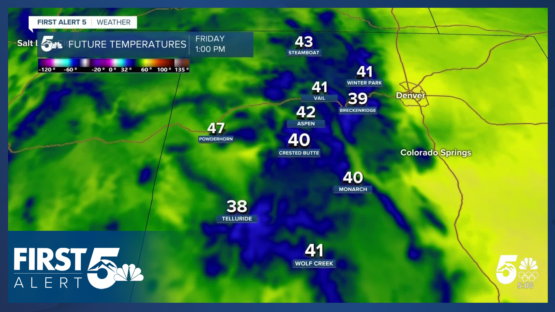
After a fairly dry week on the slopes at Colorado's ski areas - unseasonably warm weather will be the main story this weekend. Highs will reaching the upper 30s to low 40s at higher elevations of many mountains and mid 40s to even low 50s at bases — numbers more typical of April than February.
Over the past week the main snow event was a weak clipper system on Wednesday. Loveland Ski Area and Eldora were the biggest winners from Tuesday to Wednesday's system, receiving 6 inches and 4 inches of new snow respectively. Other popular resorts managed only a couple of inches.
A large ridge of high pressure will dominate the region this weekend - with this atypically strong ridge bringing dry skies and above-average temperatures. Friday afternoon temperatures in particular look very warm with mid-40s highs, even at our highest elevation resort bases.
Saturday will be slightly cooler with highs in the mid-30s, but temperatures will remain well above normal for early February. Sunday and Monday are expected to bring similar conditions with above-freezing highs, dry air and sunshine.
There are pluses and minuses to skiing this weekend. Ski areas are doing everything possible to keep terrain open - and Vail today announced a limited opening of their back bowls (portions of Sun Up and China), and Blue Sky Basin. This has been long awaited by many epic-pass product skiers in Colorado. Given the forecast, lift lines are likely to remain quite low.
However, the spring-like temperatures raise concerns about bare spots developing on slopes, particularly given current base depths. While warm temperatures can be beneficial in spring skiing with deep bases, current base depths aren't deep enough to provide that type of run dynamic. This is particularly true for south facing terrain. This is, more than usual, a weekend where the first half of the day will be much better for your runs no matter where you go.
The extended forecast offers more promising news. A significant pattern change has been well modeled for many days now, and the western trough-centric pattern idea is supported by good physics and meteorological principles. While there are timing and track differences to work out, the second half of February looks very promising...even though it would take an incredible amount of snow to try to get to a semblance of normal.
__
Watch KOAA News5 on your time, anytime with our free streaming app available for your Roku, FireTV, AppleTV and Android TV. Just search KOAA News5, download and start watching.
