

Today’s Forecast:
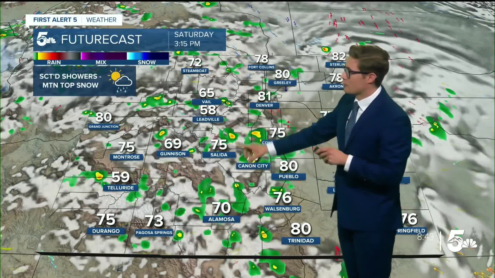
The final weekend of summer will bring in some active weather to southern Colorado. High pressure centered in northern Mexico is circulating in moisture from several tropical waves emanating off the coast of Baja California. This morning will have mostly cloudy skies, with a patchy early shower over the easternmost counties, followed by late morning clearing. We could call these the "appetizer round" of showers for today.
Additional energy and moisture arriving this afternoon will first lead to scattered mountain showers - which may impact the very tail end of the Pikes Peak Ascent today, and will produce light high altitude snow - mainly above 14,000 feet where the freezing level is today. Isolated weak thunderstorms will move through the Pikes Peak Region between 3-6PM; in Pueblo, storms could start/end a bit later...4-7 PM. In the southern tier - Walsenburg and Trinidad are looking at timing between 4-8 PM.
You'd get some gusty wind if one of them hits your neighborhood, along with some light to moderate rain. Otherwise, expect partly cloudy skies across the area with temperatures seasonal in the 60s up high, 70s to low 80s for the rest of southern Colorado.
Colorado Springs forecast: High: 76; Low: 49.
Increasing sunshine through the rest of the morning into the early afternoon. An isolated shower/t-storm is possible during the mid-afternoon. Up on top of America's mountain, the very last of the Pikes Peak Ascent racers may be greeted by a mountain top shower as well! While it's generally going to be a warm and dry day, these storms could contain lightning, so if you do hear thunder it is important to go inside until it passes by. South winds at 5-10 mph.
Pueblo forecast: High: 81; Low: 52.
It's Chile Festival time - but of course, it won't be that chili. Mostly sunny through mid-afternoon, with isolated thunderstorms possible in late afternoon. Gusty wind and some lightning are the main issue with any of the quick-lasting storms, on an otherwise beautiful final weekend of summer. Southeasterly winds at 5-10 mph.
Canon City forecast: High: 79; Low: 54.
Mostly sunny this morning, with scattered afternoon showers/weak t-storms possible. It will be a mainly nice day, but be prepared to step inside if you hear thunder. Southeast winds at 5-10 mph.
Woodland Park forecast: High: 69; Low: 40.
Partly cloudy this morning, with scattered afternoon showers and thunderstorms. Gusty wind, lightning, and small hail are possible with the "stronger" storms today, but they will be fairly short lasting. Still - be ready to go inside for a half hour if you do see the clouds getting dark or hear thunder. Otherwise, a nice day. South winds at 5-10 mph.
Tri-Lakes forecast: High: 70s; Low: 40s.
Mostly sunny through the morning, partly cloudy this afternoon, mostly cloudy tonight. Isolated afternoon thunderstorms are possible - with gusty wind the main issue with any storm (as well as lightning). It's a generally beautiful day, but be prepared to go inside temporarily if a storm does approach.
Plains forecast: High: 70s/80s; Low: 50s.
Fog should continue to dissipate, with low clouds dissipating through the rest of the morning as showers continue east into Kansas. Mostly sunny this afternoon with northeast winds at 5-10 mph.
Walsenburg and Trinidad forecast: High: 77/81; Low: 50/49.
Mostly sunny through mid-afternoon and very comfortable temperatures as well. Isolated afternoon thunderstorms in the late afternoon. East winds at 5-10 mph.
Mountains forecast: High: 60s; Low: 40s.
Partly cloudy this morning, with scattered showers and thunderstorms this afternoon. The freezing level is currently about 14,200 feet and will fluctuate a bit with storms moving through. So, very high altitude summits could get a bit of snow this afternoon with any t-storms. Otherwise, rain and gusty wind with any storms lower down. As usual storms won't last that long, but plan on being below treeline by 2:00 PM at the absolute latest to be safe. Southeast winds at 5-10 mph.
Extended outlook forecast:
Sunday will start with sunnier skies over most of the plains, with isolated fog right near the border with Kansas. There will still be isolated storms in the afternoon but they'll be more confined to the mountains. For the rest of us - it's a fairly nice and dry day with partly cloudy skies in the afternoon. Temperatures will be a few degrees warmer.
Fall officially arrives at 12:19 PM Monday - the time of the autumnal equinox - when the Sun's rays are directly over the Equator. And it sure will feel like fall! The next wave of tropical moisture will arrive Monday. This will lead to PM shower and thunderstorm chances with a potent cold front approaching in the afternoon associated with a large area of upper level low pressure. The combined systems and some Gulf moisture and northwestern pacific moisture thrown in for good measure will make for an interesting day. Temperatures plunge behind the front - on Tuesday only reaching the mid-60s. There will be scattered showers on Tuesday along with low clouds and it will feel very fall-like.
Additional energy from the passing upper level low will keep temperatures cool on Wednesday...before we warm back up toward the end of the week!
____
Curious about the First Alert 5 Weather Storm Impact Scale? Check out our cheatsheet explainer.
Watch KOAA News5 on your time, anytime with our free streaming app available for your Roku, FireTV, AppleTV and Android TV. Just search KOAA News5, download and start watching.
