

Today’s Forecast:
A strong ridge of high pressure over the Desert Southwest will bring dry westerly flow into much of Colorado on Monday. In the mountains, we will see high fire danger today, driven by gusty winds and very low relative humidity. Farther to the east along the I-25 corridor, it will be a breezy, dry and warmer day, with highs in the 80s and 90s. On the eastern Plains, Gulf moisture will bring the threat of scattered strong to severe thunderstorms to our forecast. Storms will be capable of large hail, gusty winds, and an isolated tornado.
Colorado Springs forecast: High: 88; Low: 58. After near average highs this weekend, temperatures will climb to above average this afternoon in Colorado Springs. Further warming can be expected the rest of the week, with highs each day in the 90s.
Pueblo forecast: High: 96; Low: 60. Our high today will be a few degrees warmer than Sunday, with southwest wind gusts this afternoon up around 20-25 mph.
Canon City forecast: High: 93; Low: 62. Hazy sunshine, breezy southwest winds, and lower 90s can be expected on Monday, with highs climbing into the upper 90s by Tuesday and Wednesday.
Woodland Park forecast: High: 81; Low: 52. After a pretty comfortable weekend, highs will warm into the 80s today en route to even hotter temperatures the rest of the week. Southwest winds will be moderately breezy today as well, gusting around 20-25 mph.
Tri-Lakes forecast: High: 80s; Low: 50s. Breezy and warmer on Monday, with areas of smoke and haze expected to increase from the west this afternoon. The smoke should thin out later this evening.
Plains forecast: High: 80s/90s; Low: 60s. Today will mark the beginning of what's expected to be a hot week for the eastern Plains of Colorado. While rain isn't likely in most of the state on Monday, a few rogue strong to severe thunderstorms will be possible after 3 pm on the southeastern Plains. South winds this afternoon will be also be gusty, up around 25-35 mph.
Walsenburg and Trinidad forecast: High: 80s/90s; Low: 50s/60s. The work week will begin on a warm, dry and breezy note, with afternoon highs today topping out in the upper 80s to lower 90s. Southwest winds this evening will be gusting around 20-30 mph.
Mountains forecast: High: 70s; Low: 40s/50s. We're looking at a warm, hazy and breezy start to the week for the Sangres and Wet Mountains. Peak gusts this afternoon could top 30-35 mph in some areas, with Tuesday's gusts expected to be even stronger.
Extended outlook forecast:
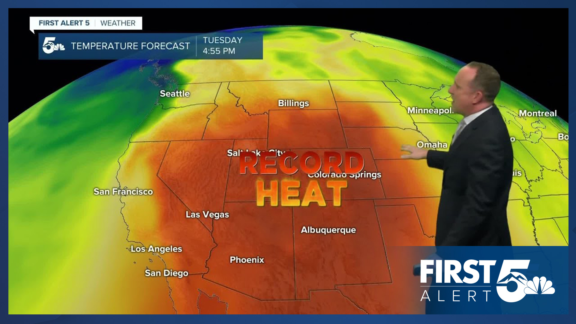
The heat dome will continue to expand over Southern Colorado on Tuesday, pushing our highs on the Plains into the 90s and 100s. In Colorado Springs, Tuesday's high of 93 degrees is the same as the current record high at the Springs Airport, which dates back to 1980. Afternoon highs will stay hot through the end of the week, with the hottest days expected to be Thursday and Friday.
A cold front arriving this weekend will drop highs back down to the 80s in Colorado Springs. Depending on the timing of the front, a rogue shower or two will be possible on Saturday for the I-25 corridor, with scattered thunderstorms region-wide by Sunday.
____
Curious about the First Alert 5 Weather Storm Impact Scale? Check out our cheatsheet explainer.
Watch KOAA News5 on your time, anytime with our free streaming app available for your Roku, FireTV, AppleTV and Android TV. Just search KOAA News5, download and start watching.
