

Today’s Forecast:
The winds have us rocking and rolling this morning in parts of southern Colorado - mainly areas west of I-25, higher elevation zones like the Palmer Ridge, and gap flow zones such as Huerfano county. This is the latest in a long string of downslope wind day set ups over the last couple weeks. That downslope breezes increase through this morning, and will remain strongest west of I-25 (to 35-40 mph), and in the Black Forest area. Temperatures are climbing quickly due to the downslope compressional warming and that trend will continue until around noon today. By then, you'll see temperatures in the upper 50s, to lower 60s along most of the plains - with some mid-60s in lower elevation zones.
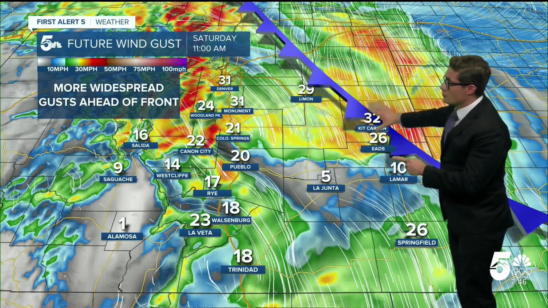
In what has become a familiar pattern over the last several days, a backdoor cold front will push in this afternoon. It's another shallow front - in fact, it's a modified version of the front you saw yesterday which pushed east early today, and gets pushed back west this afternoon by a surface high pushing through the north central states. This will start cooling down temperatures in the early afternoon, and it will change the wind direction to easterly and lower wind speeds. It'll also reduce fire danger, which is elevated this morning due to the dryness of the air.
Geminid Meteor Shower Forecast
Tonight is the peak of the Geminid Meteor Shower. The best time to view is between 10PM - 2AM, though they'll be visible all night...as long as your sky stays clear (more on that shortly). Look up and to the east at 10PM. By 2AM, the radiant (center) of the shower will be higher up, and south southeast. Find a dark location, away from city lights, and give your eyes 30 minutes to adjust. The peak rate of this shower is 120/hour, although you're most likely to see rates closer to 1-1.5/minute since it's difficult to see every single meteor of a shower due to differing brightnesses and origin points. It is still the best show of the year for Colorado because the Perseids had a waning gibbous moon, which drowned out some of the meteors.
Due to the cold front, upslope flow will result in increasing chances for fog after midnight. Your best viewing times in Colorado Springs are from 9:00 PM -1:00 AM before the clouds increase. Fog is also a potential issue in the Arkansas River Valley, with high clouds overspreading most of the plains as well later overnight. Lows drop to the 20s - pack a nice warm jacket, hat, and gloves.
Colorado Springs forecast: High: 61; Low: 26.
Sunny - with downslope warmth pushing highs back to the 60s today, with northwest winds at 10-15 mph this morning, gusting to 35 mph west of I-25 before noon. A cold front will arrive this afternoon and shift winds easterly.
Pueblo forecast: High: 66; Low: 21.
Sunny with northwest winds at 10-15 mph this morning, with stronger gusts, pushing temps into the middle 60s. A cold front this afternoon will shift winds easterly, and result in falling temperatures after 1PM, and it will get rid of the gusts.
Canon City forecast: High: 65; Low: 30.
Sunny with northwest winds at 10-15 mph gusting to 35 mph shifting northeast this afternoon.
Woodland Park forecast: High: 54; Low: 29.
A few high clouds, otherwise sunny, with northwest winds at 10-20 mph, gusting to 40 mph this morning. The cold front will not make it to you - the cold air mass is not tall enough to make it fully up the Ute Pass.
Tri-Lakes forecast: High: 50s; Low: 20s.
Sunny and incredibly mild for mid-December. North winds at 10-15 mph, gusting this morning to 35 mph. The cold front arrives late in the morning - it will stay gusty, but humidity will increase, and temperatures will fall.
Plains forecast: High: 50s/60s; Low: 20s.
Patchy morning fog becoming sunny with north winds at 10-20 mph.
Walsenburg and Trinidad forecast: High: 64/67; Low: 20s.
Sunny with north winds at 10-15 mph gusting to 40 mph.
Mountains forecast: High: 50s; Low: 20s.
Sunny with north winds at 10-20 mph, gusting to 40 mph this morning. The cold front will only make it to the lower eastern slopes - it will not reach the mountain tops.
Extended outlook forecast:
Temperatures cool slightly following the cold front this afternoon, but high pressure Sunday will prevent them from falling too much. Places like the Arkansas River Valley will cool more than places like Colorado Springs or Canon City because that cold dense air mass will sink down into the valley zones and get trapped there by upslope flow. Sunday will have calmer winds, and mostly sunny skies. If you celebrate Hanukkah, conditions look fairly pleasant if you have any evening plans with family.
A low will move south of the state on Monday, but it lacks moisture, and won't cause any issues. Temperatures stay fairly similar as well - mostly upper 50s/low 60s, and a few gap region breezes.
Tuesday and Wednesday will see a flattening of our ridge of high pressure. It will be breezy Tuesday, and windy on Wednesday. Wednesday will have fire danger concerns that we're watching closely, and will continue to update you on as we get closer to the event. Outside of the fire threat, the winds themselves have the potential to be strong in some areas.
There are some indications for a potential winter system toward the end of next week - though with northwest flow, the mountains are usually the most favored areas.
____
Curious about the First Alert 5 Weather Storm Impact Scale? Check out our cheatsheet explainer.
Watch KOAA News5 on your time, anytime with our free streaming app available for your Roku, FireTV, AppleTV and Android TV. Just search KOAA News5, download and start watching.
