

Today’s Forecast:
A big dome of high pressure continues to build today - and we'll warm into the upper 70s and lower 80s on the Plains as a result. It will be breezy in the mountains and across portions of the Upper Arkansas River Valley, where a Red Flag Warning will be in effect for Fremont County and the San Luis Valley from 12:00 PM - 9:00 PM.
Skies will remain mostly sunny today with very dry air in place, and the high pressure system producing broad subsidence (sinking air) that will keep us dry.
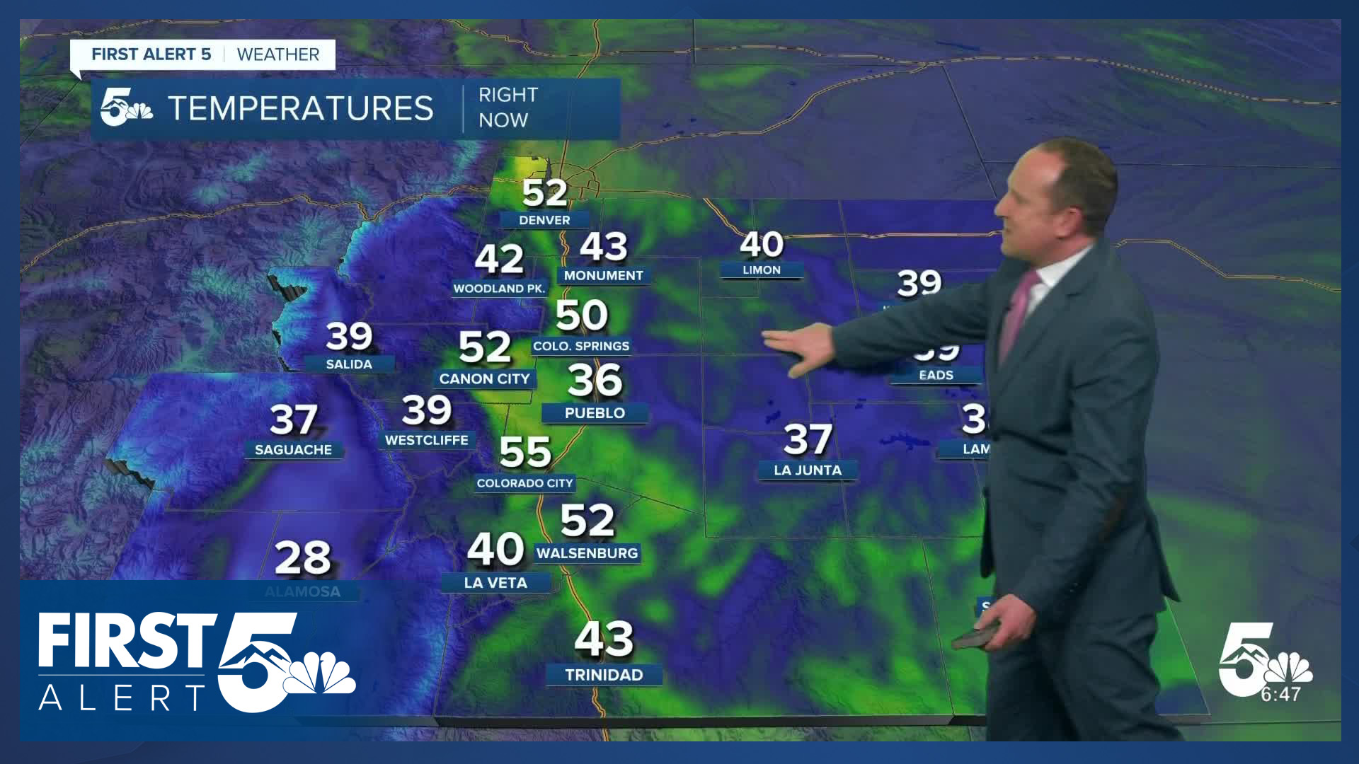
Colorado Springs forecast: High: 78; Low: 46. Ahead of record breaking heat later this week, highs on Wednesday will continue to warm, topping out in the upper 70s in Colorado Springs. Today's record sits within reach at 80 (2017).
Pueblo forecast: High: 83; Low: 42. Sunshine and heat on Wednesday, with today's high in the lower 80s more in line with late May averages than the middle of March. We also look to come within reach of today's record high, which sits at 85 (2017).
Canon City forecast: High: 82; Low: 48. Dare I say it? Today's weather in eastern Fremont County will be H-O-T, HOT! Our high this afternoon will warm into the 80s, with further warming expected region-wide through Saturday. With single digit relative humidity and wind gusts to 30 mph in our forecast today, a Red Flag Warning will remain in effect in Fremont County from noon to 9 pm.
Woodland Park forecast: High: 70; Low: 40. Spring fever will build late this week across Teller County. Our high today will warm to near 70 degrees, and it's only going to get warmer from here.
Tri-Lakes forecast: High: 70s; Low: 40s. Unseasonably warm weather will build into place starting today as highs climb into the 70s. Further warming will follow late this week, with 80s possible on Thursday, and likely from Friday to Saturday.
Plains forecast: High: 70s/80s; Low: 30s/40s. Highs will be well above average today and will only get warmer from here. Highs in the 70s and 80s today will give way to the potential for highs to warm into the 90s by Friday and Saturday.
Walsenburg and Trinidad forecast: High: 70s/80s; Low: 40s/50s. The downslope flow will bring us a warm and breezy afternoon, with highs today soaring into the upper 70s and 80s. NW winds will be sustained between 10-20 mph, gusting to 30 mph.
Mountains forecast: High: 50s/60s; Low: 30s/40s. Shrinking snowpack will unfortunately become a growing reality late this week, driven by a lack of storm energy and a surplus of warm air. Highs today will warm into the 50s and 60s in the higher terrain, with 60s and 70s in the mountain valleys.
Extended outlook forecast:
We're tracking multiple days of record warmth from Thursday to Saturday - all three days with highs in the 80s in Colorado Springs. The warmest ever high in Colorado Springs in March is 81, set in 1971. We're likely to break that record both Friday and Saturday. Saturday's highs in the mid 80s would smash that record.
In Pueblo, our warmest ever March day of 86 degrees has occured four times, most recently in 2017. Both Friday and Saturday's highs are expected to exceed the record, with a high of 87 on Friday and 91 on Saturday.
A cold front will arrive on Sunday and usher in a period of more active weather, with showers in the mountains, and "cooler" temperatures across Southern Colorado. The average high in Colorado Springs Sunday is 57...and highs will still be in the mid 60s. By the beginning of next week, we're back to the mid-70s. There is a signal for more consistent breezes arriving again next week as well. This could lead to a multi-day fire threat for portions of Southern Colorado. Stay tuned...
____
Curious about the First Alert 5 Weather Storm Impact Scale? Check out our cheatsheet explainer.
Watch KOAA News5 on your time, anytime with our free streaming app available for your Roku, FireTV, AppleTV and Android TV. Just search KOAA News5, download and start watching.
