

Today’s Forecast:
Through 8 am Tuesday, a FREEZE WARNING will remain in effect in northern El Paso County, with a FROST ADVISORY in effect for Colorado Springs, Pueblo, the I-25 corridor and portions of the eastern Plains. We hope that you took the time last night to protect any plants in your garden ahead of this morning's cold.
It's also damp and dreary this morning, with areas of mist, drizzle, rain showers and snow across Southern Colorado. Towards late morning and early afternoon, we're expecting a few sunbreaks, but it will be brief. As a disturbance approaches this evening, rain and snow showers will increase, with the potential for more widespread precipitation continuing into Wednesday morning. Snow levels will drop down to around 8,000 feet, with light accumulations in the mountains, Teller County and northern El Paso County.
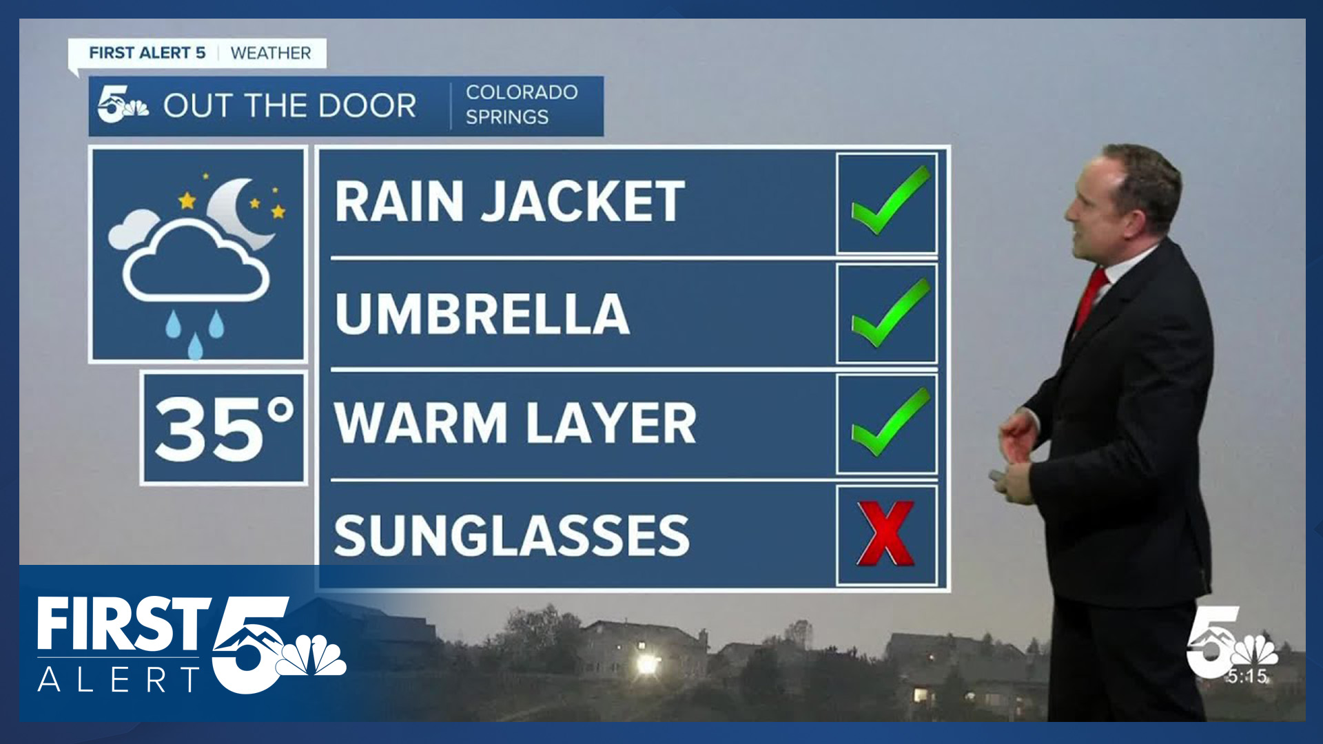
Colorado Springs forecast: High: 53; Low: 37. Out the door, you'll see a damp and dreary start to the day on Tuesday. This will give way to a few sunbreaks by late morning to early afternoon ahead of an incoming storm that looks to bring better chances for widespread precipitation this evening into Wednesday morning.
Pueblo forecast: High: 60; Low: 40. After a cool and damp start to the day, skies will turn partly cloudy this afternoon, with our high today climbing to near 60 degrees. By this evening, our next disturbance approaches, with increasing chances for wet weather.
Canon City forecast: High: 56; Low: 42. Unseasonably cool weather will follow what's been a damp and dreary start to our Tuesday. Rain showers will increase this evening, with the potential for steadier rain to fill into Fremont County late tonight and Wednesday morning.
Woodland Park forecast: High: 46; Low: 30. Overnight and morning snow showers have brought some light accumulations to Teller County this morning, with the roads mainly wet for the morning commute. A second round of snow will follow this evening, with a trace to 2" of accumulation possible through Wednesday morning.
Tri-Lakes forecast: High: 40s/50s; Low: 30s. We have seen a mix of rain and snow this morning up on Monument Hill, but thankfully, roads have been wet thus far for the morning commute. After a small break in the action this afternoon, rain and snow will return this evening. Accumulations should stay under 1".
Plains forecast: High: 60s; Low: 30s/40s. After several days of high fire danger on the southeastern Plains, a moisture rich upslope flow pattern has set up today, and this will lead to cooling highs this afternoon before rain chances increase this evening.
Walsenburg and Trinidad forecast: High: 50s/60s; Low: 30s/40s. Cloudy skies and cool temperatures this afternoon will give way to increasing chances for rain and higher elevation snowfall this evening as some beneficial moisture is finally set to hit areas south of Highway 50.
Mountains forecast: High: 30s/40s; Low: 20s. If you're planning to spend time in the high country on Tuesday, you should be prepared for the possibility of wintry driving condition. Any planned hikes or outdoor adventures might want to be put on hold for a few days. Up to 4" of snow could fall in some mountain zones through tomorrow morning.
Extended outlook forecast:
Rain showers will linger into Wednesday morning, with additional showers and thunderstorms by the afternoon and evening. Highs will remain well below average on Wednesday, only warming into the upper 50s and 60s on the Plains.
By the end of the week, temperatures will return to the 60s in Colorado Springs, with a continued threat of afternoon showers and thunderstorms. A cold front Friday may drop highs by a couple of degrees compared to Thursday.
A warm-up follows for the holiday weekend, with highs in the 70s and 80s across Southern Colorado. While shower chances will linger into Saturday, we should see drier air push into the Plains, with a continued chance of showers over and near the high country through the end of Memorial Day weekend.
____
Curious about the First Alert 5 Weather Storm Impact Scale? Check out our cheatsheet explainer.
Watch KOAA News5 on your time, anytime with our free streaming app available for your Roku, FireTV, AppleTV and Android TV. Just search KOAA News5, download and start watching.
