

Tonight's Forecast:
It will be mostly clear tonight with light wind. Overnight lows will be about 5 degrees above average.
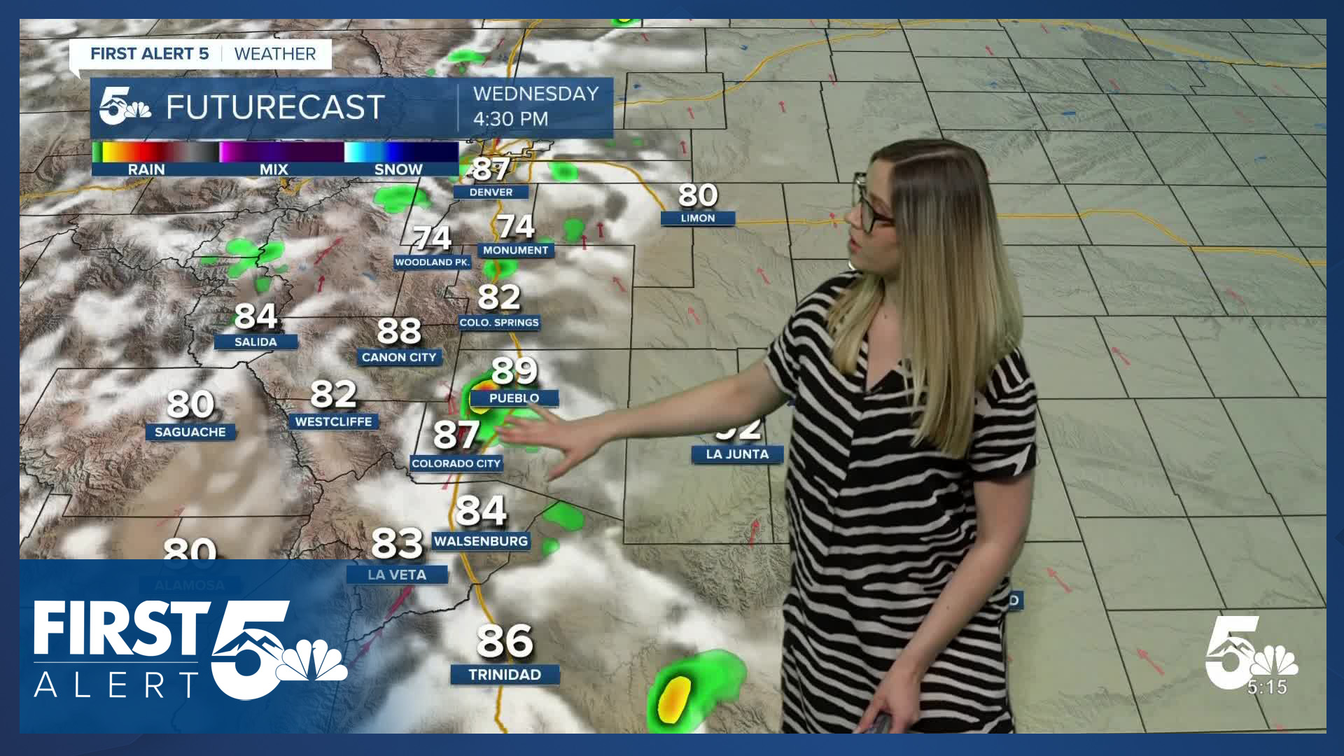
Colorado Springs forecast: Low: 47; High: 84;
Wednesday will be partly cloudy and very warm, with the forecast high set to tie the daily high temperature record of 84 for May 13th. There is a chance of an isolated thunderstorm in the afternoon, with lightning being the main hazard.
Pueblo forecast: Low: 47; High: 90;
Wednesday will be a toasty one with mostly sunny conditions. Wind will be out of the SE at 5-10 mph, gusting to 25 mph. There is a chance of an isolated afternoon thunderstorm.
Canon City forecast: Low: 51; High: 89;
Wednesday will be warm and mostly sunny. Wind will be out of the ESE at 5-10 mph, gusting to 25 mph. There is a chance of a quick afternoon shower or thunderstorm.
Woodland Park forecast: Low: 41; High: 79;
Wednesday will be partly cloudy and warm. There is a chance of isolated afternoon thunderstorms. Wind will be out of the SW at 10 mph gusting to 30 mph.
Tri-Lakes forecast: Low: 49; High: 83;
It will be partly cloudy on Wednesday with a chance of an isolated afternoon thunderstorm. Wind will be out of the SE at 10 mph, gusting to 25 mph.
Plains forecast: Low: 40s; High: 80s-90s;
It will be mostly sunny to partly cloudy on Wednesday with hot temperatures in the mid-80s to low 90s. Wind will be out of the SE at 5-10 mph, gusting 15-25 mph. Very spotty thunderstorms are possible in the afternoon and evening.
Walsenburg and Trinidad forecast: Low: 49/46; High: 86/90;
It will warm and partly cloudy on Wednesday. Wind will be out of the SSE at 5-10 mph, gusting to 25 mph. There is a chance of an isolated thunderstorm in the afternoon.
Mountains forecast: Low: 40s; High: 70s-80s;
The mountain valleys will be warm and partly cloudy on Wednesday. In the early afternoon, a few spotty rain showers and thunderstorms are possible with gusty winds and lightning being the main hazards.
Extended outlook forecast:
The rest of the week continues similarly. Thursday will be toasty in the 80s and 90s again, with a very low chance of an afternoon thunderstorm. Friday again brings 70s to 80s with a chance of afternoon thunderstorms. This pattern is very summer-like!
The warmth and spotty afternoon t-storms pattern continues through the weekend. Then on Monday, temperatures fall to the 60s and 70s after a cold front blows through. This will increase our cloud cover and rain chances on Monday.
____
Curious about the First Alert 5 Weather Storm Impact Scale? Check out our cheatsheet explainer.
Watch KOAA News5 on your time, anytime with our free streaming app available for your Roku, FireTV, AppleTV and Android TV. Just search KOAA News5, download and start watching.
