

Today’s Forecast:
This morning will start out partly to mostly cloudy, with areas of fog and mist in some areas, and a slight chance of showers. There's also a fair amount of smoke that we're tracking this morning from wildfires burning in Utah and Nevada.
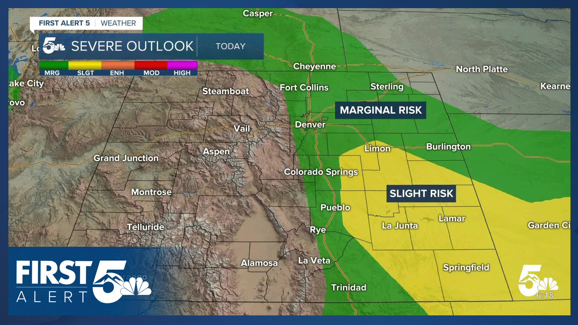
Storms will form early today, reaching I-25 between noon and 2 pm. Storms will have the potential for hail to 1.5" and wind gusts to 60 mph. Farther east, storms will intensify, with hail to 2" and wind gusts to 65 mph. There's also a low end risk of tornadoes on the Plains this afternoon.
Highs today will warm by a couple of degrees from yesterday, topping out in the 70s, 80s and lower 90s.
Colorado Springs forecast: High: 80; Low: 55. After cooling down to the upper 70s on Wednesday, highs will warm by a few notches today to near 80 degrees. Storms were few and far between yesterday. I think that today could be more active, with our best chances for rain between noon and 3 pm.
Pueblo forecast: High: 88; Low: 59. This has been our busiest and stormiest week of June so far, and it will continue into the late week period, with a daily chance of thunderstorms through Friday.
Canon City forecast: High: 88; Low: 59. Dry skies this morning will give way to scattered showers and thunderstorms this afternoon. While severe threats will be low today compared to areas to our east, some storms will be capable of 1" hail and strong wind gusts.
Woodland Park forecast: High: 74; Low: 48. After a cloudy and foggy morning, skies will turn unsettled towards the lunch hour, with a chance for thunderstorms into the mid to late afternoon hours.
Tri-Lakes forecast: High: 70s; Low: 50s. The Palmer Divide will be an area of focus for storms to form this afternoon. I think that today's storms will form as early as the lunch hour, with severe hail and wind gusts possible.
Plains forecast: High: 80s/90s; Low: 50s. After a few showers early this morning, skies will turn stormy into the mid to late afternoon hours. As storms move off of the mountains, they will become energized as low level moisture surges. Storms today will be capable of both 1-2" hail and 65 mph wind gusts. There's also a low end tornado risk today on the Plains.
Walsenburg and Trinidad forecast: High: 80s; Low: 50s. The severe weather potential will lower late this week but won't be completed erased from our forecast, with storms today capable of 1" hail and wind gusts to 60 mph.
Mountains forecast: High: 60s/70s; Low: 40s. We'll see a mixed bag of weather in the mountains today, with areas of smoke affecting air quality this morning, and a chance for showers and thunderstorms this afternoon.
Extended outlook forecast:
It's likely that we'll see one more round of scattered showers and thunderstorms in Southern Colorado on Friday, with lower end severe threats still possible. Highs will top out in the middle 80s to lower 90s Friday afternoon.
A pattern change this weekend will lead to hot, dry and windy weather for Southern Colorado. Highs will soar back into the 90s and 100s on the Plains, with daily wind gusts in the 30-40 mph range. Frie danger will also increase this weekend across the state, especially into western Colorado.
____
Curious about the First Alert 5 Weather Storm Impact Scale? Check out our cheatsheet explainer.
Watch KOAA News5 on your time, anytime with our free streaming app available for your Roku, FireTV, AppleTV and Android TV. Just search KOAA News5, download and start watching.
