



COLORADO SPRINGS, Colo. (KOAA) — Today’s Forecast:
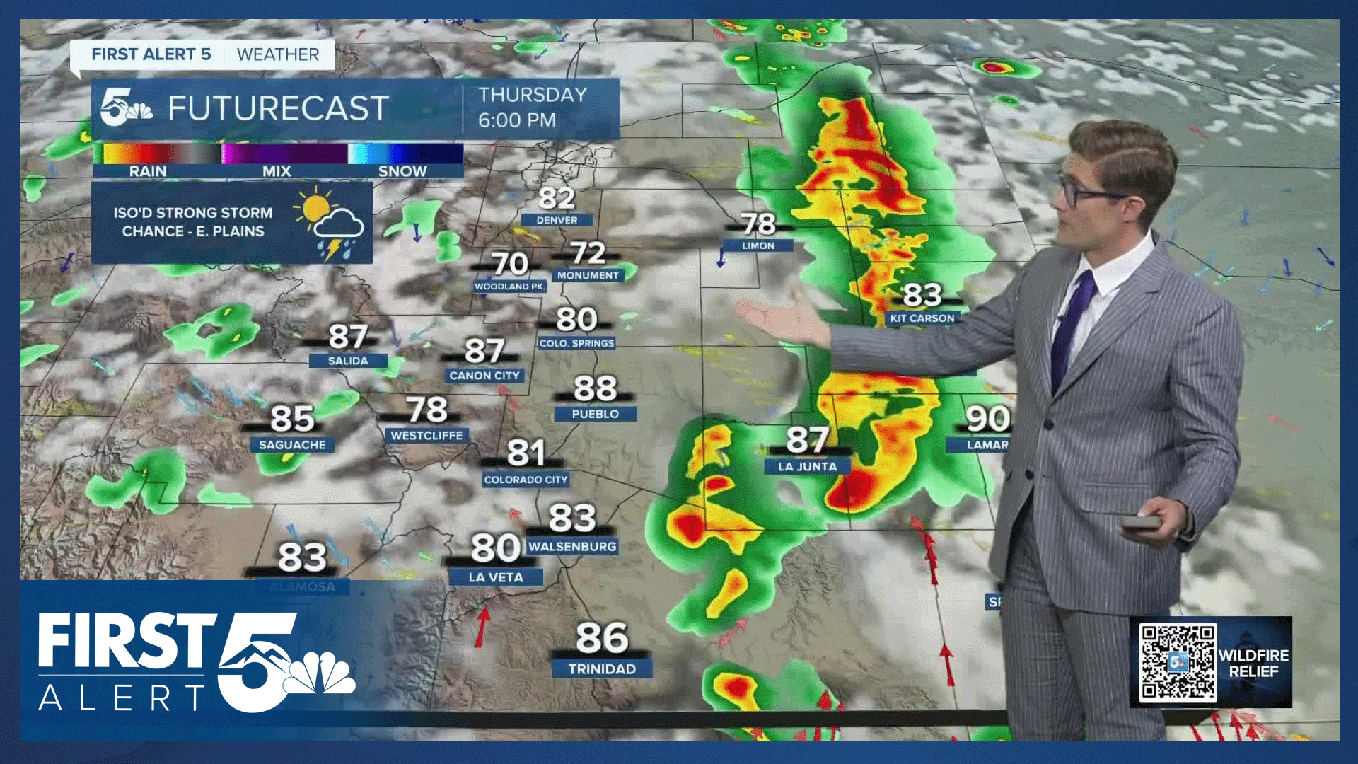
Storms become more widespread today in southern Colorado. Recycled moisture will develop storms over the mountain zones by noon, with those storms slowly meandering over to the plains through the afternoon. Today's storms will be capable of producing heavy rainfall. This is good news for firefighting efforts, but does pose a burn scar flash flooding risk. A Flash Flood Watch is in place for the Aspen Acres fire from 12 PM - 8 PM today. It will only take 1/4" of rain in an hour to produce flash flooding in this zone.
Highs today will be a bit cooler than yesterday - a couple degrees above average for early July.
Colorado Springs forecast: High: 90; Low: 58.
Skies begin the day sunny, with light smoke and haze. The smoke will then decrease heading into the afternoon due to northerly winds. Clouds will increase by 12 PM, and overall storm timing will be similar to yesterday - there will just be more storms. Like the storms that drifted off of Pikes Peak and through downtown yesterday afternoon, we see a similar slow storm motion today which means heavy rainfall is possible.
Pueblo forecast: High: 98; Low: 62.
Mostly sunny this morning with continued patchy smoke - still present, but lighter than in recent days. Scattered afternoon thunderstorms are likely with decreasing smoke in the afternoon hours. Winds from the north at 10-15 mph. Still hot.
Canon City forecast: High: 95; Low: 62.
Mostly sunny this morning with scattered but slow moving thunderstorms this afternoon that will be capable of dumping some heavy rain. ...Yay! Northwest winds this morning, northeast this afternoon...the net effect of which is that you'll see less smoke today than in recent days.
Woodland Park forecast: High: 83; Low: 51.
A couple hours of early AM sunshine, followed by increasing high and then mid-level clouds early this afternoon. Scattered afternoon thunderstorms today which will be fairly classic high country daytime heating driven. North winds at 10-15 mph.
Tri-Lakes forecast: High: 80s; Low: 50s.
Mostly sunny early this morning, partly cloudy by mid-day, with a scattered PM thunderstorms. Significant air quality improvements compared to recent days, with north winds at 10-15 mph.
Plains forecast: High: 90s/100s; Low: 60s.
Mostly sunny this morning...and another very hot day, though technically cooler than yesterday. Storm chances will increase late in the afternoon as storms meander in out of the west. Overall chances are a bit lower than in the mountains, and gusty wind would be the main issue.
Walsenburg and Trinidad forecast: High: 91/92; Low: 59/58.
Mostly sunny this morning, with patchy smoke. Afternoon slow moving thunderstorms will be capable of heavy rainfall.
Mountains forecast: High: 70s/80s; Low: 50s.
FLASH FLOOD WATCH in effect 12:00 PM - 8:00 PM for the ASPEN ACRES burn scar zone
Partly cloudy this morning, with scattered to numerous afternoon thunderstorms capable of producing heavy rain. Northwest winds at 5-10 mph with moderate smoke.
Extended outlook forecast:
More moisture means more storms Thursday, a couple of which could be slightly stronger than today. Highs will be in the middle 80s. Storms will be more isolated on Friday, but where they do occur, strong storms will be possible. Highs will again be in the mid-80s.
This weekend, a ridge of high pressure will build and temperatures will return to the 90s. At the moment, this looks to be the low 90s for the weekend and mid-90s early next week.
____
Curious about the First Alert 5 Weather Storm Impact Scale? Check out our cheatsheet explainer.
Watch KOAA News5 on your time, anytime with our free streaming app available for your Roku, FireTV, AppleTV and Android TV. Just search KOAA News5, download and start watching.
