


COLORADO SPRINGS, Colo. (KOAA) — Today’s Forecast:
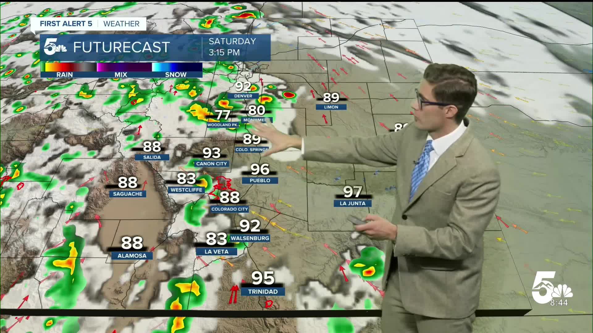
Following record heat yesterday, we're tracking more heat but also better chances for wetting rains - showers and thunderstorms - this afternoon.
High pressure will shift south today after touring the Four Corners region over the last several days. The morning will be beautiful with plenty of sunshine and light winds. You'll notice light haze from wildfire smoke that is largely elevated above the ground and is not impacting air quality.
This afternoon, weak mid-level energy will rotate in around the high. The combination will produce scattered afternoon thunderstorms. Timing should be fairly "typical" but slightly delayed relative to typical monsoon pattern setups. Isolated storms should form in the mountains between noon and 2 PM. Storms will be possible along I-25 from 2-11 PM, with the peak probability between 5-10 PM. What this boils down to is...a couple of isolated storms are likely on the plains early, with more widespread storms moving off the mountains late this afternoon into the evening.
Today's storm threats include heavy rain, frequent lightning, gusty wind and small hail. A couple of severe storms are possible.
Colorado Springs forecast: High: 92; Low: 59.
Sunny with a quick morning warm up, isolated afternoon thunderstorms. A couple of early storms are possible between 12-3 PM, with more widespread/better storm chances from 3-8 PM, with isolated chances then continuing to about 11 PM. Most storms today will be non-severe, but a couple of robust updrafts should be capable of quarter-sized hail and 60 mph wind gusts. If you get a heavier storm, it should be capable of dropping your temperature by about 20 degrees.
Pueblo forecast: High: 97; Low: 63.
It's going to be hot again, but the record of 103 will remain untouched. We'll see isolated storms develop in the mid-afternoon to the west, but storms in the local area are most likely late this afternoon into the evening. These storms will be widely scattered.
Canon City forecast: High: 94; Low: 65.
Increasing clouds after noon, very hot once again, with scattered afternoon thunderstorms. While storms will be widely scattered, if you get one, it will be capable of dropping heavy rain.
Woodland Park forecast: High: 83; Low: 53.
Increasing clouds this afternoon, with scattered afternoon showers and thunderstorms. This setup does favor multiple rounds of showers and storms, so plan for a wet evening.
Tri-Lakes forecast: High: 80s; Low: 50s.
Increasing clouds this afternoon, with scattered thunderstorms. A couple of strong storms are possible, and heavy rain is likely.
Plains forecast: High: 90s; Low: 60s.
Hot, sunny, and mainly dry today. There's a chance for a couple storms to reach you late tonight.
Walsenburg and Trinidad forecast: High: 92/97; Low: 62/61.
Partly cloudy this afternoon with isolated afternoon storms.
Mountains forecast: High: 80s; Low: 50s.
Scattered afternoon thunderstorms. Flash flooding is possible at the Aspen Acres burn scar if a storm moves over the scar directly.
Extended outlook forecast:
More monsoon moisture arrives Sunday, and storm chances continue. The storm timing should be slightly earlier than today along I-25, with isolated storms between 1-3 PM, peak potential between 3-8 PM. A couple of strong thunderstorms are possible Sunday, with quarter sized hail, torrential rainfall, and frequent lightning. It will remain hot.
The pattern will remain very consistent into the middle of next week, with daily afternoon chances for showers and thunderstorms. We will be watching the potential for flooding at the Aspen Acres burn scar, as well as more isolated flooding potential across the rest of the I-25 corridor. By late week, the monsoon firehose should redirect away from the state once again.
____
Curious about the First Alert 5 Weather Storm Impact Scale? Check out our cheatsheet explainer.
Watch KOAA News5 on your time, anytime with our free streaming app available for your Roku, FireTV, AppleTV and Android TV. Just search KOAA News5, download and start watching.
