

Today’s Forecast:
It's a chilly start to your Friday morning, with many areas waking up to temperatures in the 20s and 30s. You'll definitely want to grab a layer as you step outside, and a pair of gloves and a hat. You won't need them for too long this morning as temperatures will climb quickly after sunrise. Highs today warm to the 70s and lower 80s on the Plains, about 5 degrees warmer than yesterday.
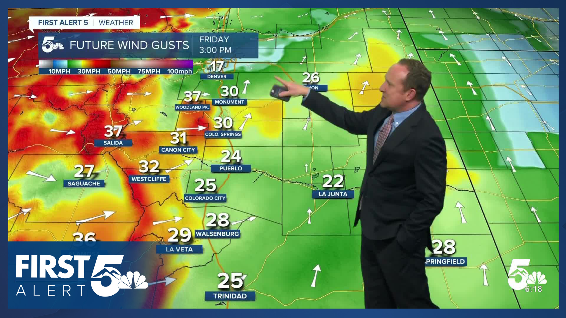
Red Flag Warnings will be in effect today from 11:00 AM - 9:00 PM. The wind won't be as gusty, strong, or widespread as you experienced early in the week, but it will still be gusty and dry today. Expect westerly wind for areas west of I-25, southwesterly to southerly east of I-25 and on the eastern Plains, with gusts at 30-40 mph this afternoon.
Skies start clear today, with increasing clouds this afternoon and tonight. A few virga showers (evaporating rain) are possible over the Palmer Divide, which will produce some additional wind gusts late today.
Colorado Springs forecast: High: 71; Low: 38. Our highs today will be more than 5 degrees warmer than yesterday, returning to the lower 70s. Driven by 25-35 mph W/SW wind gusts this afternoon, another Red Flag Warning has been issued for El Paso County.
Pueblo forecast: High: 76; Low: 38. While it will be warmer today than yesterday, we'll continue to see wind as the primary player in Pueblo County. Strong and gusty afternoon winds will lower humidity and increase fire danger.
Canon City forecast: High: 73; Low: 39. Temperatures are chilly this morning, but will warm nicely into the afternoon hours as the downslope flow strengthens across Fremont County. With another Red Flag Warning issued today, it will be our third day in a row with high fire danger.
Woodland Park forecast: High: 62; Low: 30. Another day with Red Flag Warnings will give way to a weather pattern change this weekend, which will include a daily chance of showers, thunderstorms and even some snow.
Tri-Lakes forecast: High: 60s; Low: 30s. Mild, dry and gusty, with another Red Flag Warning in effect today from 11 AM to 9 PM. Peak afternoon wind gusts on Friday will be around 25-35 mph.
Plains forecast: High: 70s/80s; Low: 30s/40s. After yesterday's slight cool down, temperatures today will warm into the 70s and lower 80s. The wind will remain gusty on Friday, with a Red Flag Warning in effect from 11 AM to 9 PM.
Walsenburg and Trinidad forecast: High: 70s; Low: 30s. Dry skies, warm highs and gusty winds will continue to keep fire danger elevated to critical on Friday, with a Red Flag Warning in effect from 11 AM to 9 PM
Mountains forecast: High: 50s/60s; Low: 20s/30s. Sunny, dry and windy until the late afternoon, with clouds begin to increase across the mountains from west to east. Driven by low humidity and 35-45 mph wind gusts, another Red Flag Warning has been issued today for the mountains.
Extended outlook forecast:
A cold front will sweep south early Saturday morning, which will lead to upslope flow during the afternoon. At the same time, an area of low pressure off the coast of California currently begins to make its way toward the state. You can expect a few isolated showers Saturday, which favor northern parts of the state and the mountains early this weekend.
On Sunday, we'll see continued upslope flow and some instability that will spark off isolated showers and thunderstorms. There's about a 3-in-10 chance Saturday, and 5-in-10 chance on Sunday, of seeing rain at your home. Sunday has much better chances for lightning compared to Saturday. Highs Saturday and Sunday will be in the 60s and low 70s on the Plains, with lows in the 30s.
Another upper-level wave will cross Colorado Monday, with some more isolated storm chances as a boundary pushes south bringing in better moisture.
Tuesday will be dry and breezy - a break in the action.
There is the potential for more significant moisture on Wednesday and Thursday. A cold front is likely to swing in on Wednesday, providing a first round of rain. This could produce a wintry mix in high elevation zones. Then, an upper level disturbance is likely to approach on Thursday. The southern track of this system provides reason for cautious optimism that this could be a truly beneficial system that brings in actual significant, and badly needed, moisture to Colorado. Stay tuned.
____
Curious about the First Alert 5 Weather Storm Impact Scale? Check out our cheatsheet explainer.
Watch KOAA News5 on your time, anytime with our free streaming app available for your Roku, FireTV, AppleTV and Android TV. Just search KOAA News5, download and start watching.
