



Today’s Forecast:
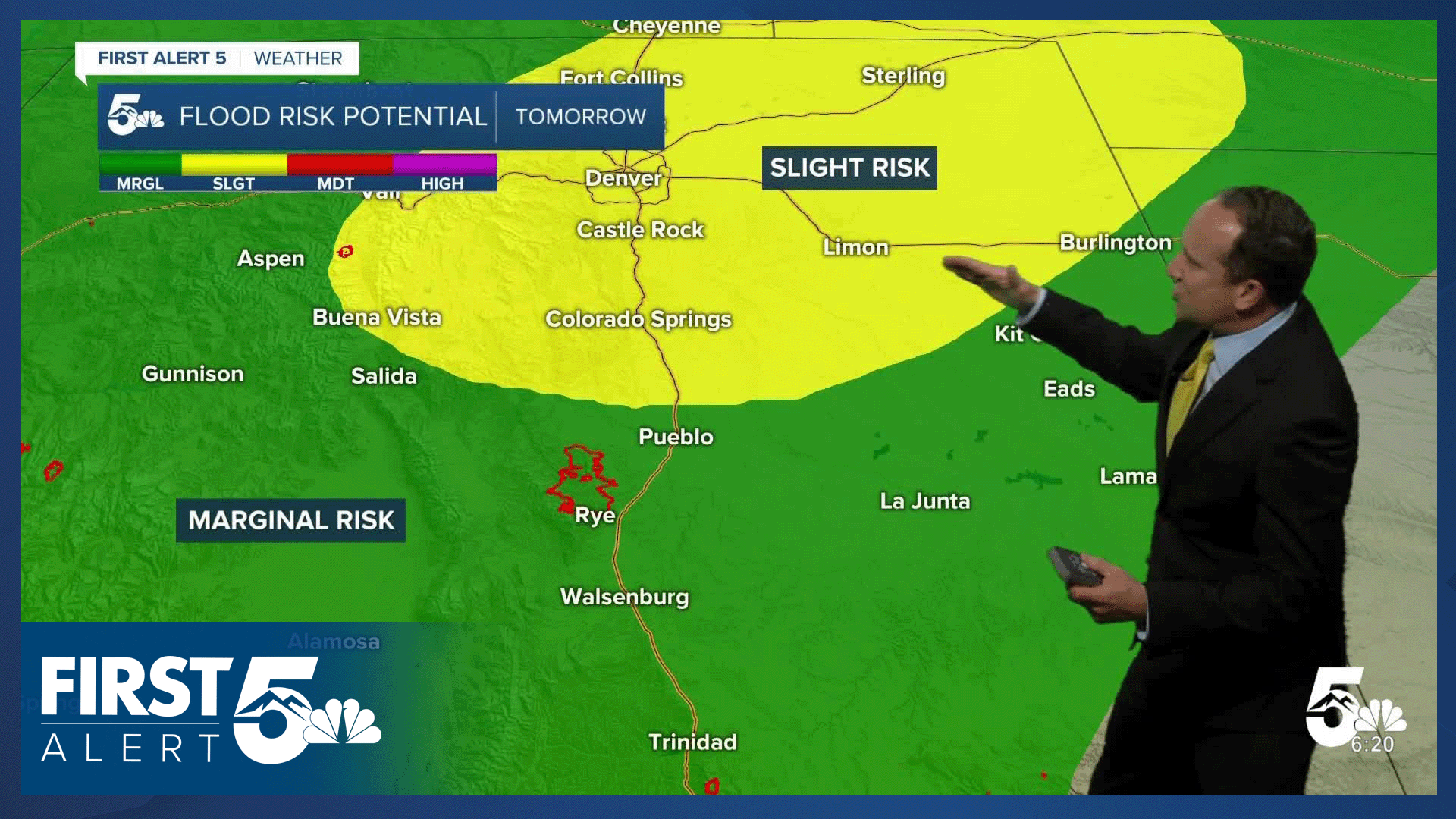
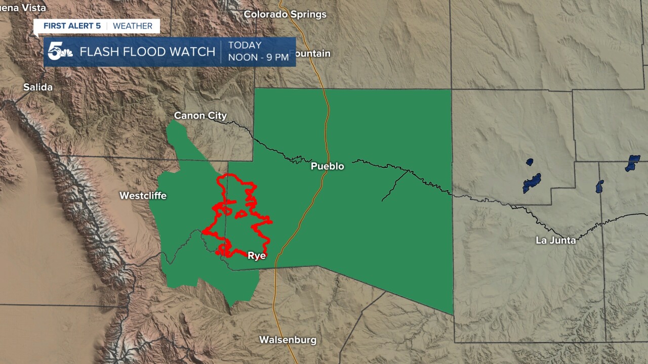
After more record-breaking heat on Wednesday, temperatures will cool considerably this afternoon, topping out in the 80s and 90s on the Plains. Cooler mountain and mountain valley locations today will see highs in the 60s and 70s. The cool down comes after the passage of a cold front last night, plus an influx of monsoonal moisture. This will lead to better chances for rain and thunderstorms this afternoon and evening. Some storms will bring potential threats of severe weather and flash flooding. A Flash Flood Watch has been issued for the Aspen Acres burn scar today from noon to 9 pm.
Colorado Springs forecast: High: 84; Low: 57. August has been hot, with another record-setting high reported yesterday at the Colorado Springs Airport. Today will be around 10 degrees cooler, with stormy skies this afternoon and evening.
Pueblo forecast: High: 90; Low: 61. After clocking six consecutive days in the triple digits, our high today will drop by around 10 degrees, topping out near 90 degrees. With the arrival of the monsoon yesterday, scattered showers and thunderstorms will be possible again this afternoon.
Canon City forecast: High: 87; Low: 63. An influx of monsoonal moisture will peak late this week, bringing us an increased chance of afternoon showers and thunderstorms, and a heightened risk of flash flooding.
Woodland Park forecast: High: 75; Low: 51. August has been pretty dry so far, but that will be changing as the monsoon is expected to bring multiple days of cooler and wetter weather to Teller County.
Tri-Lakes forecast: High: 70s/80s; Low: 50s. We need the moisture, and late this week, Mother Nature will answer the call. Both today and tomorrow, we will see numerous showers and multiple rounds of thunderstorms.
Plains forecast: High: 80s/90s; Low: 50s/60s. Dry skies this morning will give way to scattered to numerous showers and thunderstorms this afternoon, with storms lasting beyond 10 pm to midnight for the eastern counties. Storms today will be capable of 60 mph wind gusts, 1" hail, and heavy rain/flooding.
Walsenburg and Trinidad forecast: High: 80s/90s; Low: 50s/60s. Rain chances will increase late this week, but the heaviest rain looks to stay to our north. Temperatures will also be cooler due to a much more active weather pattern.
Mountains forecast: High: 60s/70s; Low: 40s/50s. Numerous showers and thunderstorms can be expected in the mountains and valleys late this week, and for areas north of Highway 50, we will see increasing threats for flash flooding. Threats in the Aspen Acres burn scar will be higher today than tomorrow.
Extended outlook forecast:
With high pressure over the southeastern U.S., moisture will remain elevated across the state through the weekend. An upper-level disturbance on Friday will bring additional threats of strong to severe thunderstorms to the Pikes Peak Region, with an ongoing threat of flooding. Highs will drop another couple of degrees in Colorado Springs as we close out the week in the lower 80s.
It will remain unsettled this weekend, with afternoon thunderstorms and a daily threat of heavy rain that will be driven by the monsoon. Temperatures will warm back into the lower 80s Saturday, and the upper 70s Sunday. A few additional thunderstorms will be possible next Monday before the monsoon tap turns off. In the mid-week period, we'll see drier skies and a return to the upper 80s.
____
Curious about the First Alert 5 Weather Storm Impact Scale? Check out our cheatsheet explainer.
Watch KOAA News5 on your time, anytime with our free streaming app available for your Roku, FireTV, AppleTV and Android TV. Just search KOAA News5, download and start watching.
