



Today’s Forecast:
Much needed rainfall has been falling this morning across the high country, with most showers dissipating quickly as they move into the Plains. Some additional energy will move into the state this afternoon. This will allow for some beneficial moisture today for the mountains, with rain chances on the smaller side for the Pikes Peak Region, I-25 corridor and eastern Plains. Our best chances for rain today in the metro areas will be between 2-5 pm.
With high pressure to our south, and downsloping wind at surface level, it will remain hot this afternoon. Highs will top out in the 80s and 90s on the Plains.
Colorado Springs forecast: High: 88; Low: 55. Today will be a lot like Sunday temperature wise as the work week begins with well above average highs, and just a slight chance of showers and thunderstorms this afternoon.
Pueblo forecast: High: 92; Low: 59. Monday's forecast will be a toasty one in Pueblo, with only a slight chance of a shower or thunderstorm this afternoon after 2 pm.
Canon City forecast: High: 90; Low: 59. The heat will be the big story on Monday ahead of cooler changes tomorrow. Thunderstorm chances will remain on the low side for the next 24-48 hours.
Woodland Park forecast: High: 78; Low: 44. Monday's highs will be around 10 degrees above average. With afternoon skies turning overcast, we will see the potential for spotty thunderstorms today in Teller County.
Tri-Lakes forecast: High: 80s; Low: 40s/50s. Even though it's the middle of September, we'll be feeling a lot like summer this afternoon. Highs will warm into the lower to middle 80s, with a few thunderstorms possible today.
Plains forecast: High: 90s; Low: 50s/60s. A warm morning will give way to highs in the 90s this afternoon and a chance for spotty thunderstorms this afternoon and evening. A few stronger storms will be capable of 1" hail and strong wind gusts.
Walsenburg and Trinidad forecast: High: 80s/90s; Low: 50s. Warm, downsloping wind will keep highs well above average this afternoon. A few rain showers will be possible today, but severe weather is not expected.
Mountains forecast: High: 60s/70s; Low: 40s. Gusty southwesterly winds will impact our mountain zones on Monday, with peak gusts today near 35-45 mph. There have been some showers this morning in the central mountains, and storms will become possible this afternoon into the southeastern mountains.
Extended outlook forecast:
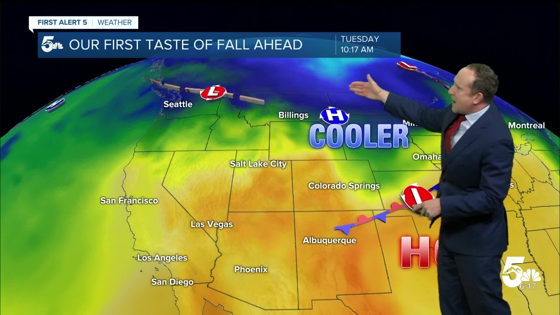
A potent cold front will bring us our first real taste of fall on Tuesday. Highs region-wide be around 15-20 degrees cooler than today, topping out in the lower 70s in Colorado Springs. Gusty northeast winds in the morning will turn southeasterly towards the afternoon, with a chance of thunderstorms for the Pikes Peak Region and Southern Colorado.
Rain chances will increase for the rest of the week, with scattered thunderstorms each day for the Pikes Peak Region and Southern Coloraod. Afternoon highs in Colorado Sprins will warm to near 80 degrees through Friday before cooling back down to the 70s this weekend.
____
Curious about the First Alert 5 Weather Storm Impact Scale? Check out our cheatsheet explainer.
Watch KOAA News5 on your time, anytime with our free streaming app available for your Roku, FireTV, AppleTV and Android TV. Just search KOAA News5, download and start watching.
