

Tonight's Forecast:
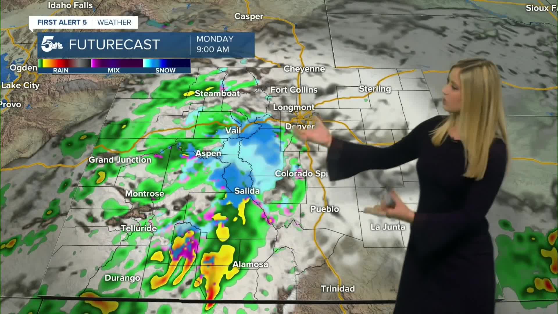
Tonight will begin clear, then clouds will increase overnight. A mix of rain and snow showers will move into the mountains by Monday morning, with the rain/snow line dropping to as low as 9,000 feet in Chaffee, Fremont, and Park Counties.
Colorado Springs forecast: Low: 38; High: 59;
Monday will be partly cloudy with spotty, light rain showers possible in the afternoon and evening. The wind will be from the SSE at 10-15 mph, gusting to 25 mph.
Pueblo forecast: Low: 40; High: 64;
Monday will be a cooler day with partly cloudy conditions and the chance of spotty light rain in the afternoon and evening. Wind will be out of the ESE at 5-10 mph, gusting to 25 mph.
Canon City forecast: Low: 41; High: 60;
Monday will be cooler with partly cloudy conditions and periodic rain showers. Wind will be out of the E at 5-10 mph, gusting to 20 mph.
Woodland Park forecast: Low: 31; High: 53;
Monday will be partly cloudy with a light wintry mix possible in the morning, then periodic rain showers in the afternoon. Wind will be out of the SSE at 10 mph, gusting to 25 mph.
Tri-Lakes forecast: Low: 36; High: 57;
It will be partly cloudy on Monday with the chance of afternoon rain showers.
Plains forecast: Low: 40s; High: 60s;
Partly cloudy on Monday with mild low to mid-60s. There is a chance of rain showers in the late afternoon, increasing in likelihood overnight.
Walsenburg and Trinidad forecast: Low: 40/39; High: 63/69;
It will be partly cloudy on Monday with spotty rain showers possible in the afternoon, with a higher chance of rain Monday night.
Mountains forecast: Low: 30s; High: 50s-60s;
The mountains will see a wintry mix on Monday morning between 9,000 to 10,000 feet. The snow line rises to about 11,000 feet during the day, with light to moderate rain showers in the mountain valleys throughout the day.
Extended outlook forecast:
Fog is possible early Tuesday morning before the sun comes back out and temperatures rise. We will be back to the 60s and 70s on Tuesday. Wednesday will be even warmer in the 60s to 80s and it will be quite gusty in the afternoon with 30-35 mph wind gusts.
The next cool down comes on Thursday, back to the 50s to 70s, and remaining breezy. Temperatures will drop to the mid-30s overnight on Friday morning and through the weekend in the plains. We could easily dip to freezing, so consider bringing in potted plants, harvesting or covering your garden, and blowing out your sprinklers this week.
____
Curious about the First Alert 5 Weather Storm Impact Scale? Check out our cheatsheet explainer.
Watch KOAA News5 on your time, anytime with our free streaming app available for your Roku, FireTV, AppleTV and Android TV. Just search KOAA News5, download and start watching.
