

Today’s Forecast:
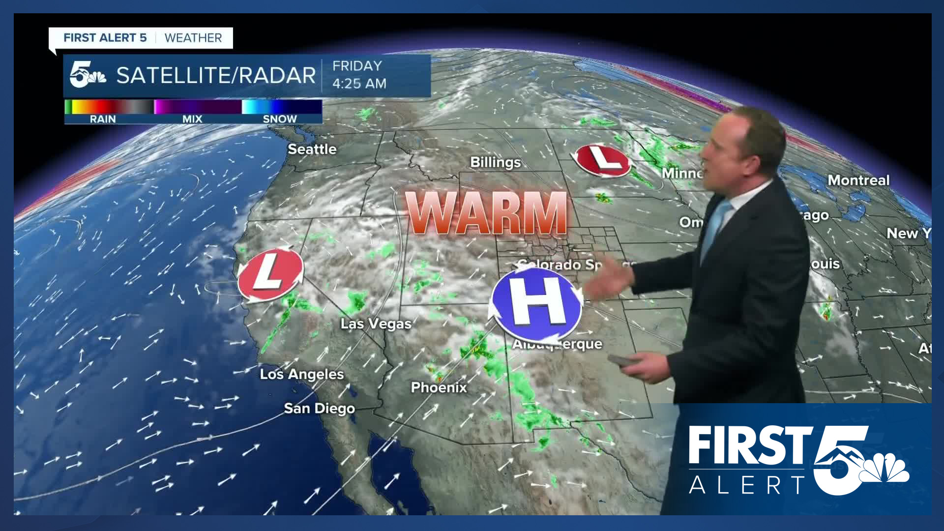
A strong high pressure system will bring a noticeable warm-up to Southern Colorado on Friday, with highs warming by as much as 8-12 degrees from yesterday. While it won't be record breaking hot today, highs will warm into the upper 70s in Colorado Springs, lower 70s in Woodland Park, and 80s on the eastern Plains.
Moisture will also undercut the ridge today, pumping into the Four Corners Region from a storm over California. If you're heading into the mountains today, there will be a chance for showers and thunderstorms, with a slight chance of a shower or two reaching the southern I-25 corridor.
Colorado Springs forecast: High: 79; Low: 51. After two days in a row in the upper 60s, we'll see a nice warm-up on Friday as summer isn't done yet with Southern Colorado.
Pueblo forecast: High: 85; Low: 53. It will be a very warm start to the 31st annual Chile and Frijoles Festival happening this weekend in Pueblo. Skies will be dry today, and for most of the weekend.
Canon City forecast: High: 83; Low: 55. Warming highs driven by high pressure will deliver summer-like temperatures to our forecast on Friday. While rain is not likely this afternoon, we will see more clouds this afternoon than yesterday.
Woodland Park forecast: High: 71; Low: 42. 70s sounds lovely, and today's weather should be both mild and dry. On Saturday, rain chances will increase across Teller County.
Tri-Lakes forecast: High: 70s; Low: 40s/50s. Savor the warmth today as highs this afternoon will be a few degrees above average for this time of the year. A mixed bag of weather will follow this weekend, with cooler and unsettled conditions on Saturday.
Plains forecast: High: 80s; Low: 50s. After stormy mid-week skies, our weather will be dry on Friday, with warming temperatures today topping out in the 80s.
Walsenburg and Trinidad forecast: High: 70s/80s; Low: 40s/50s. Highs will be warmer here compared to yesterday as we look to close out the week in the 70s and 80s. If we do see any rain that reaches the southern I-25 corridor on Friday, it should be short lived and non-severe.
Mountains forecast: High: 60s; Low: 30s/40s. Increasing moisture from a disturbance over California will bring a chance for scattered showers and thunderstorms today to the southeastern mountains. If you don't see a shower today, rain chances will be higher on Saturday.
Extended outlook forecast:
A mixed bag of weather will follow this weekend for the Pikes Peak Region and Southern Colorado. As high pressure flattens, temperatures will cool by several degrees on Saturday region-wide. Increasing moisture will allow for a better chance for showers and thunderstorms to reach the city of Colorado Springs Saturday afternoon.
Late-summer warmth returns to Colorado Springs on Sunday, with a high near 80 degrees and drier skies. Early next week, a stronger cold front will drop into the state. Monday will still be in the 70s, with 60s next Tuesday. Next week's cold front will also bring better chances for rain to our forecast, with storms possible both Monday and Tuesday.
____
Curious about the First Alert 5 Weather Storm Impact Scale? Check out our cheatsheet explainer.
Watch KOAA News5 on your time, anytime with our free streaming app available for your Roku, FireTV, AppleTV and Android TV. Just search KOAA News5, download and start watching.
