



Today’s Forecast:
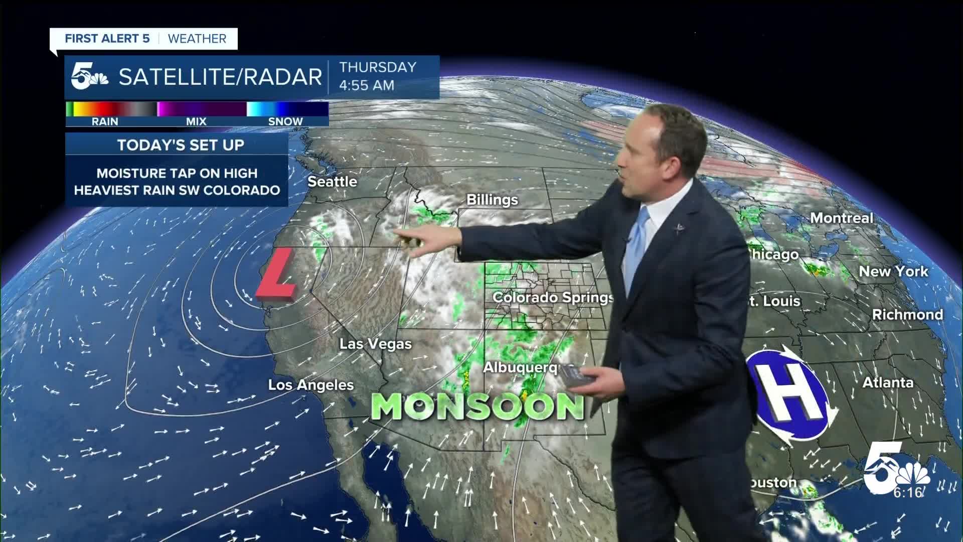
Moisture will continue to flow into Colorado on Thursday, with Flood Watches remaining in effect until midnight tonight for the southwestern part of the state. Rain from Wolf Creek Pass to Telluride will be heavy at times, and could lead to flash flooding, and mud and debris flows. Here at home, I see the potential for a few showers along and west of I-25 around the lunch hour, plus additional threats of thunderstorms into the afternoon and evening hours.
Temperatures today will rebound another couple of degrees. Highs will warm into the 70s and 80s on the I-25 corridor, with 80s and 90s on tap for the eastern Plains. The mountain zones today will see highs around the 60s and 70s.
Colorado Springs forecast: High: 81; Low: 56. After a couple of cooler days and some overnight rain, we'll see a chance of showers around the lunch hour, with additional chances for rain and thunderstorms late this afternoon and evening.
Pueblo forecast: High: 86; Low: 60. Thursday's forecast will be warmer, with the potential for some isolated showers and thunderstorms this afternoon and evening.
Canon City forecast: High: 83; Low: 59. Areas west of I-25 will see the best potential for rain and thunderstorms on Thursday, especially areas along and west of the Continental Divide.
Woodland Park forecast: High: 70; Low: 48. Stormy skies will remain a staple late this week in Teller County, with snow levels expected to stay at or above 13,000 to 14,000 feet through Friday evening.
Tri-Lakes forecast: High: 70s; Low: 50s. Warmer, with a few showers possible around the lunch hour today, and into the afternoon and evening hours. Severe weather is not expected on Thursday.
Plains forecast: High: 80s/90s; Low: 60s. Breezy to gusty south winds, which could top 40 mph in some areas this afternoon will be combined with hotter highs today in the upper 80s and lower 90s. As for rain on Thursday, our best chances will be for areas closest to I-25.
Walsenburg and Trinidad forecast: High: 70s/80s; Low: 50s/60s. Breezy to gusty south winds will continue to pump moisture into the Raton Mesa and Huerfano County on Thursday, with several rounds of showers and storms on the way.
Mountains forecast: High: 60s/70s; Low: 40s. An ample supply of moisture will continue to bring a risk of flooding to the San Juan Mountains today. For the southeastern mountains, periods of heavy rain will also be possible today, with a slightly higher risk of flooding for the Aspen Acres burn scar.
Extended outlook forecast:
The monsoon plume will continue to bring an abundance of moisture into the state on Friday, with the heaviest rain tied to the higher terrain. Storms will remain spotty to scattered in coverage along and east of the mountains. Our high in Colorado Springs will be a touch warmer than today, topping out at 82 degrees.
Highs will cool this weekend, thanks to a series of cold fronts. Saturday will stay warm, with highs in the upper 70s and lower 80s in the Pikes Peak Region. By Sunday, our high in the Springs will drop down the middle 70s. This weekend, chances for scattered afternoon showers will continue from the southeastern mountains to the Plains.
____
Curious about the First Alert 5 Weather Storm Impact Scale? Check out our cheatsheet explainer.
Watch KOAA News5 on your time, anytime with our free streaming app available for your Roku, FireTV, AppleTV and Android TV. Just search KOAA News5, download and start watching.
