

Tonight's Forecast:
A severe thunderstorm watch remains in effect now until 3 am for the counties below in pink:

Thunderstorms this afternoon have been intense. 3-inch hail was observed south of Limon.
A night round of thunderstorms is moving through the region between El Paso and Pueblo Counties, north of HWY 50 and south of I-70. They will slowly lose their strength overnight, ending by 3 am.
Sunday forecast:
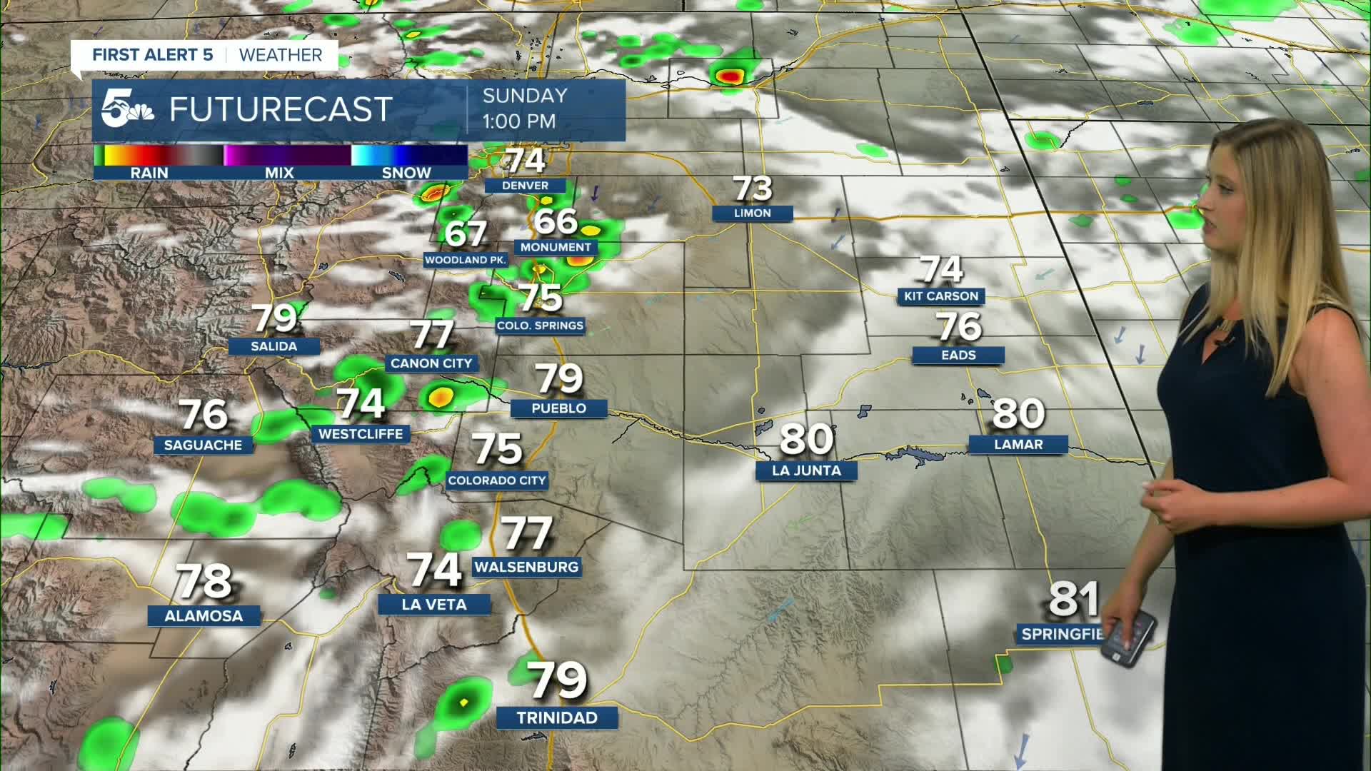
Colorado Springs forecast: Low: 55; High: 77;
Sunday will be partly cloudy with a chance of thunderstorms in the afternoon. Storms may contain hail, heavy rain, and strong wind gusts.
Pueblo forecast: Low: 60; High: 83;
Cooler with partly cloudy conditions on Sunday. There will be a better chance of thunderstorms in the afternoon with the potential of heavy rain and hail.
Canon City forecast: Low: 61; High: 81;
Partly cloudy and cooler on Sunday with a better chance of afternoon thunderstorms.
Woodland Park forecast: Low: 47; High: 70;
Partly cloudy on Sunday with a chance of afternoon thundershowers.
Tri-Lakes forecast: Low: 51; High: 74;
Cooler on Sunday with partly cloudy conditions and a chance of afternoon thunderstorms.
Plains forecast: Low: 50s-60s; High: 70s-80s;
Partly cloudy on Sunday with highs in the upper-70s to mid-80s. Thunderstorms will be more widespread than on Saturday, and they will be possible in the afternoon and evening.
Walsenburg and Trinidad forecast: Low: 56/54; High: 79/82;
It will be partly cloudy on Sunday with cooler temperatures. There is a chance of afternoon thunderstorms.
Mountains forecast: Low: 40s-50s; High: 70s-80s;
The mountain valleys will see a slightly cooler Sunday with partly cloudy conditions. Isolated afternoon rain and thunderstorms are possible, especially closer to I-25 and the foothills.
Extended outlook forecast:
Monday will be another cooler-than-average day in the 70s and 80s with isolated afternoon thunderstorms, favoring the I-25 corridor.
After that, we will heat up and dry out for the rest of the week. Spotty thunderstorms will still be possible in the mountains, but we are likely to stay dry in the plains.
____
Curious about the First Alert 5 Weather Storm Impact Scale? Check out our cheatsheet explainer.
Watch KOAA News5 on your time, anytime with our free streaming app available for your Roku, FireTV, AppleTV and Android TV. Just search KOAA News5, download and start watching.
