



COLORADO SPRINGS, Colo. (KOAA) — Today’s Forecast:
It has been dry so far this July - with no recorded rainfall at both the Colorado Springs and Pueblo airports.
Today, better moisture arrives in Colorado, and storm chances that actually bring useful rainfall become more likely. Expect clear skies with haze and smoke this morning - with poor air quality - and increasing clouds moving off the mountains after 10 AM. Isolated storms will fire up over the mountains after noon, and then push off into the plains during the afternoon. Today's storms will be slow moving, but severe threats are low. Heavy rain, frequent lightning, and gusty wind are possible with storms this afternoon.
This is overall good news for firefighting, but the gusty winds and lightning both pose some potential issues as well. In addition, burn scars will be areas to watch for possible flash flood risks. Burn scars do not absorb water in the same way as typical ground does. The top layer of the soil becomes water repellent, which causes water to run off.
Highs today will be nearly identical to Monday: hot.
Colorado Springs forecast: High: 92; Low: 60.
Finally some rain to talk about. Sunny with wildfire smoke and haze this morning.
Winds will be out of the southeast this afternoon at 10-15 mph, but may gust to 20 mph. Thunderstorms will produce gusty winds and heavy rain if you see one. Storm coverage today will be about 30% in the Pikes Peak Region.
Pueblo forecast: High: 99; Low: 64.
Feeling a bit like a hairdryer today with a combination of heat, and a bit of wind. Starting off sunny with wildfire smoke continuing to be a factor through the day. Winds will be out of the southeast this afternoon at 10-15 mph, gusting to 30 mph. There is a 3-in-10 chance of a storm at your home this afternoon. These isolated slow moving pop-up storms will produce heavy rain, lightning, and gusty wind. They are not likely to have severe threats. We will need to watch burn scars for flash flooding.
Canon City forecast: High: 96; Low: 64.
Mostly sunny this morning...and very hot once again. Increasing clouds late this morning with consistent smoke too. Note that the smoke makes it harder for rain to fall from the clouds because the water vapor has more particles to condense on. That being said, isolated thunderstorms are possible this afternoon with a 30% chance between 1-7 PM. Winds will be light out of the west, shifting south southwest and then south this afternoon.
Woodland Park forecast: High: 84; Low: 54.
Mostly sunny with haze this morning. Increasing clouds late this AM. A pretty good shot for a thunderstorm this afternoon - finally! We'll take it. Grab the umbrella (or, in typical Colorado fashion...run inside the store quickly when getting groceries and hope for the best).
Tri-Lakes forecast: High: 80s; Low: 50s.
Mostly sunny this morning, partly cloudy at lunchtime, and isolated PM thunderstorms. South winds at 10-15 mph.
Plains forecast: High: 90s/100s; Low: 60s.
Sunny and breezy through most of the day with south winds at 10-25 mph. Low chance for a late PM shower or thunderstorm.
Walsenburg and Trinidad forecast: High: 93/97; Low: 66/63.
Mostly sunny with haze through the day. Isolated afternoon thunderstorms.
Mountains forecast: High: 80s; Low: 50s.
Continued air quality impacts from smoke. Mostly sunny this morning, increasing clouds after 10/11 AM, with scattered PM thunderstorms. Storms today will be capable of producing heavy rainfall. This is good news - but we'll need to monitor burn scars for possible flash flooding impacts.
Extended outlook forecast:
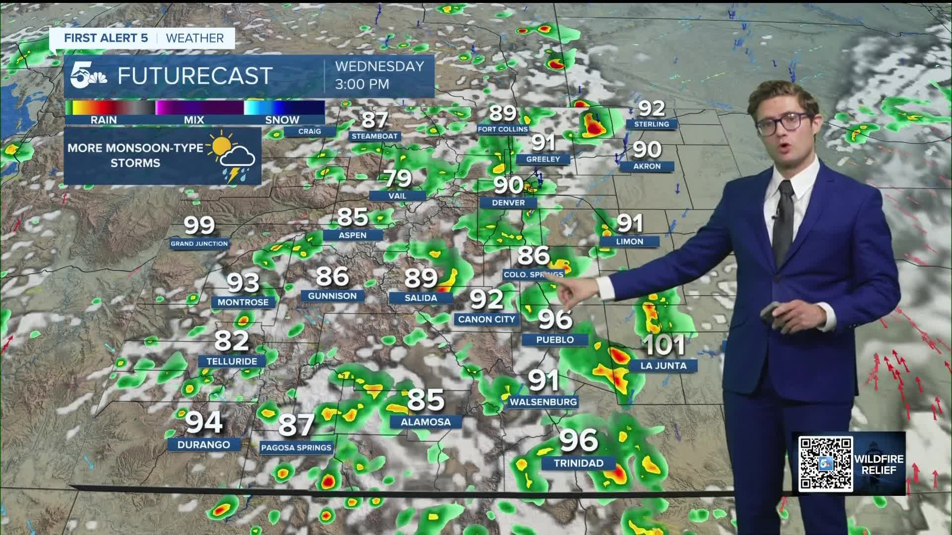
Even more moisture surges into the state under a ridge of high pressure on Wednesday. This monsoon-like pattern brings even more widespread mountain storms. If you have high country plans Wednesday, they should include a rain jacket and a very early start time!
It'll be hot once again with highs still in the 90s. Wildfire smoke will remain an issue.
Thursday and Friday are a few ticks cooler, with continued isolated to scattered PM storms across both the mountains and the plains.
This weekend, a powerful heat dome will set up across the west, bringing the hottest temperatures of 2026 so far. In Colorado Springs, on average the hottest high temperatures of the year in the last 30 years have been between July 14th and July 16th when the average high reaches 87 degrees. In Pueblo, they're between July 12th and July 16th with an average high of 93.9 degrees. Temperatures this weekend will be about 10 degrees above average, continuing into early next week, before a true monsoonal pattern becomes more likely.
____
Curious about the First Alert 5 Weather Storm Impact Scale? Check out our cheatsheet explainer.
Watch KOAA News5 on your time, anytime with our free streaming app available for your Roku, FireTV, AppleTV and Android TV. Just search KOAA News5, download and start watching.
